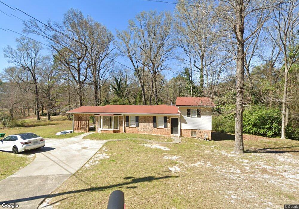
118 Taylor St Warner Robins, GA 31093
Estimated Value: $217,000 - $237,000
3
Beds
4
Baths
2,143
Sq Ft
$105/Sq Ft
Est. Value
About This Home
This home is located at 118 Taylor St, Warner Robins, GA 31093 and is currently estimated at $224,457, approximately $104 per square foot. 118 Taylor St is a home located in Houston County with nearby schools including Westside Elementary School, Northside Middle School, and Northside High School.
Ownership History
Date
Name
Owned For
Owner Type
Purchase Details
Closed on
May 8, 2024
Sold by
Ingle Cecil Lamar
Bought by
Batson Christopher P
Current Estimated Value
Home Financials for this Owner
Home Financials are based on the most recent Mortgage that was taken out on this home.
Original Mortgage
$215,000
Outstanding Balance
$211,951
Interest Rate
6.82%
Mortgage Type
VA
Estimated Equity
$12,506
Purchase Details
Closed on
Jan 28, 2011
Sold by
Wood Ricky M
Bought by
Ingle Cecil Lamar
Home Financials for this Owner
Home Financials are based on the most recent Mortgage that was taken out on this home.
Original Mortgage
$96,531
Interest Rate
4.82%
Mortgage Type
VA
Purchase Details
Closed on
Apr 22, 2010
Sold by
State Bank & Trust Company
Bought by
Wood Ricky M
Purchase Details
Closed on
Jan 5, 2010
Sold by
Corrects 5042 and Corrects 110
Bought by
State Bank & Trust Company
Purchase Details
Closed on
Sep 1, 2009
Sold by
Bender Daniel R
Bought by
State Bank & Trust Company and Security Bank Of Houston County
Purchase Details
Closed on
Jan 2, 2008
Sold by
Bender Daniel R and Bender Daniel
Bought by
Alliance Land & Development Llc
Purchase Details
Closed on
Dec 7, 2004
Sold by
Jp Morgan Chase Bank
Bought by
Bender Daniel
Purchase Details
Closed on
Feb 3, 2004
Sold by
Wainwright Michael S
Bought by
Jp Morgan Chase Bank
Purchase Details
Closed on
Apr 29, 2003
Sold by
Wiswell Thomas L
Bought by
Wainwright Michael S
Purchase Details
Closed on
Oct 5, 1999
Sold by
Huff Juliet S
Bought by
Wiswell Thomas L
Purchase Details
Closed on
Jul 20, 1989
Sold by
Pelissier Alice L
Bought by
Huff Juliet S
Purchase Details
Closed on
Jul 1, 1983
Sold by
Pelissier Richard A
Bought by
Pelissier Alice L
Purchase Details
Closed on
Feb 25, 1972
Sold by
Snellgrove M R
Bought by
Pelissier Richard A
Purchase Details
Closed on
Feb 7, 1972
Bought by
Pelissier Richard A
Purchase Details
Closed on
Mar 31, 1966
Sold by
Chester E Beverly
Bought by
Snellgrove M R
Create a Home Valuation Report for This Property
The Home Valuation Report is an in-depth analysis detailing your home's value as well as a comparison with similar homes in the area
Home Values in the Area
Average Home Value in this Area
Purchase History
| Date | Buyer | Sale Price | Title Company |
|---|---|---|---|
| Batson Christopher P | $215,000 | None Listed On Document | |
| Ingle Cecil Lamar | $94,500 | None Available | |
| Wood Ricky M | $14,900 | None Available | |
| State Bank & Trust Company | -- | -- | |
| State Bank & Trust Company | $42,400 | None Available | |
| Alliance Land & Development Llc | -- | None Available | |
| Alliance Land And Development Llc | -- | -- | |
| Bender Daniel | $46,000 | -- | |
| Jp Morgan Chase Bank | $72,300 | -- | |
| Wainwright Michael S | $95,000 | -- | |
| Wiswell Thomas L | -- | -- | |
| Huff Juliet S | -- | -- | |
| Pelissier Alice L | -- | -- | |
| Pelissier Richard A | -- | -- | |
| Pelissier Richard A | -- | -- | |
| Snellgrove M R | -- | -- |
Source: Public Records
Mortgage History
| Date | Status | Borrower | Loan Amount |
|---|---|---|---|
| Open | Batson Christopher P | $215,000 | |
| Previous Owner | Ingle Cecil Lamar | $96,531 |
Source: Public Records
Tax History Compared to Growth
Tax History
| Year | Tax Paid | Tax Assessment Tax Assessment Total Assessment is a certain percentage of the fair market value that is determined by local assessors to be the total taxable value of land and additions on the property. | Land | Improvement |
|---|---|---|---|---|
| 2024 | $1,403 | $60,640 | $6,200 | $54,440 |
| 2023 | $1,122 | $48,440 | $4,000 | $44,440 |
| 2022 | $986 | $42,800 | $3,240 | $39,560 |
| 2021 | $907 | $39,320 | $3,240 | $36,080 |
| 2020 | $889 | $38,440 | $3,240 | $35,200 |
| 2019 | $889 | $38,440 | $3,240 | $35,200 |
| 2018 | $889 | $38,440 | $3,240 | $35,200 |
| 2017 | $890 | $38,440 | $3,240 | $35,200 |
| 2016 | $941 | $38,440 | $3,240 | $35,200 |
| 2015 | $943 | $38,440 | $3,240 | $35,200 |
| 2014 | -- | $38,440 | $3,240 | $35,200 |
| 2013 | -- | $38,440 | $3,240 | $35,200 |
Source: Public Records
Map
Nearby Homes
- 221 Gilchrist Dr
- 725 B East Side Dr
- 501 Pinecrest Dr
- 110 Foxfire Dr
- 111 Hawthorne Rd
- 303 Pinecrest Dr
- 123 Tanglewood Dr
- 209 Knodishall Dr
- 857 Ola Dr
- 200 Ridgeland Dr
- 110 Westcliff Cir Unit C
- 316 Meadowridge Dr
- 103 Westcliff Cir Unit A
- 103 Westcliff Cir Unit A
- 106 Westcliff Cir
- 102 Williams St
- 112 Emory Dr
- 111 Oakridge Dr
- 115 Wray St
- 102 Westcliff Center St Unit D