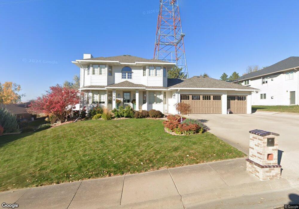
118 Terri Ln Pierre, SD 57501
Estimated Value: $388,000 - $520,000
3
Beds
4
Baths
2,220
Sq Ft
$204/Sq Ft
Est. Value
About This Home
This home is located at 118 Terri Ln, Pierre, SD 57501 and is currently estimated at $452,862, approximately $203 per square foot. 118 Terri Ln is a home with nearby schools including T.F. Riggs High School and Pierre SDA School.
Ownership History
Date
Name
Owned For
Owner Type
Purchase Details
Closed on
Jul 7, 2005
Sold by
Bankwest Inc
Bought by
Halverson Steven T and Halverson Constance D
Current Estimated Value
Home Financials for this Owner
Home Financials are based on the most recent Mortgage that was taken out on this home.
Original Mortgage
$130,000
Outstanding Balance
$67,862
Interest Rate
5.66%
Estimated Equity
$385,000
Create a Home Valuation Report for This Property
The Home Valuation Report is an in-depth analysis detailing your home's value as well as a comparison with similar homes in the area
Home Values in the Area
Average Home Value in this Area
Purchase History
| Date | Buyer | Sale Price | Title Company |
|---|---|---|---|
| Halverson Steven T | $320,000 | -- |
Source: Public Records
Mortgage History
| Date | Status | Borrower | Loan Amount |
|---|---|---|---|
| Open | Halverson Steven T | $130,000 |
Source: Public Records
Tax History
| Year | Tax Paid | Tax Assessment Tax Assessment Total Assessment is a certain percentage of the fair market value that is determined by local assessors to be the total taxable value of land and additions on the property. | Land | Improvement |
|---|---|---|---|---|
| 2025 | $5,838 | $502,523 | $65,355 | $437,168 |
| 2024 | $5,830 | $481,705 | $65,355 | $416,350 |
| 2023 | $5,354 | $468,736 | $62,541 | $406,195 |
| 2022 | $5,037 | $398,059 | $59,563 | $338,496 |
| 2021 | $4,933 | $355,410 | $53,181 | $302,229 |
| 2020 | $5,051 | $345,058 | $51,632 | $293,426 |
| 2019 | $5,042 | $345,058 | $51,632 | $293,426 |
| 2018 | $4,827 | $335,008 | $50,128 | $284,880 |
| 2017 | -- | $319,055 | $47,741 | $271,314 |
| 2016 | $5,054 | $319,055 | $47,741 | $271,314 |
| 2015 | -- | $309,762 | $46,350 | $263,412 |
| 2014 | -- | $300,740 | $45,000 | $255,740 |
| 2013 | -- | $300,740 | $45,000 | $255,740 |
| 2011 | -- | $291,628 | $47,580 | $244,048 |
Source: Public Records
Map
Nearby Homes
- 100 Terri Ln
- 1313 Edgewater Dr
- 1020 W Capitol Ave
- 814 W 3rd St
- 310 Country Dr
- 712 W Prospect Ave
- 814 N Harney Ct
- 105 Cove Ct
- 500 W Pleasant Dr
- 109 S Oneida Ave
- 418 W Pleasant Dr
- 314 W 7th St
- 114 Port Weyms Ct
- 2607 Whispering Shores Dr
- 324 W Pleasant Dr
- 2000 Skerrols St
- 110 N Yankton Ave
- 703 N Huron Ave
- 523 N Huron Ave
- Lot 5B Island Dr
- 114 Terri Ln
- 1200 Woodriver Dr
- 1127 Lakewood Dr
- 110 Terri Ln
- 1126 Woodriver Dr
- 1201 Woodriver Dr
- 1130 Lakewood Dr
- 1127 Woodriver Dr
- 106 Terri Ln
- 1123 Lakewood Dr
- 1122 Woodriver Dr
- 1126 Lakewood Dr
- 1123 Woodriver Dr
- 1208 Woodriver Dr
- 1131 Westwood Dr
- 140 River Rd
- 1205 Woodriver Dr
- 1122 Lakewood Dr
- 1127 Westwood Dr
- 136 River Rd
Your Personal Tour Guide
Ask me questions while you tour the home.