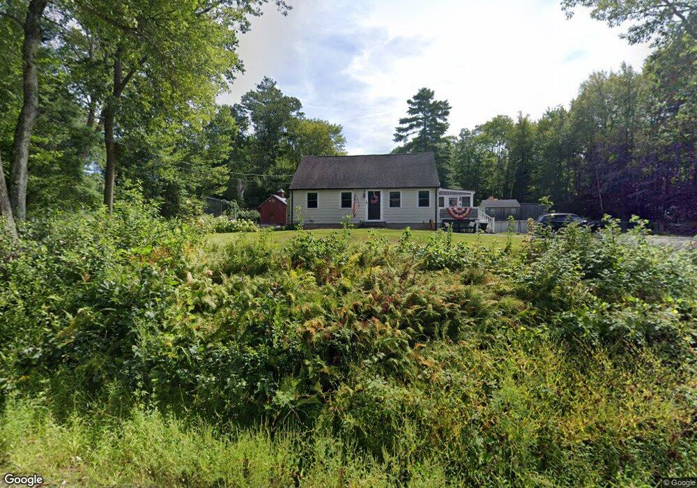
118 Thresher Rd Hampden, MA 01036
Estimated Value: $361,000 - $413,000
3
Beds
2
Baths
1,591
Sq Ft
$245/Sq Ft
Est. Value
About This Home
This home is located at 118 Thresher Rd, Hampden, MA 01036 and is currently estimated at $390,424, approximately $245 per square foot. 118 Thresher Rd is a home located in Hampden County with nearby schools including Minnechaug Regional High School.
Ownership History
Date
Name
Owned For
Owner Type
Purchase Details
Closed on
Apr 16, 2004
Sold by
Hampden Town Of
Bought by
Hrycay Christopher
Current Estimated Value
Purchase Details
Closed on
Jan 28, 2000
Sold by
Mccarthy Robert H
Bought by
Hrycay Christopher J
Home Financials for this Owner
Home Financials are based on the most recent Mortgage that was taken out on this home.
Original Mortgage
$103,600
Interest Rate
7.83%
Mortgage Type
Purchase Money Mortgage
Create a Home Valuation Report for This Property
The Home Valuation Report is an in-depth analysis detailing your home's value as well as a comparison with similar homes in the area
Home Values in the Area
Average Home Value in this Area
Purchase History
| Date | Buyer | Sale Price | Title Company |
|---|---|---|---|
| Hrycay Christopher | $5,500 | -- | |
| Hrycay Christopher J | $129,500 | -- |
Source: Public Records
Mortgage History
| Date | Status | Borrower | Loan Amount |
|---|---|---|---|
| Previous Owner | Hrycay Christopher J | $136,500 | |
| Previous Owner | Hrycay Christopher J | $103,600 | |
| Closed | Hrycay Christopher J | $19,425 |
Source: Public Records
Tax History
| Year | Tax Paid | Tax Assessment Tax Assessment Total Assessment is a certain percentage of the fair market value that is determined by local assessors to be the total taxable value of land and additions on the property. | Land | Improvement |
|---|---|---|---|---|
| 2025 | $5,378 | $356,400 | $104,200 | $252,200 |
| 2024 | $5,024 | $320,800 | $95,100 | $225,700 |
| 2023 | $4,783 | $283,500 | $95,100 | $188,400 |
| 2022 | $4,772 | $254,900 | $95,100 | $159,800 |
| 2021 | $4,746 | $241,300 | $95,100 | $146,200 |
| 2020 | $4,800 | $238,200 | $107,100 | $131,100 |
| 2019 | $4,690 | $238,200 | $107,100 | $131,100 |
| 2018 | $4,720 | $236,000 | $107,100 | $128,900 |
| 2017 | $4,334 | $224,700 | $107,100 | $117,600 |
| 2016 | $4,308 | $222,500 | $110,200 | $112,300 |
| 2015 | $4,269 | $224,900 | $110,200 | $114,700 |
Source: Public Records
Map
Nearby Homes
- 155 S Monson Rd
- 175 Scantic Rd
- 261 Chapin Rd
- Lot 2R &3 Chapin Rd
- 179 Chapin Rd
- 285 Lower Hampden Rd
- 0 Mountain Rd Unit 73267162
- 0 Mountain Rd Unit 72942534
- Lot D South Rd
- 8 S Ridge Rd
- 188 Bumstead Rd
- 102 Bogan Rd
- 230V Burleigh Rd
- 10 Robbins Rd
- 41 Martin Farms Rd
- 1070 Glendale Rd
- 1 Cedar Swamp Rd
- 733 Monson Rd
- 175 Stafford Rd
- 24 Haas Rd
- 122 Thresher Rd
- 119 Thresher Rd
- 115 Thresher Rd
- 128 Thresher Rd Unit 1
- 111 Thresher Rd
- 134 Thresher Rd
- 107 Thresher Rd
- 230 S Monson Rd
- 146 Thresher Rd
- 103 Thresher Rd
- 103 Thresher Rd
- 152 Thresher Rd
- 94 Thresher Rd
- 222 S Monson Rd
- 246 S Monson Rd
- 252 S Monson Rd
- 92 Thresher Rd
- 93 Thresher Rd
- 196 S Monson Rd
- 258 S Monson Rd
Your Personal Tour Guide
Ask me questions while you tour the home.