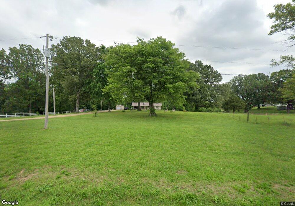
118 Twin Lake Dr Paragould, AR 72450
Estimated Value: $124,841 - $149,000
--
Bed
2
Baths
1,264
Sq Ft
$111/Sq Ft
Est. Value
About This Home
This home is located at 118 Twin Lake Dr, Paragould, AR 72450 and is currently estimated at $140,210, approximately $110 per square foot. 118 Twin Lake Dr is a home located in Greene County with nearby schools including Paragould High School.
Ownership History
Date
Name
Owned For
Owner Type
Purchase Details
Closed on
Aug 6, 2013
Sold by
Messer John
Bought by
Messer John
Current Estimated Value
Purchase Details
Closed on
Jul 30, 2002
Bought by
John and Dena Messer
Purchase Details
Closed on
Mar 15, 1999
Bought by
Dena John E and Dena Messer
Purchase Details
Closed on
Oct 18, 1993
Bought by
12Ac- 12Ac- 1 and 12Ac- John E
Purchase Details
Closed on
Jun 16, 1993
Bought by
12Ac- 12Ac- 1 and 12Ac- John E
Purchase Details
Closed on
Jan 9, 1992
Bought by
Gail Messer
Purchase Details
Closed on
Mar 9, 1990
Bought by
12Ac- 12Ac- 1 and 12Ac- John E
Purchase Details
Closed on
May 19, 1962
Bought by
Melburn and Gail Lorene Messer
Create a Home Valuation Report for This Property
The Home Valuation Report is an in-depth analysis detailing your home's value as well as a comparison with similar homes in the area
Home Values in the Area
Average Home Value in this Area
Purchase History
| Date | Buyer | Sale Price | Title Company |
|---|---|---|---|
| Messer John | -- | None Available | |
| John | -- | -- | |
| Dena John E | $1,000 | -- | |
| 12Ac- 12Ac- 1 | -- | -- | |
| 12Ac- 12Ac- 1 | -- | -- | |
| Gail Messer | -- | -- | |
| 12Ac- 12Ac- 1 | -- | -- | |
| Melburn | -- | -- |
Source: Public Records
Tax History Compared to Growth
Tax History
| Year | Tax Paid | Tax Assessment Tax Assessment Total Assessment is a certain percentage of the fair market value that is determined by local assessors to be the total taxable value of land and additions on the property. | Land | Improvement |
|---|---|---|---|---|
| 2025 | $823 | $22,680 | $4,750 | $17,930 |
| 2024 | $789 | $22,680 | $4,750 | $17,930 |
| 2023 | $755 | $17,080 | $4,200 | $12,880 |
| 2022 | $380 | $17,080 | $4,200 | $12,880 |
| 2021 | $345 | $17,080 | $4,200 | $12,880 |
| 2020 | $686 | $15,170 | $2,720 | $12,450 |
| 2019 | $311 | $15,170 | $2,720 | $12,450 |
| 2018 | $336 | $15,170 | $2,720 | $12,450 |
| 2017 | $671 | $15,170 | $2,720 | $12,450 |
| 2016 | $321 | $15,170 | $2,720 | $12,450 |
| 2015 | $258 | $13,750 | $2,720 | $11,030 |
| 2014 | $538 | $13,750 | $2,720 | $11,030 |
Source: Public Records
Map
Nearby Homes
- 146 Messer Dr
- 5.38 AC Highway 135 N
- 181 Misty Marie
- 205 Raymond
- 422 Sunset Dr
- 44 Oak Grove Rd
- 193 Granny Jean Ln
- 522 Vaughn Dr
- 233 Lois Ln
- 1387 Greene Road 517
- 1094 Greene Road 508
- Tract 4 Greene 726 Rd
- Tract 3 Greene 726 Rd
- Tract 2 Greene 726 Rd
- 000 Hwy 412 Byp Everett Dr
- 0 Hwy 49s Unit 10124883
- 3407 Sweet Gum St
- 3505 Sweet Gum St
- 0 Acres Highway 49n Unit 10121154
- 3501 Sweet Gum St