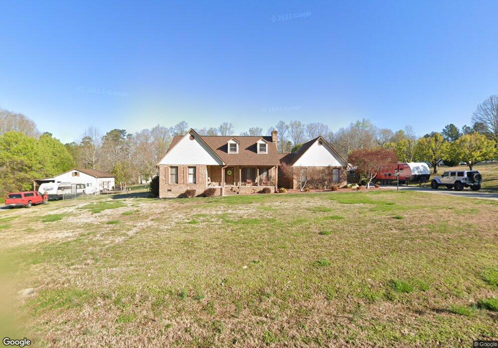
118 Whetstine Rd Kings Mountain, NC 28086
Estimated Value: $331,922 - $425,000
--
Bed
--
Bath
1,695
Sq Ft
$228/Sq Ft
Est. Value
About This Home
This home is located at 118 Whetstine Rd, Kings Mountain, NC 28086 and is currently estimated at $385,981, approximately $227 per square foot. 118 Whetstine Rd is a home located in Cleveland County with nearby schools including Bethware Elementary School, Kings Mountain Intermediate School, and Kings Mountain Middle.
Ownership History
Date
Name
Owned For
Owner Type
Purchase Details
Closed on
Aug 26, 2005
Sold by
Pauley Harlen and Pauley Gloria
Bought by
Crawford James Calvin and Crawford Debra A
Current Estimated Value
Home Financials for this Owner
Home Financials are based on the most recent Mortgage that was taken out on this home.
Original Mortgage
$50,000
Interest Rate
5.71%
Mortgage Type
New Conventional
Create a Home Valuation Report for This Property
The Home Valuation Report is an in-depth analysis detailing your home's value as well as a comparison with similar homes in the area
Home Values in the Area
Average Home Value in this Area
Purchase History
| Date | Buyer | Sale Price | Title Company |
|---|---|---|---|
| Crawford James Calvin | $180,000 | None Available |
Source: Public Records
Mortgage History
| Date | Status | Borrower | Loan Amount |
|---|---|---|---|
| Closed | Crawford James Calvin | $50,000 |
Source: Public Records
Tax History Compared to Growth
Tax History
| Year | Tax Paid | Tax Assessment Tax Assessment Total Assessment is a certain percentage of the fair market value that is determined by local assessors to be the total taxable value of land and additions on the property. | Land | Improvement |
|---|---|---|---|---|
| 2025 | $2,068 | $325,693 | $31,379 | $294,314 |
| 2024 | $1,960 | $236,479 | $23,524 | $212,955 |
| 2023 | $1,958 | $236,479 | $23,524 | $212,955 |
| 2022 | $1,951 | $236,479 | $23,524 | $212,955 |
| 2021 | $1,958 | $236,479 | $23,524 | $212,955 |
| 2020 | $1,583 | $182,395 | $19,235 | $163,160 |
| 2019 | $1,583 | $182,395 | $19,235 | $163,160 |
| 2018 | $1,579 | $182,395 | $19,235 | $163,160 |
| 2017 | $1,571 | $182,395 | $19,235 | $163,160 |
| 2016 | $1,495 | $182,395 | $19,235 | $163,160 |
| 2015 | -- | $166,148 | $16,164 | $149,984 |
| 2014 | -- | $166,148 | $16,164 | $149,984 |
Source: Public Records
Map
Nearby Homes
- 600 Ginger Dr
- 605 Ginger Dr
- 5139 E Dixon Blvd
- 5067 E Dixon Blvd
- 107 Stony Point Rd
- 2207 David Baptist Ch Rd
- 2166 Vestibule Church Rd
- 236 Hoyles Rd
- 103 Stony Point Rd
- 1238 Oak Grove Rd
- 2167 Vestibule Church Rd Unit 5U, 16U
- 507 Bethlehem Rd
- 839 Oak Grove Rd
- 153 Harbourtown Dr
- 111 High Ridge Ct
- 116 Cypress Point Dr
- 110 Cypress Point Dr
- 105 High Ridge Ct
- 310 Yarbro Rd
- 100 Tripp Dr
- 101 Jamestown Ct
- 120 Whetstine Rd
- 116 Whetstine Rd
- 113 Whetstine Rd
- 103 Jamestown Ct
- 117 Whetstine Rd
- 102 Jamestown Ct
- 114 Whetstine Rd
- 119 Whetstine Rd
- 121 Whetstine Rd
- 104 Jamestown Ct
- 112 Whetstine Rd Unit 1
- 121 Whetstine Dr
- 110 Whetstine Rd
- 103 Biggerstaff Ct
- 115 Whetstine Rd
- 124 Whetstine Rd
- 108 Whetstine Rd
- 106 Whetstine Rd
- 104 Biggerstaff Ct