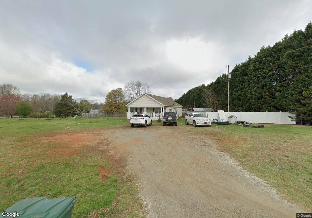
1180 Cooper Rd Salisbury, NC 28147
Estimated Value: $292,384 - $350,000
3
Beds
2
Baths
1,210
Sq Ft
$275/Sq Ft
Est. Value
About This Home
This home is located at 1180 Cooper Rd, Salisbury, NC 28147 and is currently estimated at $332,346, approximately $274 per square foot. 1180 Cooper Rd is a home located in Rowan County with nearby schools including Millbridge Elementary School, Southeast Middle School, and West Rowan High School.
Ownership History
Date
Name
Owned For
Owner Type
Purchase Details
Closed on
Mar 6, 2008
Sold by
Gmac Mortgage Llc
Bought by
Rollans Samuel Ashley
Current Estimated Value
Home Financials for this Owner
Home Financials are based on the most recent Mortgage that was taken out on this home.
Original Mortgage
$80,275
Outstanding Balance
$49,687
Interest Rate
5.62%
Mortgage Type
Purchase Money Mortgage
Estimated Equity
$282,659
Purchase Details
Closed on
Nov 29, 2007
Sold by
Morris Lisa Nicole and Morris Danny
Bought by
Gmac Mortgage Llc
Purchase Details
Closed on
May 27, 2004
Sold by
Swiney Helen R
Bought by
Morris Danny and Morris Lisa Nicole
Home Financials for this Owner
Home Financials are based on the most recent Mortgage that was taken out on this home.
Original Mortgage
$106,650
Interest Rate
7.12%
Mortgage Type
Purchase Money Mortgage
Create a Home Valuation Report for This Property
The Home Valuation Report is an in-depth analysis detailing your home's value as well as a comparison with similar homes in the area
Home Values in the Area
Average Home Value in this Area
Purchase History
| Date | Buyer | Sale Price | Title Company |
|---|---|---|---|
| Rollans Samuel Ashley | $84,500 | None Available | |
| Gmac Mortgage Llc | $95,273 | None Available | |
| Morris Danny | $118,500 | -- |
Source: Public Records
Mortgage History
| Date | Status | Borrower | Loan Amount |
|---|---|---|---|
| Open | Rollans Samuel Ashley | $80,275 | |
| Previous Owner | Morris Danny | $106,650 |
Source: Public Records
Tax History Compared to Growth
Tax History
| Year | Tax Paid | Tax Assessment Tax Assessment Total Assessment is a certain percentage of the fair market value that is determined by local assessors to be the total taxable value of land and additions on the property. | Land | Improvement |
|---|---|---|---|---|
| 2025 | $1,387 | $204,673 | $48,400 | $156,273 |
| 2024 | $1,387 | $204,673 | $48,400 | $156,273 |
| 2023 | $1,387 | $204,673 | $48,400 | $156,273 |
| 2022 | $913 | $120,866 | $32,065 | $88,801 |
| 2021 | $903 | $120,866 | $32,065 | $88,801 |
| 2020 | $903 | $120,866 | $32,065 | $88,801 |
| 2019 | $903 | $120,866 | $32,065 | $88,801 |
| 2018 | $771 | $104,060 | $32,065 | $71,995 |
| 2017 | $771 | $104,060 | $32,065 | $71,995 |
| 2016 | $771 | $104,060 | $32,065 | $71,995 |
| 2015 | $780 | $104,060 | $32,065 | $71,995 |
| 2014 | $765 | $106,923 | $32,065 | $74,858 |
Source: Public Records
Map
Nearby Homes
- 260 Cress School Rd
- 0 Patrick Dr
- 4860 Patterson Rd
- 2570 Lipe Rd
- 611 Davis Farm Dr
- 462 Cress Loop Rd
- 1213 Stonegate Dr
- 1340 Coppergate Dr
- 1370 Coppergate Dr
- 1355 Coppergate Dr
- 203 Trinity Ct
- 3080 Shue Rd
- 328 Bramblewood Dr
- 1280 Coppergate Dr
- Azalea II Plan at Yorkshire Farms
- Daffodil Plan at Yorkshire Farms
- 1005 Osprey Ln
- 1045 Castle Mill Ln Unit 38
- 1033 Stonegate Dr
- 1240 Coppergate Dr
- 1180 Cooper Rd
- 1290 Cooper Rd
- 1285 Cooper Rd
- 1285 Cooper Rd
- 1185 Cooper Rd
- 1330 Cooper Rd
- 110 Plum Tree Dr
- 1325 Cooper Rd
- 120 Plum Tree Dr
- 0 Quail Pointe Dr
- 1135 Cooper Rd
- 85 Paige Dr
- 1425 Cooper Rd
- 225 Paige Dr
- 1165 Cooper Rd
- 215 Paige Dr
- 160 Plum Tree Dr
- 1440 Cooper Rd
- 210 Plum Tree Dr
- 224 Plum Tree Dr