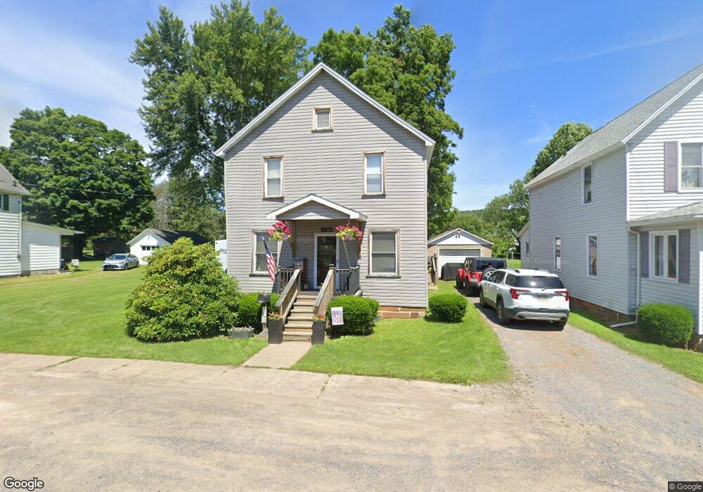
1180 Hilton Ave Smethport, PA 16749
Estimated Value: $108,762 - $137,000
--
Bed
--
Bath
1,824
Sq Ft
$65/Sq Ft
Est. Value
About This Home
This home is located at 1180 Hilton Ave, Smethport, PA 16749 and is currently estimated at $118,191, approximately $64 per square foot. 1180 Hilton Ave is a home located in McKean County with nearby schools including Smethport Area Elementary School and Smethport Area Junior/Senior High School.
Ownership History
Date
Name
Owned For
Owner Type
Purchase Details
Closed on
Jul 11, 2013
Sold by
Clark Robert G and Clark Diana L
Bought by
Kinner Nicholas N and Kinner Molly A
Current Estimated Value
Home Financials for this Owner
Home Financials are based on the most recent Mortgage that was taken out on this home.
Original Mortgage
$61,000
Outstanding Balance
$29,537
Interest Rate
3.83%
Mortgage Type
New Conventional
Estimated Equity
$88,654
Purchase Details
Closed on
Jul 15, 2010
Sold by
Clark Robert G and Clark Diana L
Bought by
Clark Robert G and Clark Diana L
Create a Home Valuation Report for This Property
The Home Valuation Report is an in-depth analysis detailing your home's value as well as a comparison with similar homes in the area
Home Values in the Area
Average Home Value in this Area
Purchase History
| Date | Buyer | Sale Price | Title Company |
|---|---|---|---|
| Kinner Nicholas N | $45,000 | None Available | |
| Clark Robert G | -- | None Available |
Source: Public Records
Mortgage History
| Date | Status | Borrower | Loan Amount |
|---|---|---|---|
| Open | Kinner Nicholas N | $61,000 |
Source: Public Records
Tax History Compared to Growth
Tax History
| Year | Tax Paid | Tax Assessment Tax Assessment Total Assessment is a certain percentage of the fair market value that is determined by local assessors to be the total taxable value of land and additions on the property. | Land | Improvement |
|---|---|---|---|---|
| 2025 | $1,296 | $37,810 | $6,620 | $31,190 |
| 2024 | $1,249 | $37,810 | $6,620 | $31,190 |
| 2023 | $1,249 | $37,810 | $6,620 | $31,190 |
| 2022 | $1,249 | $37,810 | $6,620 | $31,190 |
| 2021 | $1,233 | $37,810 | $6,620 | $31,190 |
| 2020 | $1,233 | $37,810 | $6,620 | $31,190 |
| 2019 | $1,171 | $37,810 | $6,620 | $31,190 |
| 2018 | $11 | $37,810 | $6,620 | $31,190 |
| 2017 | -- | $37,810 | $6,620 | $31,190 |
| 2016 | $1,054 | $37,810 | $6,620 | $31,190 |
| 2015 | $292 | $37,810 | $6,620 | $31,190 |
| 2014 | $292 | $29,670 | $6,620 | $23,050 |
Source: Public Records
Map
Nearby Homes
- 00 W Main St
- 911 W Main St
- 305 State St
- 19 W Willow St
- 108 Library Dr
- 314 Emerald Isle
- 402 E Water St
- 308 Emerald Isle
- 41 Bank St
- 225 Emerald Isle
- 501 Allegheny St
- 0 Rte 59 Smethport Ormsby Rd Unit 24-264
- 18398 Route 6
- 18398 U S 6
- 6113 Route 46
- 198 Spring Run Rd
- 3488 Pennsylvania 46
- 3488 Route 46
- 179 White Hollow Rd
- 0 Bordell Rd Unit LotWP006 17041600
- 1190 Hilton Ave
- 1196 Hilton Ave
- 1191 Hilton Ave
- 1187 Hilton Ave
- 1187 Hilton Ave
- 1179 Hilton Ave
- 1169 Hilton Ave
- 1206 Hilton Ave
- 1203 Hilton Ave
- 1203 Hilton Ave
- 916 W King St
- 916 W King St
- 18 E Ralph St
- 120 Hilton Avenue Trailer Ct
- 102 Hilton Avenue Trailer Ct
- 1107 W Water St
- 1403 W Main St
- 1113 Hilton Ave
- 26 High St
- 1101 W Water St