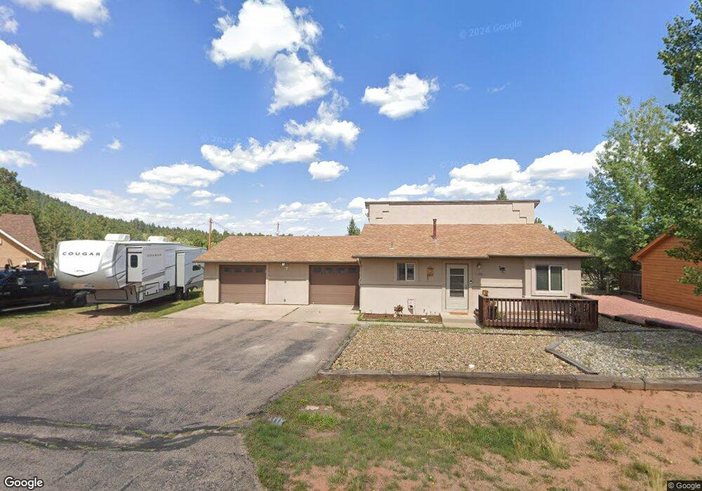
1180 Michael Ln Woodland Park, CO 80863
Estimated Value: $419,603 - $498,000
3
Beds
2
Baths
878
Sq Ft
$521/Sq Ft
Est. Value
About This Home
This home is located at 1180 Michael Ln, Woodland Park, CO 80863 and is currently estimated at $457,401, approximately $520 per square foot. 1180 Michael Ln is a home located in Teller County with nearby schools including Merit Academy, Woodland Park Junior/Senior High School, and Colorado Springs Christian School.
Ownership History
Date
Name
Owned For
Owner Type
Purchase Details
Closed on
May 7, 2015
Sold by
Deutsch John T and Deutsch Laura W
Bought by
Houser Chad J and Houser Tammy R
Current Estimated Value
Home Financials for this Owner
Home Financials are based on the most recent Mortgage that was taken out on this home.
Original Mortgage
$185,300
Outstanding Balance
$143,059
Interest Rate
3.74%
Mortgage Type
New Conventional
Estimated Equity
$314,342
Purchase Details
Closed on
Mar 19, 1982
Bought by
Houser Chad J and Houser Tammy R
Purchase Details
Closed on
Dec 10, 1981
Bought by
Houser Chad J and Houser Tammy R
Create a Home Valuation Report for This Property
The Home Valuation Report is an in-depth analysis detailing your home's value as well as a comparison with similar homes in the area
Home Values in the Area
Average Home Value in this Area
Purchase History
| Date | Buyer | Sale Price | Title Company |
|---|---|---|---|
| Houser Chad J | $218,000 | Empire Title Woodland Park | |
| Houser Chad J | $60,000 | -- | |
| Houser Chad J | $9,800 | -- |
Source: Public Records
Mortgage History
| Date | Status | Borrower | Loan Amount |
|---|---|---|---|
| Open | Houser Chad J | $185,300 |
Source: Public Records
Tax History Compared to Growth
Tax History
| Year | Tax Paid | Tax Assessment Tax Assessment Total Assessment is a certain percentage of the fair market value that is determined by local assessors to be the total taxable value of land and additions on the property. | Land | Improvement |
|---|---|---|---|---|
| 2024 | $2,003 | $25,290 | $3,476 | $21,814 |
| 2023 | $2,003 | $25,290 | $3,480 | $21,810 |
| 2022 | $1,780 | $21,900 | $3,530 | $18,370 |
| 2021 | $1,822 | $22,530 | $3,630 | $18,900 |
| 2020 | $1,537 | $19,450 | $3,370 | $16,080 |
| 2019 | $1,527 | $19,450 | $0 | $0 |
| 2018 | $1,231 | $15,340 | $0 | $0 |
| 2017 | $1,233 | $15,340 | $0 | $0 |
| 2016 | $1,258 | $15,610 | $0 | $0 |
| 2015 | $683 | $7,810 | $0 | $0 |
| 2014 | -- | $13,240 | $0 | $0 |
Source: Public Records
Map
Nearby Homes
- 1127 Michael Ln
- 1136 Ptarmigan Dr
- 1300 Thomas Cir
- 1163 Ptarmigan Dr
- 1149 Ptarmigan Dr
- 1145 Ptarmigan Dr
- 828 Northwoods Dr E
- 1313 Stone Ridge Dr
- 1290 Firestone Dr
- 0 Firestone Dr
- 1279 Firestone Dr
- 1322 Firestone Dr
- 1260 Sundance St
- 780 W Kelley's Rd
- 718 Misty Pines Cir
- 29507 N Highway 67
- 13990 N Highway 67
- Tract 36 N Highway 67
- 29545 N Highway 67
- 14077 N Highway 67
- 1200 Michael Ln
- 1160 Michael Ln
- 1220 Michael Ln
- 1150 Michael Ln
- 925 Northwoods Dr W
- 1147 Michael Ln
- 1140 Michael Ln
- 1217 Michael Ln
- 1240 Michael Ln
- 1130 Michael Ln
- 1237 Michael Ln
- 915 Northwoods Dr W
- 1120 Michael Ln
- 1280 Michael Ln
- 1182 Ptarmigan Dr
- 1190 Ptarmigan Dr
- 910 Northwoods Dr W
- 1186 Ptarmigan Dr
- 1110 Michael Ln
- 1247 Michael Ln