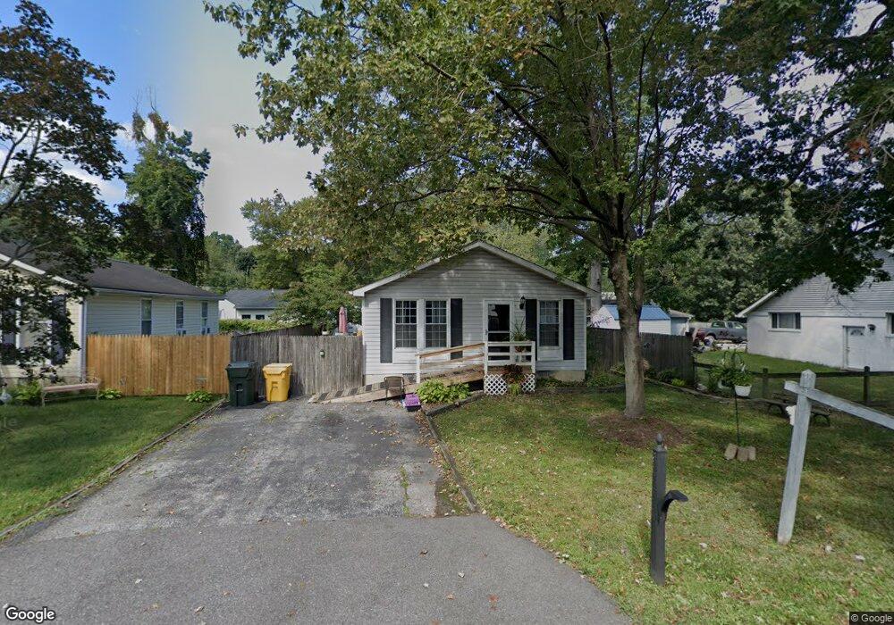
1180 Spruce Ave Shady Side, MD 20764
Estimated Value: $306,000 - $322,000
3
Beds
1
Bath
864
Sq Ft
$362/Sq Ft
Est. Value
About This Home
This home is located at 1180 Spruce Ave, Shady Side, MD 20764 and is currently estimated at $312,960, approximately $362 per square foot. 1180 Spruce Ave is a home located in Anne Arundel County with nearby schools including Shady Side Elementary School, Southern Middle School, and Southern High School.
Ownership History
Date
Name
Owned For
Owner Type
Purchase Details
Closed on
Apr 6, 2017
Sold by
Tumulty Sherry
Bought by
Tumulty Sherry and Tumulty Patrick W
Current Estimated Value
Purchase Details
Closed on
Feb 28, 2009
Sold by
Knicley Adam D
Bought by
Shahan Sherry
Home Financials for this Owner
Home Financials are based on the most recent Mortgage that was taken out on this home.
Original Mortgage
$225,132
Interest Rate
5.19%
Mortgage Type
New Conventional
Purchase Details
Closed on
Oct 22, 2004
Sold by
Belcher I A
Bought by
Knicley Adam D
Purchase Details
Closed on
Jun 18, 2002
Sold by
Leapley William R
Bought by
Belcher Brandi A
Create a Home Valuation Report for This Property
The Home Valuation Report is an in-depth analysis detailing your home's value as well as a comparison with similar homes in the area
Home Values in the Area
Average Home Value in this Area
Purchase History
| Date | Buyer | Sale Price | Title Company |
|---|---|---|---|
| Tumulty Sherry | -- | None Available | |
| Shahan Sherry | $210,000 | -- | |
| Knicley Adam D | $200,000 | -- | |
| Belcher Brandi A | $136,000 | -- |
Source: Public Records
Mortgage History
| Date | Status | Borrower | Loan Amount |
|---|---|---|---|
| Previous Owner | Shahan Sherry | $225,132 | |
| Closed | Belcher Brandi A | -- |
Source: Public Records
Tax History
| Year | Tax Paid | Tax Assessment Tax Assessment Total Assessment is a certain percentage of the fair market value that is determined by local assessors to be the total taxable value of land and additions on the property. | Land | Improvement |
|---|---|---|---|---|
| 2025 | $3,007 | $241,533 | -- | -- |
| 2024 | $3,007 | $230,167 | $0 | $0 |
| 2023 | $2,901 | $218,800 | $131,300 | $87,500 |
| 2022 | $2,735 | $215,833 | $0 | $0 |
| 2020 | $2,612 | $209,900 | $131,300 | $78,600 |
| 2019 | $2,609 | $201,600 | $0 | $0 |
| 2018 | $1,960 | $193,300 | $0 | $0 |
| 2017 | $2,444 | $185,000 | $0 | $0 |
| 2016 | -- | $178,467 | $0 | $0 |
| 2015 | -- | $171,933 | $0 | $0 |
| 2014 | -- | $165,400 | $0 | $0 |
Source: Public Records
Map
Nearby Homes
- 1176 Spruce Ave
- 1191 Spruce Ave
- 1205 Poplar Ave
- 0 Pine Ave Unit MDAA2139458
- 1160 Oak Ave
- 5191 Spring Ave
- 1199 Oak Ave
- 1168 Maple Ave
- 1235 Spruce Ave
- 1461 Cedarhurst Rd
- 0 Haile Pkwy Unit MDAA2127474
- 1445 & 1447 Haile Pkwy
- 1436 Haile Pkwy
- 4949 Idlewilde Rd
- 1451 Shady Rest Rd
- 0 Shady Side Rd Unit MDAA2113156
- 0 Shady Side Rd Unit MDAA2113166
- 1428 Haile Pkwy
- 1411 Haile Pkwy
- 1419 Shady Rest Rd
Your Personal Tour Guide
Ask me questions while you tour the home.