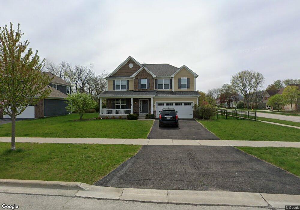
1180 W Thomas Rd Wheaton, IL 60187
Northside-Wheaton NeighborhoodEstimated Value: $810,157 - $872,000
4
Beds
4
Baths
3,000
Sq Ft
$283/Sq Ft
Est. Value
About This Home
This home is located at 1180 W Thomas Rd, Wheaton, IL 60187 and is currently estimated at $850,039, approximately $283 per square foot. 1180 W Thomas Rd is a home located in DuPage County with nearby schools including Carl Sandburg Elementary School, Monroe Middle School, and Wheaton North High School.
Ownership History
Date
Name
Owned For
Owner Type
Purchase Details
Closed on
May 30, 2023
Sold by
Khan Erum and Faizan Yar
Bought by
Niekamp Thomas R and Niekamp Dina M
Current Estimated Value
Home Financials for this Owner
Home Financials are based on the most recent Mortgage that was taken out on this home.
Original Mortgage
$616,500
Outstanding Balance
$597,084
Interest Rate
6.5%
Mortgage Type
New Conventional
Estimated Equity
$252,955
Purchase Details
Closed on
Mar 27, 2017
Sold by
M I Homes Of Chicago Llc
Bought by
Khan Erum
Create a Home Valuation Report for This Property
The Home Valuation Report is an in-depth analysis detailing your home's value as well as a comparison with similar homes in the area
Home Values in the Area
Average Home Value in this Area
Purchase History
| Date | Buyer | Sale Price | Title Company |
|---|---|---|---|
| Niekamp Thomas R | $685,000 | Chicago Title | |
| Khan Erum | $570,000 | First American Title Insuran |
Source: Public Records
Mortgage History
| Date | Status | Borrower | Loan Amount |
|---|---|---|---|
| Open | Niekamp Thomas R | $616,500 |
Source: Public Records
Tax History
| Year | Tax Paid | Tax Assessment Tax Assessment Total Assessment is a certain percentage of the fair market value that is determined by local assessors to be the total taxable value of land and additions on the property. | Land | Improvement |
|---|---|---|---|---|
| 2024 | $14,713 | $236,281 | $36,970 | $199,311 |
| 2023 | $15,365 | $227,360 | $34,030 | $193,330 |
| 2022 | $14,881 | $214,880 | $32,160 | $182,720 |
| 2021 | $14,423 | $209,780 | $31,400 | $178,380 |
| 2020 | $14,380 | $207,830 | $31,110 | $176,720 |
| 2019 | $14,057 | $202,350 | $30,290 | $172,060 |
| 2018 | $13,854 | $197,270 | $28,540 | $168,730 |
| 2017 | $9,835 | $5,500 | $5,500 | $0 |
| 2016 | $4,913 | $5,280 | $5,280 | $0 |
| 2015 | $402 | $5,040 | $5,040 | $0 |
Source: Public Records
Map
Nearby Homes
- 570 Amy Ln
- 0 Ellis Ave
- 2018 N West St
- 26W181 Grand Ave
- Lot 11 Ellis Ave
- 1N248 Darling St
- 25W275 Doris Ave
- 114 W Prairie Ave
- 1115 N Main St
- 0N105 Lot 1 Nepil Ave
- 0N105 Lot 2 Nepil Ave
- 1017 N Main St
- 0N049 Page St
- 340 Parkway Dr
- 1902 N Washington St
- 0N655 Courtney Ln
- 107 N Pierce Ave
- 26W548 Prairie Ave
- 26W172 Klein Creek Dr
- 405 W Front St Unit 3207
- 1180 W Thomas Rd
- 1170 W Thomas Rd
- 1711 N Woodlawn St
- 1200 W Thomas Rd
- 1701 N Woodlawn St
- 1800 Knollwood Dr
- 1134 Royal Ct
- lot Knollwood Dr
- 1710 N Woodlawn St
- 1805 Woodlawn St
- 1210 W Thomas Rd
- 1685 N Woodlawn St
- 1810 Knollwood Dr
- 1700 N Woodlawn St
- 1126 Royal Ct
- 1801 Knollwood Dr
- 1815 Woodlawn St
- 1815 Woodlawn St
- 1686 N Woodlawn St
- 1220 W Thomas Rd
Your Personal Tour Guide
Ask me questions while you tour the home.