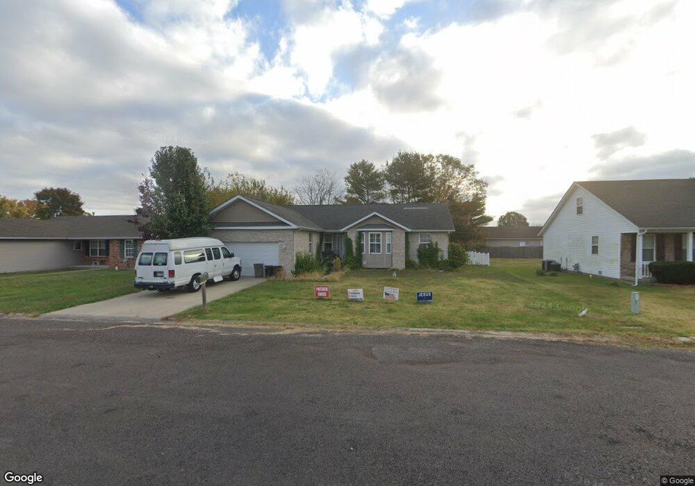
1180 Windshire Dr Mascoutah, IL 62258
Estimated Value: $277,519 - $314,000
Studio
--
Bath
1,568
Sq Ft
$190/Sq Ft
Est. Value
About This Home
This home is located at 1180 Windshire Dr, Mascoutah, IL 62258 and is currently estimated at $297,380, approximately $189 per square foot. 1180 Windshire Dr is a home located in St. Clair County with nearby schools including Mascoutah High School and Holy Childhood of Jesus School.
Ownership History
Date
Name
Owned For
Owner Type
Purchase Details
Closed on
Nov 17, 2003
Sold by
Miner Stanley R and Miner Barbara D
Bought by
1180 Windshire Drive Land Trust
Current Estimated Value
Purchase Details
Closed on
May 28, 2003
Sold by
Sauerhage David
Bought by
Miner Stanley R and Miner Barbara D
Home Financials for this Owner
Home Financials are based on the most recent Mortgage that was taken out on this home.
Original Mortgage
$20,000
Interest Rate
5.9%
Mortgage Type
Seller Take Back
Create a Home Valuation Report for This Property
The Home Valuation Report is an in-depth analysis detailing your home's value as well as a comparison with similar homes in the area
Purchase History
| Date | Buyer | Sale Price | Title Company |
|---|---|---|---|
| 1180 Windshire Drive Land Trust | $151,000 | Benchmark Title Company | |
| Miner Stanley R | $20,000 | Benchmark Title Company |
Source: Public Records
Mortgage History
| Date | Status | Borrower | Loan Amount |
|---|---|---|---|
| Previous Owner | Miner Stanley R | $20,000 |
Source: Public Records
Tax History
| Year | Tax Paid | Tax Assessment Tax Assessment Total Assessment is a certain percentage of the fair market value that is determined by local assessors to be the total taxable value of land and additions on the property. | Land | Improvement |
|---|---|---|---|---|
| 2024 | $6,038 | $82,357 | $14,099 | $68,258 |
| 2023 | $5,766 | $75,267 | $12,885 | $62,382 |
| 2022 | $5,714 | $68,499 | $11,726 | $56,773 |
| 2021 | $5,694 | $67,123 | $11,357 | $55,766 |
| 2020 | $5,460 | $62,962 | $10,653 | $52,309 |
| 2019 | $5,336 | $62,962 | $10,653 | $52,309 |
| 2018 | $5,229 | $61,271 | $10,367 | $50,904 |
| 2017 | $5,233 | $58,529 | $9,538 | $48,991 |
| 2016 | $5,182 | $57,687 | $9,401 | $48,286 |
| 2014 | $4,602 | $56,368 | $9,186 | $47,182 |
| 2013 | $4,348 | $55,567 | $9,055 | $46,512 |
Source: Public Records
Map
Nearby Homes
- 9719 Iroquois Dr
- 1151 Illiniwek Dr
- 1120 Lear Ln
- 1145 Gulfstream Way
- 1144 Menominee Trail
- 1204 Gulfstream Way
- 1113 Menominee Trail
- 9723 Weatherby St
- 908 Indian Prairie Dr
- 7 Hunters Trail
- 9640 Mallard Dr
- 1192 Widgeon Dr
- 713 Beebe Dr
- 924 Dere Bere Dr
- 9604 Winchester St
- 755 Moorland Cir
- 652 Moorland Cir
- 847 Topaz Ct
- 633 Fallen Timber Ln
- 121 Concord Cir
- 1176 Windshire Dr
- 1184 Windshire Dr
- 2075 Nathan Ave
- 2087 Nathan Ave
- 2063 Nathan Ave
- 1172 Windshire Dr
- 409 Lorene Place
- 1188 Windshire Dr
- 408 Lorene Place
- 2163 Nathan Ave
- 1987 Nathan Ave
- 1189 Windshire Dr
- 1168 Windshire Dr
- 1167 Windshire Dr
- 2072 Nathan Ave
- 320 Adam Ct
- 414 Lorene Place
- 2175 Nathan Ave
- 1975 Nathan Ave
- 407 Windshire Ct
Your Personal Tour Guide
Ask me questions while you tour the home.