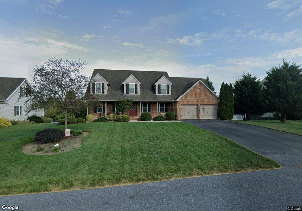
11800 Melrose Ave Greencastle, PA 17225
Estimated Value: $431,000 - $659,388
--
Bed
--
Bath
2,404
Sq Ft
$218/Sq Ft
Est. Value
About This Home
This home is located at 11800 Melrose Ave, Greencastle, PA 17225 and is currently estimated at $523,847, approximately $217 per square foot. 11800 Melrose Ave is a home located in Franklin County with nearby schools including Greencastle-Antrim Primary School, Greencastle-Antrim Elementary School, and Greencastle-Antrim Middle School.
Ownership History
Date
Name
Owned For
Owner Type
Purchase Details
Closed on
Jun 16, 2005
Sold by
Pt Envoy Llc
Bought by
Poole Larry W and Poole Susan Q
Current Estimated Value
Home Financials for this Owner
Home Financials are based on the most recent Mortgage that was taken out on this home.
Original Mortgage
$195,000
Outstanding Balance
$101,605
Interest Rate
5.73%
Mortgage Type
New Conventional
Estimated Equity
$422,242
Create a Home Valuation Report for This Property
The Home Valuation Report is an in-depth analysis detailing your home's value as well as a comparison with similar homes in the area
Home Values in the Area
Average Home Value in this Area
Purchase History
| Date | Buyer | Sale Price | Title Company |
|---|---|---|---|
| Poole Larry W | $327,200 | None Available |
Source: Public Records
Mortgage History
| Date | Status | Borrower | Loan Amount |
|---|---|---|---|
| Open | Poole Larry W | $195,000 |
Source: Public Records
Tax History Compared to Growth
Tax History
| Year | Tax Paid | Tax Assessment Tax Assessment Total Assessment is a certain percentage of the fair market value that is determined by local assessors to be the total taxable value of land and additions on the property. | Land | Improvement |
|---|---|---|---|---|
| 2025 | $6,703 | $40,070 | $4,100 | $35,970 |
| 2024 | $6,081 | $40,070 | $4,100 | $35,970 |
| 2023 | $6,010 | $40,070 | $4,100 | $35,970 |
| 2022 | $6,010 | $40,070 | $4,100 | $35,970 |
| 2021 | $5,893 | $40,070 | $4,100 | $35,970 |
| 2020 | $5,740 | $40,070 | $4,100 | $35,970 |
| 2019 | $5,609 | $40,070 | $4,100 | $35,970 |
| 2018 | $5,549 | $40,070 | $4,100 | $35,970 |
| 2017 | $5,409 | $40,070 | $4,100 | $35,970 |
| 2016 | $1,148 | $40,070 | $4,100 | $35,970 |
| 2015 | $1,070 | $40,070 | $4,100 | $35,970 |
| 2014 | $1,070 | $40,070 | $4,100 | $35,970 |
Source: Public Records
Map
Nearby Homes
- 20 Helens Dr
- 32 Helens Dr
- 1033 Webling Cir
- 11043 Grant Shook Rd
- 11051 Grant Shook Rd
- 10937 Grant Shook Rd
- 10925 Grant Shook Rd
- 10949 Grant Shook Rd
- 11115 Grant Shook Rd
- 1825 W Highland Ct
- 10199 Jasper Dr
- 12689 Williamsport Pike
- 878 Joy Dr
- 2428 Pikeside Dr
- TDB Paradise View Dr
- 382 Teaberry Dr
- 34.77 Acres Red Oak Estate S
- 270 Paradise View Dr
- 0 Molly Pitcher Hwy Unit PAFL2030380
- 0 Molly Pitcher Hwy Unit PAFL178468
- 11788 Melrose Ave
- 11818 Melrose Ave
- 11859 Buck Run Dr
- 11776 Melrose Ave
- 11793 Melrose Ave
- 11866 Buck Run Dr
- 11785 Melrose Ave
- 11811 Melrose Ave
- 11851 Buck Run Dr
- 11777 Melrose Ave
- 11768 Melrose Ave
- 11848 Buck Run Dr
- 510 Shook Ct E
- 11765 Melrose Ave
- 518 Shook Ct E
- 2010 Farmall Dr
- 11805 Buck Run Dr
- 11833 Buck Run Dr
- 521 Shook Ct E
- 526 Shook Ct E