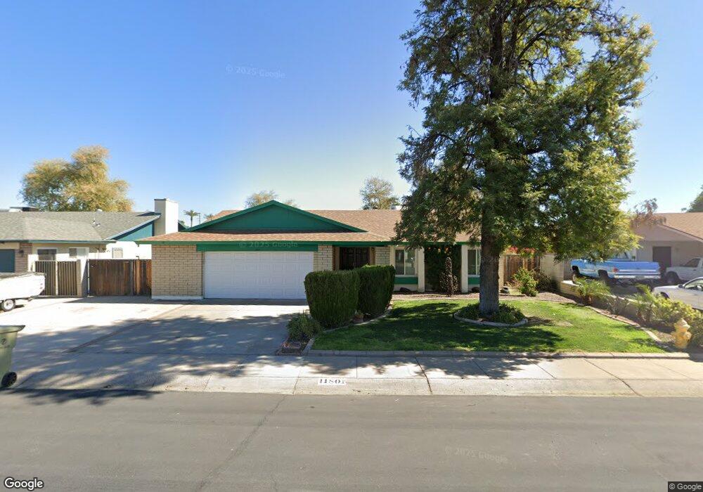
11801 N 52nd Ave Glendale, AZ 85304
Estimated Value: $329,793 - $448,000
4
Beds
2
Baths
1,824
Sq Ft
$218/Sq Ft
Est. Value
About This Home
This home is located at 11801 N 52nd Ave, Glendale, AZ 85304 and is currently estimated at $397,198, approximately $217 per square foot. 11801 N 52nd Ave is a home located in Maricopa County with nearby schools including Desert Palms Elementary School, Ironwood High School, and Intelli-School Glendale.
Ownership History
Date
Name
Owned For
Owner Type
Purchase Details
Closed on
Jul 10, 2025
Sold by
Grant-Mathai Joy E
Bought by
Mathai Living Trust and Grant-Mathai
Current Estimated Value
Purchase Details
Closed on
May 21, 2025
Sold by
Mathai Johnson N
Bought by
Grant-Mathai Joy E and Mathai Jordan N
Purchase Details
Closed on
Dec 8, 2022
Sold by
Mathai Johnson
Bought by
Grant-Mathai Joy
Purchase Details
Closed on
Aug 31, 2001
Sold by
Nemeth George S and Nemeth Maria
Bought by
Mathai Johnson
Home Financials for this Owner
Home Financials are based on the most recent Mortgage that was taken out on this home.
Original Mortgage
$115,900
Interest Rate
6.91%
Mortgage Type
New Conventional
Create a Home Valuation Report for This Property
The Home Valuation Report is an in-depth analysis detailing your home's value as well as a comparison with similar homes in the area
Home Values in the Area
Average Home Value in this Area
Purchase History
| Date | Buyer | Sale Price | Title Company |
|---|---|---|---|
| Mathai Living Trust | -- | None Listed On Document | |
| Grant-Mathai Joy E | -- | None Listed On Document | |
| Grant-Mathai Joy E | -- | None Listed On Document | |
| Grant-Mathai Joy | -- | -- | |
| Mathai Johnson | $122,000 | Capital Title Agency |
Source: Public Records
Mortgage History
| Date | Status | Borrower | Loan Amount |
|---|---|---|---|
| Previous Owner | Mathai Johnson | $115,900 |
Source: Public Records
Tax History Compared to Growth
Tax History
| Year | Tax Paid | Tax Assessment Tax Assessment Total Assessment is a certain percentage of the fair market value that is determined by local assessors to be the total taxable value of land and additions on the property. | Land | Improvement |
|---|---|---|---|---|
| 2025 | $1,031 | $13,226 | -- | -- |
| 2024 | $1,029 | $12,597 | -- | -- |
| 2023 | $1,029 | $28,470 | $5,690 | $22,780 |
| 2022 | $1,019 | $21,880 | $4,370 | $17,510 |
| 2021 | $1,094 | $20,160 | $4,030 | $16,130 |
| 2020 | $1,111 | $19,110 | $3,820 | $15,290 |
| 2019 | $1,080 | $17,310 | $3,460 | $13,850 |
| 2018 | $1,054 | $16,050 | $3,210 | $12,840 |
| 2017 | $1,061 | $13,720 | $2,740 | $10,980 |
| 2016 | $1,055 | $12,950 | $2,590 | $10,360 |
| 2015 | $989 | $12,720 | $2,540 | $10,180 |
Source: Public Records
Map
Nearby Homes
- 11639 N 52nd Ave
- 11640 N 51st Ave Unit 204
- 11640 N 51st Ave Unit 137
- 11640 N 51st Ave Unit 221
- 5174 W Laurel Ave
- 5214 W Cholla St
- 12031 N 53rd Ave
- 5315 W Shaw Butte Dr
- 5318 W Shaw Butte Dr
- 5432 W Sunnyside Dr
- 11840 N 49th Ave
- 11241 N 50th Ave
- 11051 N 53rd Ave
- 5341 W Bloomfield Rd
- 4810 W Laurel Ln
- 5221 W Columbine Dr
- 4747 W Sunnyside Ave
- 12407 N 54th Ave
- 4743 W Shaw Butte Dr
- 5534 W Riviera Dr
- 11807 N 52nd Ave
- 11813 N 52nd Ave
- 5166 W Sunnyside Dr
- 11633 N 52nd Ave
- 5202 W Sunnyside Dr
- 5201 W Sunnyside Dr
- 5162 W Sunnyside Dr
- 5165 W Poinsettia Dr
- 11819R N 52nd Ave
- 11819 N 52nd Ave
- 5203 W Poinsettia Dr
- 11627 N 52nd Ave
- 5161 W Poinsettia Dr
- 5158 W Sunnyside Dr
- 5208 W Sunnyside Dr
- 5207 W Sunnyside Dr
- 5170 W Poinsettia Dr
- 5202 W Altadena Ave
- 5204 W Altadena Ave
- 5157 W Poinsettia Dr