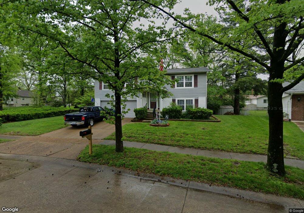
11808 Wexford Place Dr Maryland Heights, MO 63043
Estimated Value: $254,553 - $304,000
3
Beds
2
Baths
1,032
Sq Ft
$272/Sq Ft
Est. Value
About This Home
This home is located at 11808 Wexford Place Dr, Maryland Heights, MO 63043 and is currently estimated at $280,888, approximately $272 per square foot. 11808 Wexford Place Dr is a home located in St. Louis County with nearby schools including Parkwood Elementary, Pattonville Heights Middle School, and Pattonville High School.
Ownership History
Date
Name
Owned For
Owner Type
Purchase Details
Closed on
Mar 26, 2003
Sold by
Ozark Dome Inc
Bought by
Biesiada William P
Current Estimated Value
Home Financials for this Owner
Home Financials are based on the most recent Mortgage that was taken out on this home.
Original Mortgage
$139,050
Outstanding Balance
$59,297
Interest Rate
5.77%
Mortgage Type
VA
Estimated Equity
$221,591
Purchase Details
Closed on
Mar 7, 2001
Sold by
Ardester Williams
Bought by
Ozark Domes Inc
Create a Home Valuation Report for This Property
The Home Valuation Report is an in-depth analysis detailing your home's value as well as a comparison with similar homes in the area
Home Values in the Area
Average Home Value in this Area
Purchase History
| Date | Buyer | Sale Price | Title Company |
|---|---|---|---|
| Biesiada William P | $135,000 | -- | |
| Ozark Domes Inc | $87,000 | -- | |
| Ozark Domes Inc | -- | -- |
Source: Public Records
Mortgage History
| Date | Status | Borrower | Loan Amount |
|---|---|---|---|
| Open | Biesiada William P | $139,050 |
Source: Public Records
Tax History Compared to Growth
Tax History
| Year | Tax Paid | Tax Assessment Tax Assessment Total Assessment is a certain percentage of the fair market value that is determined by local assessors to be the total taxable value of land and additions on the property. | Land | Improvement |
|---|---|---|---|---|
| 2025 | $3,068 | $44,560 | $11,270 | $33,290 |
| 2024 | $3,068 | $40,200 | $9,670 | $30,530 |
| 2023 | $3,068 | $40,200 | $9,670 | $30,530 |
| 2022 | $2,825 | $33,560 | $8,080 | $25,480 |
| 2021 | $2,853 | $33,560 | $8,080 | $25,480 |
| 2020 | $2,505 | $29,710 | $5,640 | $24,070 |
| 2019 | $2,497 | $29,710 | $5,640 | $24,070 |
| 2018 | $2,421 | $26,380 | $4,830 | $21,550 |
| 2017 | $2,418 | $26,380 | $4,830 | $21,550 |
| 2016 | $2,326 | $24,890 | $3,610 | $21,280 |
| 2015 | $2,300 | $24,890 | $3,610 | $21,280 |
| 2014 | $2,593 | $28,580 | $5,780 | $22,800 |
Source: Public Records
Map
Nearby Homes
- 2755 Eldon Ave
- 2801 Eldon Ave
- 2727 Edgeworth Ave
- 20 Millwell Dr
- 2826 Foxwood Dr
- 134 Cumberland Ave
- 11502 Wylwood Dr
- 167 Edgeworth Ave
- 11848 Foxwood Dr
- 316 Harding Ave
- 11482 Essex Ave
- 19 Shumate Ave
- 11846 Sologne Ct Unit 39B
- 11983 Brookmont Dr
- 11818 Smoke Rise Ct
- 16 Midland Ave
- 11342 de Runtz Ave
- 11833 McKelvey Gardens Dr
- 12597 Fee Rd
- 11410 Essex Ave
- 2717 Eldon Ave
- 11812 Wexford Place Dr
- 2711 Eldon Ave
- 11815 Wexford Place Dr
- 11816 Wexford Place Dr
- 2706 Lakeport Dr
- 2712 Lakeport Dr
- 2729 Eldon Ave
- 2713 Lakeport Dr
- 11821 Wexford Place Dr
- 11820 Wexford Place Dr
- 2716 Lakeport Dr
- 2720 Eldon Ave
- 11814 Flushing Dr
- 2730 Eldon Ave
- 11829 Wexford Place Dr
- 2739 Eldon Ave
- 11828 Wexford Place Dr
- 717 Midland Ave
- 2720 Lakeport Dr