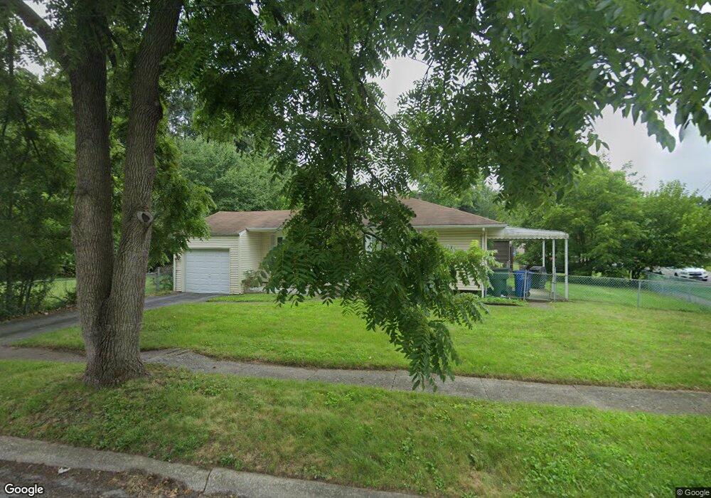
1181 Billie Dr Columbus, OH 43227
Shady Lane NeighborhoodEstimated Value: $161,000 - $236,000
3
Beds
1
Bath
990
Sq Ft
$208/Sq Ft
Est. Value
About This Home
This home is located at 1181 Billie Dr, Columbus, OH 43227 and is currently estimated at $206,140, approximately $208 per square foot. 1181 Billie Dr is a home located in Franklin County with nearby schools including Shady Lane Elementary School, Sherwood Middle School, and Walnut Ridge High School.
Ownership History
Date
Name
Owned For
Owner Type
Purchase Details
Closed on
Mar 22, 1996
Sold by
Slane Frank D
Bought by
Frank D Slane
Current Estimated Value
Home Financials for this Owner
Home Financials are based on the most recent Mortgage that was taken out on this home.
Original Mortgage
$54,000
Outstanding Balance
$2,125
Interest Rate
7.06%
Mortgage Type
FHA
Estimated Equity
$204,015
Purchase Details
Closed on
Feb 12, 1993
Purchase Details
Closed on
Jul 1, 1992
Create a Home Valuation Report for This Property
The Home Valuation Report is an in-depth analysis detailing your home's value as well as a comparison with similar homes in the area
Home Values in the Area
Average Home Value in this Area
Purchase History
| Date | Buyer | Sale Price | Title Company |
|---|---|---|---|
| Frank D Slane | $57,225 | -- | |
| -- | -- | -- | |
| -- | -- | -- |
Source: Public Records
Mortgage History
| Date | Status | Borrower | Loan Amount |
|---|---|---|---|
| Open | Frank D Slane | $54,000 |
Source: Public Records
Tax History Compared to Growth
Tax History
| Year | Tax Paid | Tax Assessment Tax Assessment Total Assessment is a certain percentage of the fair market value that is determined by local assessors to be the total taxable value of land and additions on the property. | Land | Improvement |
|---|---|---|---|---|
| 2024 | $3,010 | $67,060 | $18,550 | $48,510 |
| 2023 | $2,971 | $67,060 | $18,550 | $48,510 |
| 2022 | $1,658 | $31,960 | $8,190 | $23,770 |
| 2021 | $1,661 | $31,960 | $8,190 | $23,770 |
| 2020 | $1,663 | $31,960 | $8,190 | $23,770 |
| 2019 | $1,489 | $24,540 | $6,550 | $17,990 |
| 2018 | $1,391 | $24,540 | $6,550 | $17,990 |
| 2017 | $1,488 | $24,540 | $6,550 | $17,990 |
| 2016 | $1,429 | $21,570 | $6,060 | $15,510 |
| 2015 | $1,297 | $21,570 | $6,060 | $15,510 |
| 2014 | $1,300 | $21,570 | $6,060 | $15,510 |
| 2013 | $755 | $25,375 | $7,140 | $18,235 |
Source: Public Records
Map
Nearby Homes
- 1130 Little Plum Ln
- 4991 Justin Rd
- 1320 Nancy Ln
- 4501 Amesbury Rd
- 1281 Maetzel Dr
- 1085 S Hamilton Rd
- 4484 Grimsby Rd
- 4677 E Livingston Ave
- 1486 Efner Dr
- 4467 Grimsby Rd
- 931 Antwerp Rd
- 4571 Aragon Ave
- 1563 Genoa Place
- 1607 Shady Lane Rd
- 1607 Simpson Dr
- 1571 Baxter Dr
- 4701 Janis Dr
- 4662 Jae Ave
- 1678 Huxley Dr
- 1120 Fairway Blvd
- 1175 Lockwood Rd
- 1195 Littlejohn Dr
- 1173 Lockwood Rd
- 1159 Billie Dr
- 1199 Littlejohn Dr
- 1182 Billie Dr
- 1171 Lockwood Rd
- 1172 Billie Dr
- 1192 Billie Dr
- 1166 Lockwood Rd
- 1164 Billie Dr
- 1205 Littlejohn Dr
- 1156 Little Plum Ln
- 1169 Lockwood Rd
- 1156 Billie Dr
- 1196 Littlejohn Dr
- 1149 Billie Dr
- 1200 Littlejohn Dr
- 1213 Littlejohn Dr
- 1146 Little Plum Ln