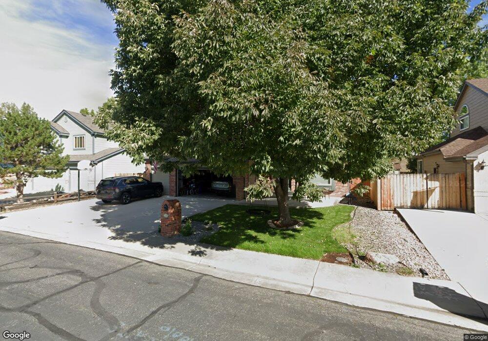
11813 W 75th Cir Arvada, CO 80005
Harvest Lane NeighborhoodEstimated Value: $761,832 - $877,000
5
Beds
4
Baths
2,942
Sq Ft
$282/Sq Ft
Est. Value
About This Home
This home is located at 11813 W 75th Cir, Arvada, CO 80005 and is currently estimated at $828,708, approximately $281 per square foot. 11813 W 75th Cir is a home located in Jefferson County with nearby schools including Fremont Elementary School, Oberon Middle School, and Arvada West High School.
Ownership History
Date
Name
Owned For
Owner Type
Purchase Details
Closed on
Jul 2, 2020
Sold by
Jamie E Alley Trust
Bought by
Arndt Ryan and Arndt Kelsey
Current Estimated Value
Home Financials for this Owner
Home Financials are based on the most recent Mortgage that was taken out on this home.
Original Mortgage
$494,400
Outstanding Balance
$438,401
Interest Rate
3.1%
Mortgage Type
New Conventional
Estimated Equity
$390,307
Purchase Details
Closed on
Feb 12, 2019
Sold by
Alley Jamie E
Bought by
Michael S Alley Trust and Jamie E Alley Trust
Purchase Details
Closed on
Aug 28, 1997
Sold by
Alley Michael S
Bought by
Alley Jamie E
Create a Home Valuation Report for This Property
The Home Valuation Report is an in-depth analysis detailing your home's value as well as a comparison with similar homes in the area
Home Values in the Area
Average Home Value in this Area
Purchase History
| Date | Buyer | Sale Price | Title Company |
|---|---|---|---|
| Arndt Ryan | $618,000 | Land Title Guarantee | |
| Michael S Alley Trust | -- | None Available | |
| Alley Jamie E | -- | -- |
Source: Public Records
Mortgage History
| Date | Status | Borrower | Loan Amount |
|---|---|---|---|
| Open | Arndt Ryan | $494,400 |
Source: Public Records
Tax History Compared to Growth
Tax History
| Year | Tax Paid | Tax Assessment Tax Assessment Total Assessment is a certain percentage of the fair market value that is determined by local assessors to be the total taxable value of land and additions on the property. | Land | Improvement |
|---|---|---|---|---|
| 2024 | $4,299 | $44,318 | $13,544 | $30,774 |
| 2023 | $4,299 | $44,318 | $13,544 | $30,774 |
| 2022 | $3,792 | $38,723 | $12,371 | $26,352 |
| 2021 | $3,855 | $39,837 | $12,727 | $27,110 |
| 2020 | $3,436 | $35,606 | $10,619 | $24,987 |
| 2019 | $3,390 | $35,606 | $10,619 | $24,987 |
| 2018 | $3,035 | $30,996 | $7,708 | $23,288 |
| 2017 | $2,778 | $30,996 | $7,708 | $23,288 |
| 2016 | $2,978 | $31,301 | $7,978 | $23,323 |
| 2015 | $2,545 | $31,301 | $7,978 | $23,323 |
| 2014 | $2,545 | $25,138 | $6,965 | $18,173 |
Source: Public Records
Map
Nearby Homes
- 7482 Routt Ln
- 11854 W 76th Ln
- 7454 Queen Cir
- 11825 W 73rd Dr
- 7255 Taft Ct
- 11802 W 77th Dr
- 11290 W 77th Dr
- 11495 W 77th Dr
- 7130 Simms St Unit 207
- 7587 Wright Ct
- 8055 Simms St
- 7154 Welch Ct
- 7631 Oak St
- 7080 Simms St Unit 204
- 12871 W 74th Dr
- 12940 W 75th Ave
- 13023 W 75th Place
- 7049 Van Gordon Ct
- 13111 W 74th Dr Unit 59
- 10512 W 75th Ave
- 11833 W 75th Cir
- 11773 W 75th Cir
- 11753 W 75th Cir
- 11853 W 75th Cir
- 11812 W 75th Cir
- 11832 W 75th Cir
- 11772 W 75th Cir
- 11733 W 75th Cir
- 11852 W 75th Cir
- 11752 W 75th Cir
- 7590 Tabor St
- 11811 W 75th Dr
- 11713 W 75th Cir
- 11831 W 75th Dr
- 11771 W 75th Dr
- 11732 W 75th Cir
- 7554 Taft Ct
- 11751 W 75th Dr
- 7535 Taft St
- 11703 W 75th Cir