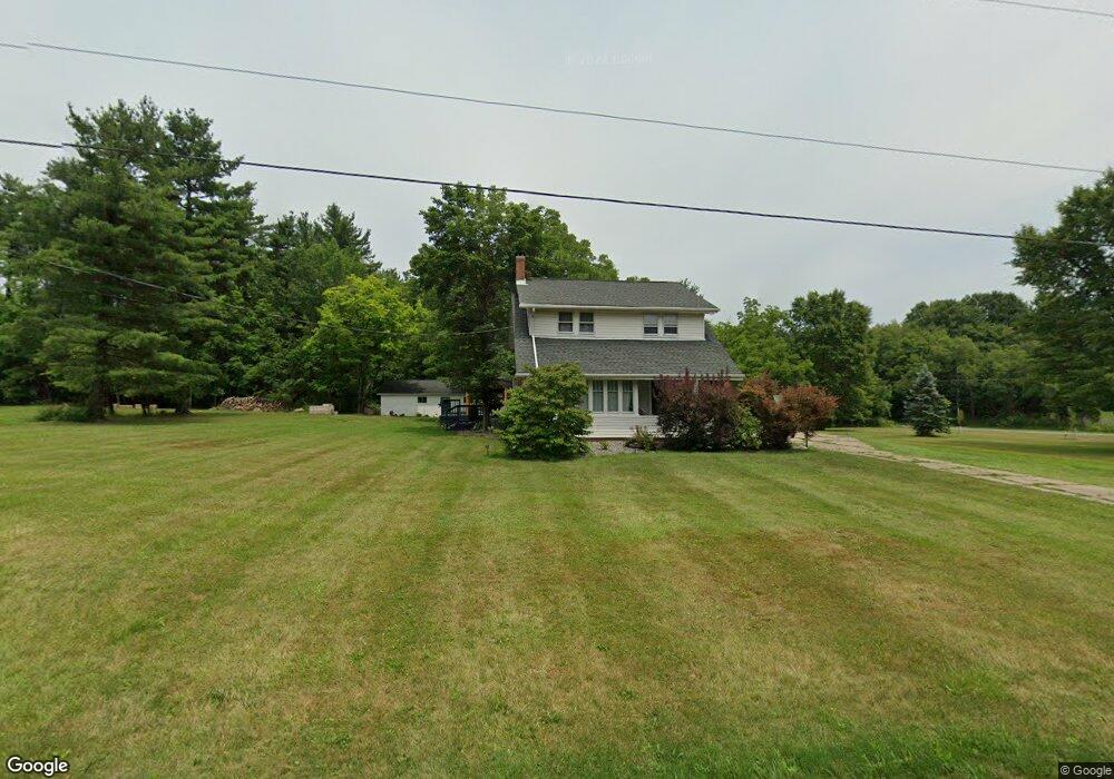
11815 Beeson St NE Alliance, OH 44601
Estimated Value: $289,911 - $405,000
3
Beds
2
Baths
1,793
Sq Ft
$185/Sq Ft
Est. Value
About This Home
This home is located at 11815 Beeson St NE, Alliance, OH 44601 and is currently estimated at $331,478, approximately $184 per square foot. 11815 Beeson St NE is a home located in Stark County with nearby schools including Marlington High School and Regina Coeli/St Joseph School.
Ownership History
Date
Name
Owned For
Owner Type
Purchase Details
Closed on
May 1, 2015
Sold by
Codrea Jenifer L
Bought by
Gazdak Michelle L
Current Estimated Value
Home Financials for this Owner
Home Financials are based on the most recent Mortgage that was taken out on this home.
Original Mortgage
$130,000
Outstanding Balance
$100,147
Interest Rate
3.68%
Mortgage Type
Purchase Money Mortgage
Estimated Equity
$231,331
Purchase Details
Closed on
May 4, 2009
Sold by
Codrea Jenifer Lee
Bought by
Codrea Jenifer L
Purchase Details
Closed on
Sep 26, 1988
Create a Home Valuation Report for This Property
The Home Valuation Report is an in-depth analysis detailing your home's value as well as a comparison with similar homes in the area
Home Values in the Area
Average Home Value in this Area
Purchase History
| Date | Buyer | Sale Price | Title Company |
|---|---|---|---|
| Gazdak Michelle L | $175,000 | Diamond Title Co | |
| Codrea Jenifer L | -- | None Available | |
| -- | $54,000 | -- |
Source: Public Records
Mortgage History
| Date | Status | Borrower | Loan Amount |
|---|---|---|---|
| Open | Gazdak Michelle L | $130,000 |
Source: Public Records
Tax History Compared to Growth
Tax History
| Year | Tax Paid | Tax Assessment Tax Assessment Total Assessment is a certain percentage of the fair market value that is determined by local assessors to be the total taxable value of land and additions on the property. | Land | Improvement |
|---|---|---|---|---|
| 2025 | -- | $84,430 | $26,500 | $57,930 |
| 2024 | -- | $84,430 | $26,500 | $57,930 |
| 2023 | $2,248 | $63,500 | $21,950 | $41,550 |
| 2022 | $2,256 | $63,500 | $21,950 | $41,550 |
| 2021 | $2,263 | $63,500 | $21,950 | $41,550 |
| 2020 | $2,209 | $55,240 | $18,940 | $36,300 |
| 2019 | $2,195 | $53,610 | $18,950 | $34,660 |
| 2018 | $2,133 | $53,610 | $18,950 | $34,660 |
| 2017 | $1,975 | $46,490 | $13,620 | $32,870 |
| 2016 | $1,840 | $43,300 | $12,950 | $30,350 |
| 2015 | $1,792 | $43,300 | $12,950 | $30,350 |
| 2014 | $1,702 | $37,560 | $12,010 | $25,550 |
| 2013 | $828 | $37,560 | $12,010 | $25,550 |
Source: Public Records
Map
Nearby Homes
- 10666 Wilma Ave NE
- 0 Reeder Ave NE
- 13334 Cindy St NE
- 0 Meadow St NE
- 12355 Edison St NE
- 11960 Freshley Ave NE
- 1430 Westwood Ave
- 11480 Aebi Ave NE
- 13109 Edison St NE
- 2377 Ansley St Unit 2377
- 0 W Main St Unit 5090123
- 2081 Marwood Cir
- 12415 Snode St NE
- 2851 Patriots Path Unit 3D
- 2435 Queensbury Rd
- 000 Klinger Ave
- 0 Valewood Cir Unit 5006281
- 432 Johnson Ave
- 1201 Overlook Dr
- 0 Easton St NE
- 11751 Beeson St NE
- 10444 Mccallum Ave NE
- 10635 Mccallum Ave NE
- 11977 Beeson St NE
- 11655 Beeson St NE
- 10632 Mccallum Ave NE
- 10717 Mccallum Ave NE
- 11621 Beeson St NE
- 10555 May Ave NE
- 11575 Beeson St NE
- 10801 Mccallum Ave NE
- 12080 Beeson St NE
- 0 Beeson St NE Unit 3963277
- 0 Beeson St NE Unit 3933099
- 10788 Mccallum Ave NE
- 10201 Mccallum Ave NE
- 10845 Mccallum Ave NE
- 10170 Mccallum Ave NE
- 12170 Beeson St NE
- 10874 Mccallum Ave NE