
Seller's Agent in 2025
Craig Wainwright
Wainwright Realty
(309) 236-8523
29 in this area
117 Total Sales
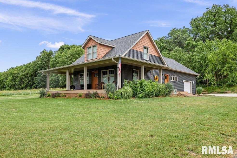
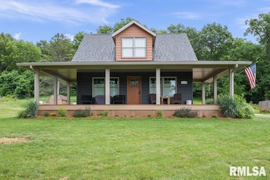
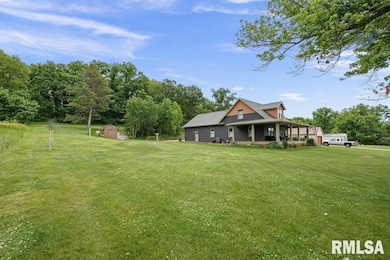
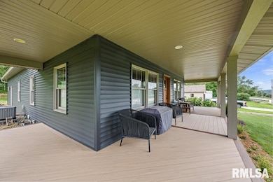
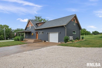
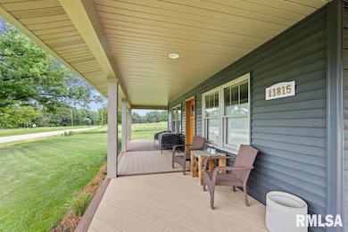
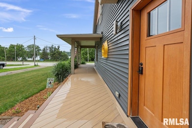
CRAFTMANSHIP - OPEN FLOOR PLAN. The seller remodeled this home in 2020 never to leave and has never stopped making perfection. 760 sq. ft. wrap around PVC Covered deck, built w/ 2/8 on 12" center set on concrete pilings, with partial views to Mississippi River. House-12" on center, floor joists tied for no squeak, 2 x 6 walls, 1" XPS foam on exterior taped, dense pack cellulose insulation in walls-R28 and ceiling-R60, 24" energy heel truss roof system, Anderson 400 series tip-in/removable double hung windows. Oak craftsman style trim and doors. Fiberglass Oak/like exterior doors. The main level has engineered wood floor, and the 2nd level bonus room has LVT flooring. Carpet is Stain-master Pet protect carpet. Kitchen has 1/4 Sawn Oak Cabinetry and granite counter tops. Main level bath has extra deep 19" tub/shower combo and penny tile floor. Master bedroom has reading nook, 36" X 60" Onyx shower and heated tile floor. Foundation and gutter drainage buried to road. Room at rear of lot for new owner's 32' x 36' garage.
Last Agent to Sell the Property
Wainwright Realty Brokerage Phone: 309-523-3338 License #471.006013/B59424000 Listed on: 06/27/2025
| Date | Type | Sale Price | Title Company |
|---|---|---|---|
| Warranty Deed | $317,500 | Gomez Title | |
| Quit Claim Deed | $28,100 | Codilis & Associates Pc | |
| Sheriffs Deed | -- | Codilis & Associates Pc |
| Date | Status | Loan Amount | Loan Type |
|---|---|---|---|
| Open | $49,750 | No Value Available | |
| Open | $172,500 | New Conventional |
| Date | Event | Price | List to Sale | Price per Sq Ft |
|---|---|---|---|---|
| 08/22/2025 08/22/25 | Sold | $317,500 | -2.3% | $174 / Sq Ft |
| 07/18/2025 07/18/25 | Pending | -- | -- | -- |
| 06/27/2025 06/27/25 | For Sale | $325,000 | -- | $178 / Sq Ft |
| Year | Tax Paid | Tax Assessment Tax Assessment Total Assessment is a certain percentage of the fair market value that is determined by local assessors to be the total taxable value of land and additions on the property. | Land | Improvement |
|---|---|---|---|---|
| 2024 | $4,429 | $71,162 | $8,567 | $62,595 |
| 2023 | $4,429 | $88,222 | $7,860 | $80,362 |
| 2022 | $3,565 | $57,170 | $7,496 | $49,674 |
| 2021 | $2,080 | $28,945 | $7,105 | $21,840 |
| 2020 | $2,048 | $28,517 | $7,000 | $21,517 |
| 2019 | $1,623 | $28,517 | $7,000 | $21,517 |
| 2018 | $2,561 | $42,233 | $12,571 | $29,662 |
| 2017 | $2,517 | $42,233 | $12,571 | $29,662 |
| 2016 | $2,484 | $41,649 | $12,397 | $29,252 |
| 2015 | $2,399 | $40,113 | $11,940 | $28,173 |
| 2014 | $416 | $39,716 | $11,822 | $27,894 |
| 2013 | $416 | $39,716 | $11,822 | $27,894 |
Seller's Agent in 2025
Craig Wainwright
Wainwright Realty
(309) 236-8523
29 in this area
117 Total Sales
C
Buyer's Agent in 2025
Chad Cox
Quad Cities Iowa Realty - Moline
1 in this area
2 Total Sales
Source: RMLS Alliance
MLS Number: QC4264799
APN: 04-13-100-007
Disclaimer: Certain information contained herein is derived from information provided by parties other than Homes.com. All information provided is deemed reliable, but is not guaranteed to be accurate and should be independently verified.
![]() IDX information is provided exclusively for personal, non-commercial use, and may not be used for any purpose other than to identify prospective properties consumers may be interested in purchasing. Information is deemed reliable but not guaranteed.
IDX information is provided exclusively for personal, non-commercial use, and may not be used for any purpose other than to identify prospective properties consumers may be interested in purchasing. Information is deemed reliable but not guaranteed.