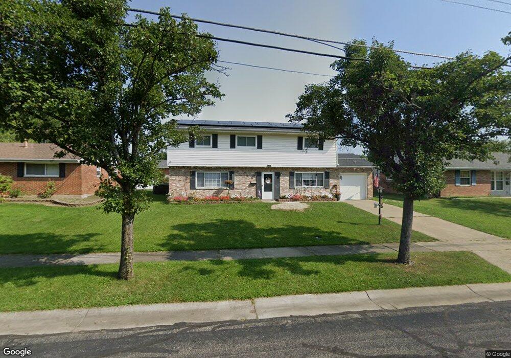
11819 Neuss Ave Cincinnati, OH 45246
Estimated Value: $241,844 - $268,000
4
Beds
3
Baths
1,960
Sq Ft
$129/Sq Ft
Est. Value
About This Home
This home is located at 11819 Neuss Ave, Cincinnati, OH 45246 and is currently estimated at $251,961, approximately $128 per square foot. 11819 Neuss Ave is a home located in Hamilton County with nearby schools including Springdale Elementary School, Princeton Community Middle School, and Princeton High School.
Ownership History
Date
Name
Owned For
Owner Type
Purchase Details
Closed on
Oct 31, 2018
Sold by
Byrd Jimmy R and Byrd Sylvia
Bought by
Bacon Timothy W
Current Estimated Value
Home Financials for this Owner
Home Financials are based on the most recent Mortgage that was taken out on this home.
Original Mortgage
$106,043
Outstanding Balance
$94,731
Interest Rate
5.62%
Mortgage Type
FHA
Estimated Equity
$157,230
Create a Home Valuation Report for This Property
The Home Valuation Report is an in-depth analysis detailing your home's value as well as a comparison with similar homes in the area
Home Values in the Area
Average Home Value in this Area
Purchase History
| Date | Buyer | Sale Price | Title Company |
|---|---|---|---|
| Bacon Timothy W | $108,000 | None Available |
Source: Public Records
Mortgage History
| Date | Status | Borrower | Loan Amount |
|---|---|---|---|
| Open | Bacon Timothy W | $106,043 |
Source: Public Records
Tax History Compared to Growth
Tax History
| Year | Tax Paid | Tax Assessment Tax Assessment Total Assessment is a certain percentage of the fair market value that is determined by local assessors to be the total taxable value of land and additions on the property. | Land | Improvement |
|---|---|---|---|---|
| 2024 | $3,089 | $67,617 | $12,219 | $55,398 |
| 2023 | $3,034 | $67,617 | $12,219 | $55,398 |
| 2022 | $2,080 | $37,800 | $8,848 | $28,952 |
| 2021 | $2,066 | $37,800 | $8,848 | $28,952 |
| 2020 | $2,038 | $37,800 | $8,848 | $28,952 |
| 2019 | $2,407 | $41,045 | $7,564 | $33,481 |
| 2018 | $2,269 | $41,045 | $7,564 | $33,481 |
| 2017 | $2,165 | $41,045 | $7,564 | $33,481 |
| 2016 | $2,182 | $40,572 | $7,875 | $32,697 |
| 2015 | $2,171 | $40,572 | $7,875 | $32,697 |
| 2014 | $2,174 | $40,572 | $7,875 | $32,697 |
| 2013 | $2,260 | $43,162 | $8,379 | $34,783 |
Source: Public Records
Map
Nearby Homes
- 107 Harter Ave
- 11760 Van Camp Ln
- 11839 Mangrove Ln
- 11837 Mangrove Ln
- 11907 Lawnview Ave
- 230 Edinburgh Ln Unit 47
- 228 Edinburgh Ln
- 415 Lisbon Ln
- 403 Lisbon Ln Unit 131
- 256 Centerbury Ct Unit 67
- 278 Centerbury Ct
- 275 Bennington Way
- 12021 Mallet Dr
- 365 Northland Blvd
- 982 Pilgrim Place
- 11566 Rose Ln
- 1030 Castro Ln
- 186 Garfield Ave
- 43 Oakwood Ct
- 515 Grandin Ave
- 11817 Neuss Ave
- 11821 Neuss Ave
- 105 Rosetta Ct
- 109 Rosetta Ct
- 11815 Neuss Ave
- 11823 Neuss Ave
- 101 Rosetta Ct
- 113 Rosetta Ct
- 11818 Neuss Ave
- 11820 Neuss Ave
- 11816 Neuss Ave
- 11813 Neuss Ave
- 117 Rosetta Ct
- 100 Rosetta Ct
- 11822 Neuss Ave
- 11825 Neuss Ave
- 83 Silverwood Cir
- 11814 Neuss Ave
- 85 Silverwood Cir
- 108 Rosetta Ct