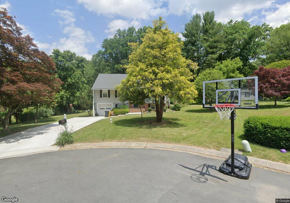
1182 Heron Ct Millersville, MD 21108
Estimated Value: $605,469 - $696,000
4
Beds
3
Baths
1,404
Sq Ft
$465/Sq Ft
Est. Value
About This Home
This home is located at 1182 Heron Ct, Millersville, MD 21108 and is currently estimated at $652,367, approximately $464 per square foot. 1182 Heron Ct is a home located in Anne Arundel County with nearby schools including Millersville Elementary School, Old Mill High School, and Guidepost Montessori at Gambrills.
Ownership History
Date
Name
Owned For
Owner Type
Purchase Details
Closed on
Jun 19, 2009
Sold by
Svensson Daniel V
Bought by
Coppage Patrick L and Coppage Christine D
Current Estimated Value
Home Financials for this Owner
Home Financials are based on the most recent Mortgage that was taken out on this home.
Original Mortgage
$382,936
Outstanding Balance
$243,895
Interest Rate
4.92%
Mortgage Type
FHA
Estimated Equity
$408,472
Purchase Details
Closed on
Jul 26, 1999
Sold by
Anderson Douglas E
Bought by
Svensson Daniel and Svensson Gemma T
Create a Home Valuation Report for This Property
The Home Valuation Report is an in-depth analysis detailing your home's value as well as a comparison with similar homes in the area
Home Values in the Area
Average Home Value in this Area
Purchase History
| Date | Buyer | Sale Price | Title Company |
|---|---|---|---|
| Coppage Patrick L | $390,000 | -- | |
| Svensson Daniel | $212,000 | -- |
Source: Public Records
Mortgage History
| Date | Status | Borrower | Loan Amount |
|---|---|---|---|
| Open | Coppage Patrick L | $382,936 | |
| Closed | Svensson Daniel | -- |
Source: Public Records
Tax History Compared to Growth
Tax History
| Year | Tax Paid | Tax Assessment Tax Assessment Total Assessment is a certain percentage of the fair market value that is determined by local assessors to be the total taxable value of land and additions on the property. | Land | Improvement |
|---|---|---|---|---|
| 2025 | $5,143 | $461,800 | $251,700 | $210,100 |
| 2024 | $5,143 | $441,067 | $0 | $0 |
| 2023 | $4,465 | $420,333 | $0 | $0 |
| 2022 | $4,666 | $399,600 | $241,700 | $157,900 |
| 2021 | $9,075 | $387,300 | $0 | $0 |
| 2020 | $4,370 | $375,000 | $0 | $0 |
| 2019 | $4,245 | $362,700 | $201,700 | $161,000 |
| 2018 | $3,520 | $347,100 | $0 | $0 |
| 2017 | $3,821 | $331,500 | $0 | $0 |
| 2016 | -- | $315,900 | $0 | $0 |
| 2015 | -- | $315,900 | $0 | $0 |
| 2014 | -- | $315,900 | $0 | $0 |
Source: Public Records
Map
Nearby Homes
- 1759 Daisey Ct
- 1270 Dorothy Rd
- 30 Highland Dr
- 605, 607 Crain Hwy N
- 1400 Lower View Ct
- 397 Charles Hall Dr
- 1458 Wilderness Ridge Trail
- 1508 Cornerstone Ct
- 1160 Saint Stephens Church Rd
- 1080 Generals Hwy
- 2425 MacAllister Ln
- 1404 Cotton Ct
- 1220 Indian Landing Rd
- 902 Gunnison Ct
- 820 Annapolis Rd
- 1610 Hog Farm Rd
- 1405 Wigeon Way Unit 206
- 1007 Carbondale Way
- 771 Generals Hwy
- 2305 Nantucket Dr
- 1827 Woodrail Dr
- 1184 Heron Ct
- 1805 Woodrail Dr
- 1807 Woodrail Dr
- 1803 Woodrail Dr
- 1179 Tanager Dr
- 1186 Heron Ct
- 1181 Tanager Dr
- 1809 Woodrail Dr
- 1811 Woodrail Dr
- 1834 Woodrail Dr
- 1177 Tanager Dr
- 1823 Woodrail Dr
- 1183 Tanager Dr
- 1815 Woodrail Dr
- 1806 Woodrail Dr
- 1804 Woodrail Dr
- 1808 Woodrail Dr
- 1185 Tanager Dr
- 1817 Woodrail Dr