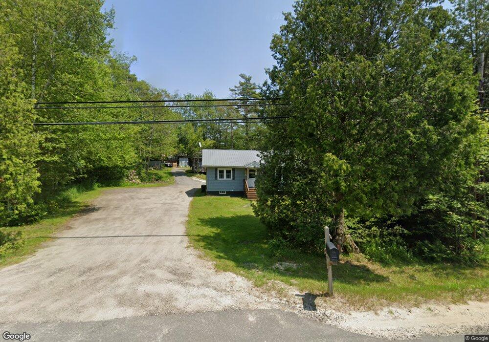
1182 Main Rd Phippsburg, ME 04562
Phippsburg NeighborhoodEstimated Value: $266,000 - $495,000
3
Beds
2
Baths
936
Sq Ft
$386/Sq Ft
Est. Value
About This Home
This home is located at 1182 Main Rd, Phippsburg, ME 04562 and is currently estimated at $360,853, approximately $385 per square foot. 1182 Main Rd is a home with nearby schools including Morse High School.
Ownership History
Date
Name
Owned For
Owner Type
Purchase Details
Closed on
Jul 15, 2019
Sold by
Koehling Donald A
Bought by
Koehling Donald A and Koehling Glenda J
Current Estimated Value
Purchase Details
Closed on
Dec 7, 2018
Sold by
Koehling Donald A and Koehling Glenda I
Bought by
Koehling Donald A and Koehling Glenda J
Purchase Details
Closed on
Mar 5, 2007
Sold by
Koehling Donald A and Koehling Glenda J
Bought by
Koehling Donald A and Koehling Glenda J
Create a Home Valuation Report for This Property
The Home Valuation Report is an in-depth analysis detailing your home's value as well as a comparison with similar homes in the area
Home Values in the Area
Average Home Value in this Area
Purchase History
| Date | Buyer | Sale Price | Title Company |
|---|---|---|---|
| Koehling Donald A | -- | -- | |
| Koehling Donald A | -- | -- | |
| Koehling Donald A | -- | -- | |
| Koehling Donald A | -- | -- | |
| Koehling Donald A | -- | -- | |
| Koehling Donald A | -- | -- |
Source: Public Records
Mortgage History
| Date | Status | Borrower | Loan Amount |
|---|---|---|---|
| Previous Owner | Koehling Donald A | $50,000 |
Source: Public Records
Tax History
| Year | Tax Paid | Tax Assessment Tax Assessment Total Assessment is a certain percentage of the fair market value that is determined by local assessors to be the total taxable value of land and additions on the property. | Land | Improvement |
|---|---|---|---|---|
| 2024 | $1,946 | $165,200 | $81,000 | $84,200 |
| 2023 | $1,890 | $165,200 | $81,000 | $84,200 |
| 2022 | $1,672 | $165,200 | $81,000 | $84,200 |
| 2021 | $1,503 | $165,200 | $81,000 | $84,200 |
| 2020 | $1,510 | $165,200 | $81,000 | $84,200 |
| 2019 | $1,510 | $165,200 | $81,000 | $84,200 |
| 2018 | $1,432 | $158,400 | $74,200 | $84,200 |
| 2017 | $1,416 | $158,400 | $74,200 | $84,200 |
| 2016 | $1,381 | $158,400 | $74,200 | $84,200 |
| 2015 | $1,356 | $158,400 | $74,200 | $84,200 |
| 2014 | $1,236 | $158,400 | $74,200 | $84,200 |
Source: Public Records
Map
Nearby Homes
- 0 Victory Ln
- 15 Church Ln
- Lot 5 Sagamore Dr
- Lot 5 Sagamore Dr Unit 5
- Lot 3 Sagamore Dr Unit 3
- Lot 3 Sagamore Dr
- 17-1 Bald Head Rd
- 16 Spinney Point Ln
- 001 Popham Rd
- 140 Clifford Rd
- 0 Main Rd
- 10 Lewis Way
- 823 Popham Rd
- 129 Five Islands Rd
- 111 Rockweed Rd
- 47 Snowman Ln
- 87 Austin Rd
- 53 High St
- 61 N End Rd
- 242 Long Reach Ln