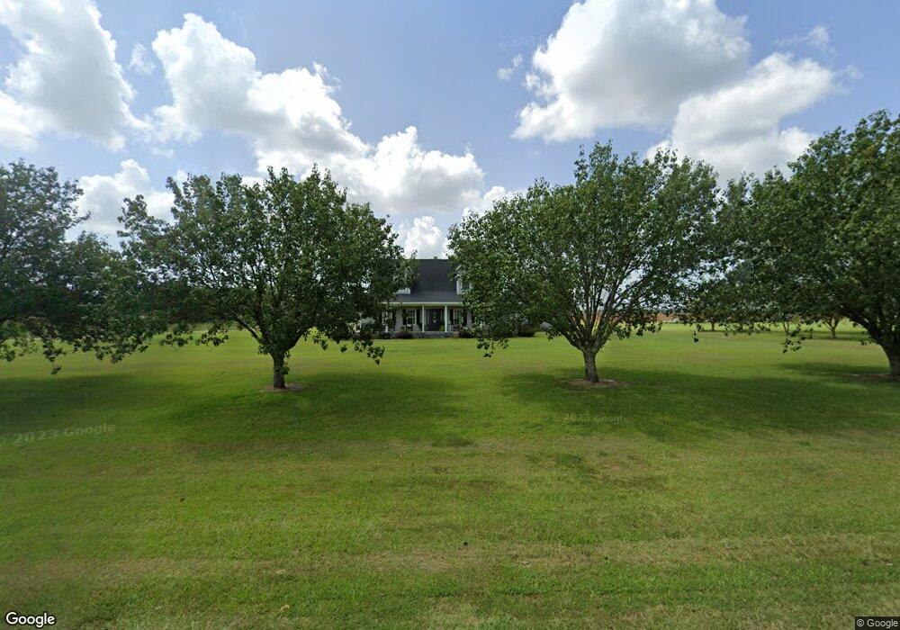
1182 Pat Lewis Rd Baxley, GA 31513
Estimated Value: $212,000 - $336,000
--
Bed
4
Baths
2,285
Sq Ft
$111/Sq Ft
Est. Value
About This Home
This home is located at 1182 Pat Lewis Rd, Baxley, GA 31513 and is currently estimated at $254,049, approximately $111 per square foot. 1182 Pat Lewis Rd is a home located in Appling County.
Ownership History
Date
Name
Owned For
Owner Type
Purchase Details
Closed on
Jul 30, 2019
Sold by
Powers Donald J
Bought by
Powers Coby Ryne and Powers Mikala Baxley
Current Estimated Value
Purchase Details
Closed on
Mar 29, 2016
Sold by
Katharine B Oberry
Bought by
Powers Coby
Home Financials for this Owner
Home Financials are based on the most recent Mortgage that was taken out on this home.
Original Mortgage
$165,000
Interest Rate
3.71%
Purchase Details
Closed on
Jun 8, 2012
Sold by
Odum Randall
Bought by
Odum Powers Llc
Purchase Details
Closed on
Dec 23, 1992
Bought by
Powers Donald J
Create a Home Valuation Report for This Property
The Home Valuation Report is an in-depth analysis detailing your home's value as well as a comparison with similar homes in the area
Home Values in the Area
Average Home Value in this Area
Purchase History
| Date | Buyer | Sale Price | Title Company |
|---|---|---|---|
| Powers Coby Ryne | -- | -- | |
| Powers Coby | -- | -- | |
| Odum Powers Llc | -- | -- | |
| Powers Donald J | -- | -- |
Source: Public Records
Mortgage History
| Date | Status | Borrower | Loan Amount |
|---|---|---|---|
| Previous Owner | Powers Coby | $165,000 | |
| Previous Owner | Powers Coby | -- |
Source: Public Records
Tax History Compared to Growth
Tax History
| Year | Tax Paid | Tax Assessment Tax Assessment Total Assessment is a certain percentage of the fair market value that is determined by local assessors to be the total taxable value of land and additions on the property. | Land | Improvement |
|---|---|---|---|---|
| 2024 | $1,493 | $66,840 | $1,400 | $65,440 |
| 2023 | $1,493 | $66,840 | $1,400 | $65,440 |
| 2022 | $1,200 | $52,505 | $1,437 | $51,068 |
| 2021 | $1,199 | $52,505 | $1,437 | $51,068 |
| 2020 | $1,249 | $52,505 | $1,437 | $51,068 |
| 2019 | $1,275 | $52,505 | $1,437 | $51,068 |
| 2018 | $1,300 | $52,505 | $1,437 | $51,068 |
| 2017 | $1,300 | $52,505 | $1,437 | $51,068 |
| 2016 | $1,300 | $52,505 | $1,437 | $51,068 |
| 2015 | $1,302 | $52,504 | $1,437 | $51,068 |
| 2014 | $1,305 | $52,505 | $1,437 | $51,068 |
| 2013 | -- | $52,504 | $1,436 | $51,068 |
Source: Public Records
Map
Nearby Homes
- 235 S Fork Dr
- 320 Bill Morris Rd
- 315 Crosby Chapel Rd
- 288 Robin Rd
- 908 Bethel Freewill Rd
- 261 Colorado Rd
- 455 Forest Ave
- 2115 Blackshear Hwy
- 503 Satilla Church Rd
- 250 Weatherly Dr
- 1793 Blackshear Hwy
- 201 Miles Rd
- 501 Brandon St
- 151 Lake Gloria Ln
- 646 Corey St
- 99 Jennifer Ln
- 12 Clifton Rd
- 105 Auburn St
- 1657 Hatch Pkwy S
- 802 Pat Lewis Rd
- 1355 Pat Lewis Rd
- 1086 Pat Lewis Rd
- 819 Jr Harper Rd
- 204 Jw Lewis Rd
- 204 Jw Lewis Rd
- 346 Jw Lewis Rd
- 673 Jr Harper Rd
- 623 Jr Harper Rd
- 1658 Pat Lewis Rd
- 474 Jr Harper Rd
- 692 Flood Rd
- 736 Flood Rd
- 1210 Clifton Crosby Rd
- 1210 Clifton Crosby Rd
- 459 Jw Lewis Rd
- 1457 Jr Harper Rd
- 1910 Pat Lewis Rd
- 436 Bud Miles Rd
- 1937 Pat Lewis Rd