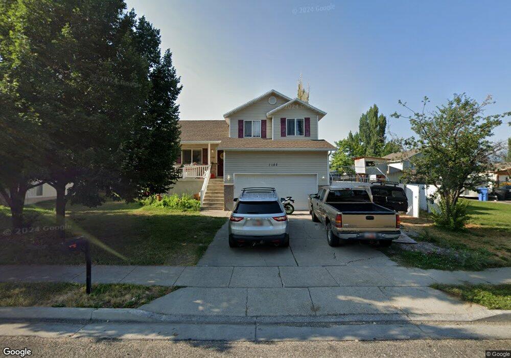
1182 W 400 S Unit 38 Logan, UT 84321
Woodruff NeighborhoodEstimated Value: $409,000 - $424,000
--
Bed
--
Bath
1,408
Sq Ft
$294/Sq Ft
Est. Value
About This Home
This home is located at 1182 W 400 S Unit 38, Logan, UT 84321 and is currently estimated at $414,462, approximately $294 per square foot. 1182 W 400 S Unit 38 is a home located in Cache County with nearby schools including Woodruff School, Mount Logan Middle School, and Logan High School.
Ownership History
Date
Name
Owned For
Owner Type
Purchase Details
Closed on
Sep 16, 2015
Sold by
Tiew Chorn and Tiew Linna C
Bought by
Christensen Greg
Current Estimated Value
Purchase Details
Closed on
Sep 26, 2005
Sold by
Jimerson Desmond D and Jimerson Tina M
Bought by
Tiew Chorn and Tiew Linna C
Home Financials for this Owner
Home Financials are based on the most recent Mortgage that was taken out on this home.
Original Mortgage
$28,750
Interest Rate
5.7%
Mortgage Type
Stand Alone Second
Create a Home Valuation Report for This Property
The Home Valuation Report is an in-depth analysis detailing your home's value as well as a comparison with similar homes in the area
Home Values in the Area
Average Home Value in this Area
Purchase History
| Date | Buyer | Sale Price | Title Company |
|---|---|---|---|
| Christensen Greg | -- | Richland Title Ins Agency In | |
| Christensen Greg | -- | Richland Title Ins Agency In | |
| Tiew Chorn | -- | Cache Title Compamy | |
| Tiew Chorn | -- | Cache Title Compamy |
Source: Public Records
Mortgage History
| Date | Status | Borrower | Loan Amount |
|---|---|---|---|
| Previous Owner | Tiew Chorn | $28,750 | |
| Previous Owner | Tiew Chorn | $115,100 |
Source: Public Records
Tax History Compared to Growth
Tax History
| Year | Tax Paid | Tax Assessment Tax Assessment Total Assessment is a certain percentage of the fair market value that is determined by local assessors to be the total taxable value of land and additions on the property. | Land | Improvement |
|---|---|---|---|---|
| 2025 | $1,718 | $222,250 | $0 | $0 |
| 2024 | $178 | $222,635 | $0 | $0 |
| 2023 | $1,846 | $220,380 | $0 | $0 |
| 2022 | $1,646 | $183,530 | $0 | $0 |
| 2021 | $1,597 | $275,150 | $41,000 | $234,150 |
| 2020 | $1,389 | $215,317 | $41,000 | $174,317 |
| 2019 | $1,452 | $215,317 | $41,000 | $174,317 |
| 2018 | $1,422 | $192,580 | $41,000 | $151,580 |
| 2017 | $1,335 | $95,590 | $0 | $0 |
| 2016 | $1,384 | $95,590 | $0 | $0 |
| 2015 | $1,344 | $92,730 | $0 | $0 |
| 2014 | $1,215 | $92,730 | $0 | $0 |
| 2013 | -- | $92,730 | $0 | $0 |
Source: Public Records
Map
Nearby Homes
- 1099 Three Pointe Ave
- 370 S 1200 W Unit 2
- 1227 W 500 S Unit 151
- 506 S 1225 W
- 518 S 1225 W
- 542 S 1225 W Unit 116
- 548 S 1225 W Unit 115
- 1271 W 350 S
- 1220 W 575 S
- 1239 W 575 S Unit 152
- Hemlock Plan at Sugar Creek - Logan
- Eucalyptus Plan at Sugar Creek - Logan
- Blackberry Plan at Sugar Creek - Logan
- Magnolia Plan at Sugar Creek - Logan
- 2399 W 430 S Unit 33
- 542 1225 W
- 248 Sunstone Ct
- 985 W 720 S
- 1585 W Silver Canoe Way
- 1615 Silver Canoe Way
- 1182 W 400 S
- 1174 W 400 S
- 1194 W 400 S
- 431 Oakcreek Place
- 428 S 1200 W Unit 12
- 428 S 1200 W
- 439 Oakcreek Place
- 1189 W 400 S
- 1177 W 400 S Unit 46
- 1177 W 400 S
- 1156 W 400 S
- 432 S Oak Creek Place Unit 69
- 438 S 1200 W Unit 13
- 438 S 1200 W
- 390 S 1200 W Unit 10
- 390 S 1200 W
- 1163 W 400 S Unit 47
- 1163 W 400 S
- 430 Oakcreek Place
- 1145 W 400 S