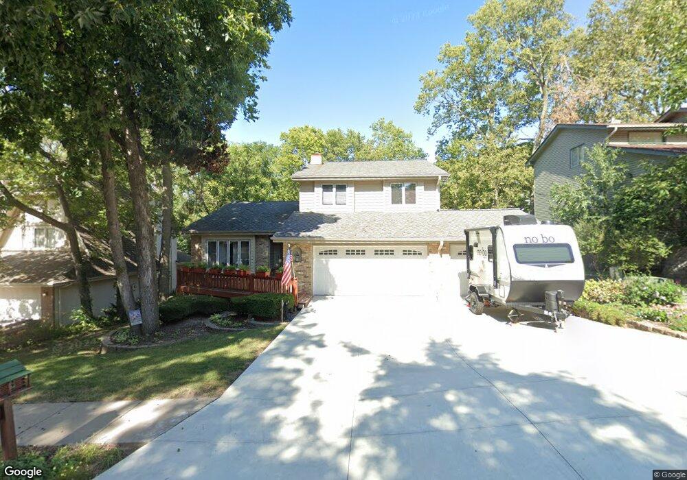
11821 Gow Cir Papillion, NE 68133
Estimated Value: $371,000 - $449,000
4
Beds
5
Baths
2,382
Sq Ft
$167/Sq Ft
Est. Value
About This Home
This home is located at 11821 Gow Cir, Papillion, NE 68133 and is currently estimated at $398,834, approximately $167 per square foot. 11821 Gow Cir is a home located in Sarpy County with nearby schools including Anderson Grove Elementary School, Papillion Middle School, and Papillion La Vista South High School.
Ownership History
Date
Name
Owned For
Owner Type
Purchase Details
Closed on
Jun 2, 2004
Sold by
Hemminger Duane and Hemminger Marianne
Bought by
Sorensen Richard S and Sorensen Janet L
Current Estimated Value
Home Financials for this Owner
Home Financials are based on the most recent Mortgage that was taken out on this home.
Original Mortgage
$171,100
Outstanding Balance
$83,752
Interest Rate
6.02%
Estimated Equity
$315,082
Purchase Details
Closed on
Jun 16, 1998
Sold by
Hemminger Duane
Bought by
Hemminger Duane
Create a Home Valuation Report for This Property
The Home Valuation Report is an in-depth analysis detailing your home's value as well as a comparison with similar homes in the area
Home Values in the Area
Average Home Value in this Area
Purchase History
| Date | Buyer | Sale Price | Title Company |
|---|---|---|---|
| Sorensen Richard S | $214,000 | Midwest Land Title | |
| Hemminger Duane | -- | -- |
Source: Public Records
Mortgage History
| Date | Status | Borrower | Loan Amount |
|---|---|---|---|
| Open | Sorensen Richard S | $171,100 | |
| Closed | Sorensen Richard S | $42,800 |
Source: Public Records
Tax History Compared to Growth
Tax History
| Year | Tax Paid | Tax Assessment Tax Assessment Total Assessment is a certain percentage of the fair market value that is determined by local assessors to be the total taxable value of land and additions on the property. | Land | Improvement |
|---|---|---|---|---|
| 2025 | $5,440 | $326,624 | $54,000 | $272,624 |
| 2024 | $6,314 | $315,661 | $49,000 | $266,661 |
| 2023 | $6,314 | $301,864 | $44,000 | $257,864 |
| 2022 | $6,059 | $273,347 | $44,000 | $229,347 |
| 2021 | $5,584 | $248,305 | $38,000 | $210,305 |
| 2020 | $5,496 | $243,029 | $38,000 | $205,029 |
| 2019 | $5,183 | $229,368 | $38,000 | $191,368 |
| 2018 | $5,097 | $222,383 | $32,000 | $190,383 |
| 2017 | $4,869 | $212,475 | $32,000 | $180,475 |
| 2016 | $4,551 | $198,919 | $32,000 | $166,919 |
| 2015 | $4,434 | $194,301 | $30,000 | $164,301 |
| 2014 | $4,471 | $194,693 | $30,000 | $164,693 |
| 2012 | -- | $194,064 | $30,000 | $164,064 |
Source: Public Records
Map
Nearby Homes
- 4406 Barksdale Dr
- 4510 Barksdale Dr
- 4614 Windcrest Dr
- 4552 Barksdale Dr
- 11817 Quail Dr
- 4556 Barksdale Dr
- 11809 Quail Dr
- 4305 Barksdale Dr
- 4557 Barksdale Dr
- 12017 Daniell Rd
- 4714 Coffey St
- 4223 Barksdale Cir
- 4210 Barksdale Cir
- 12029 Daniell Rd
- 12035 S 45 St
- 12033 Daniell Rd
- 12039 S 45th Ave
- 4724 Coffey St
- 12037 Daniell Rd
- 11903 S 49th St
- 11817 Gow Cir
- 11825 Gow Cir
- 4418 Anchor Mill Dr
- 11813 Gow Cir
- 11822 Gow Cir
- 11818 Gow Cir
- 11826 Gow Cir
- 11809 Gow Cir
- 4414 Anchor Mill Dr
- 4417 Anchor Mill Dr
- 11814 Gow Cir
- 4410 Anchor Mill Dr
- 4503 Anchor Mill Dr
- 11806 Gow Cir
- 11805 Gow Cir
- 4505 Anderson Cir
- 11907 Gow Ln
- 4413 Anchor Mill Dr
- 4411 Anderson Grove
- 4415 Anderson Grove