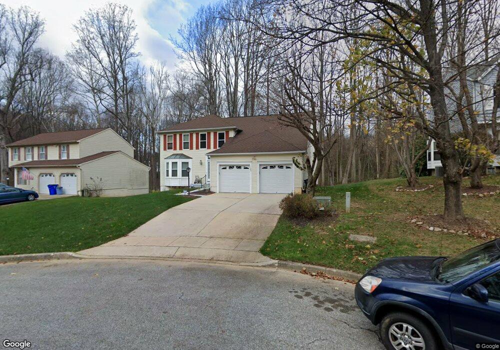
11821 Snow Patch Way Columbia, MD 21044
Hickory Ridge NeighborhoodEstimated Value: $644,482 - $763,000
Studio
3
Baths
2,616
Sq Ft
$270/Sq Ft
Est. Value
About This Home
This home is located at 11821 Snow Patch Way, Columbia, MD 21044 and is currently estimated at $705,621, approximately $269 per square foot. 11821 Snow Patch Way is a home located in Howard County with nearby schools including Swansfield Elementary School, Harpers Choice Middle School, and Wilde Lake High.
Ownership History
Date
Name
Owned For
Owner Type
Purchase Details
Closed on
Dec 4, 1986
Sold by
Ryland Group Inc The
Bought by
Singh Gauinder and Singh Kawal P
Current Estimated Value
Home Financials for this Owner
Home Financials are based on the most recent Mortgage that was taken out on this home.
Original Mortgage
$133,250
Interest Rate
9.5%
Purchase Details
Closed on
Aug 8, 1986
Sold by
Howard Research Development Corp
Bought by
Ryland Group Inc The
Create a Home Valuation Report for This Property
The Home Valuation Report is an in-depth analysis detailing your home's value as well as a comparison with similar homes in the area
Home Values in the Area
Average Home Value in this Area
Purchase History
| Date | Buyer | Sale Price | Title Company |
|---|---|---|---|
| Singh Gauinder | $181,000 | -- | |
| Ryland Group Inc The | $185,000 | -- |
Source: Public Records
Mortgage History
| Date | Status | Borrower | Loan Amount |
|---|---|---|---|
| Closed | Singh Gauinder | $133,250 |
Source: Public Records
Tax History
| Year | Tax Paid | Tax Assessment Tax Assessment Total Assessment is a certain percentage of the fair market value that is determined by local assessors to be the total taxable value of land and additions on the property. | Land | Improvement |
|---|---|---|---|---|
| 2025 | $8,665 | $588,833 | $0 | $0 |
| 2024 | $8,665 | $567,900 | $250,500 | $317,400 |
| 2023 | $8,189 | $542,233 | $0 | $0 |
| 2022 | $7,779 | $516,567 | $0 | $0 |
| 2021 | $7,203 | $490,900 | $223,400 | $267,500 |
| 2020 | $7,203 | $475,500 | $0 | $0 |
| 2019 | $6,981 | $460,100 | $0 | $0 |
| 2018 | $6,416 | $444,700 | $167,100 | $277,600 |
| 2017 | $6,338 | $444,700 | $0 | $0 |
| 2016 | $1,347 | $436,633 | $0 | $0 |
| 2015 | $1,347 | $432,600 | $0 | $0 |
| 2014 | $1,314 | $432,600 | $0 | $0 |
Source: Public Records
Map
Nearby Homes
- 11630 Sun Circle Way
- 5960 Watch Chain Way Unit 1205
- 12227 Sleepy Horse Ln
- 11415 Little Patuxent Pkwy Unit 402
- 11089 Swansfield Rd
- 11247 Skilift Ct Unit B
- 11093 Wineglass Ct
- 10807 Timber View Way
- 6531 River Run
- 10829 Henley Ct
- 5720 Cedar Ln
- 5412 Bucksaw Ct
- 5319 Woodnote Ln
- 5585 Suffield Ct
- 6405 Quiet Night Ride
- 5476 Cedar Ln Unit C3
- 5490 Cedar Ln Unit B4
- 7936 Lawndale Cir
- 5475 El Camino
- 5430 El Camino
- 11817 Snow Patch Way
- 11822 Snow Patch Way
- 11813 Snow Patch Way
- 11818 Snow Patch Way
- 11805 Snow Patch Way
- 11814 Snow Patch Way
- 11810 Snow Patch Way
- 11824 Winterlong Way
- 11804 Blue February Way
- 11801 Snow Patch Way
- 11808 Blue February Way
- 11830 Winterlong Way
- 11806 Snow Patch Way
- 11812 Blue February Way
- 11834 Winterlong Way
- 11808 Winterlong Way
- 11816 Blue February Way
- 11838 Winterlong Way
- 11804 Winterlong Way
- 11800 Winterlong Way
Your Personal Tour Guide
Ask me questions while you tour the home.