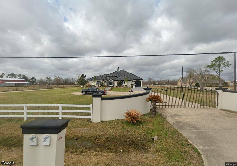
11824 Country Side Dr Unit Dr Rosharon, TX 77583
Estimated Value: $903,000 - $1,033,000
6
Beds
8
Baths
6,833
Sq Ft
$145/Sq Ft
Est. Value
About This Home
This home is located at 11824 Country Side Dr Unit Dr, Rosharon, TX 77583 and is currently estimated at $988,316, approximately $144 per square foot. 11824 Country Side Dr Unit Dr is a home located in Brazoria County.
Ownership History
Date
Name
Owned For
Owner Type
Purchase Details
Closed on
Jan 17, 2006
Sold by
Terrill Danny and Terrill Jeanne
Bought by
Flores Belinda
Current Estimated Value
Purchase Details
Closed on
Aug 16, 2004
Sold by
Hemme Kenneth A and Hemme Dorothy V
Bought by
Terrill Danny and Terrill Jeanne
Home Financials for this Owner
Home Financials are based on the most recent Mortgage that was taken out on this home.
Original Mortgage
$33,500
Interest Rate
6.02%
Mortgage Type
Purchase Money Mortgage
Create a Home Valuation Report for This Property
The Home Valuation Report is an in-depth analysis detailing your home's value as well as a comparison with similar homes in the area
Home Values in the Area
Average Home Value in this Area
Purchase History
| Date | Buyer | Sale Price | Title Company |
|---|---|---|---|
| Flores Belinda | -- | American Title Co | |
| Terrill Danny | -- | -- |
Source: Public Records
Mortgage History
| Date | Status | Borrower | Loan Amount |
|---|---|---|---|
| Previous Owner | Terrill Danny | $33,500 |
Source: Public Records
Tax History Compared to Growth
Tax History
| Year | Tax Paid | Tax Assessment Tax Assessment Total Assessment is a certain percentage of the fair market value that is determined by local assessors to be the total taxable value of land and additions on the property. | Land | Improvement |
|---|---|---|---|---|
| 2025 | $13,429 | $1,051,850 | $135,000 | $916,850 |
| 2023 | $13,429 | $760,447 | $156,660 | $819,010 |
| 2022 | $12,633 | $590,430 | $55,200 | $535,230 |
| 2021 | $13,310 | $590,000 | $57,600 | $532,400 |
| 2020 | $13,401 | $585,200 | $57,600 | $527,600 |
| 2019 | $13,262 | $658,250 | $48,000 | $610,250 |
| 2018 | $12,064 | $510,910 | $48,000 | $462,910 |
| 2017 | $12,239 | $510,910 | $48,000 | $462,910 |
| 2016 | $11,672 | $487,220 | $20,000 | $467,220 |
| 2014 | $8,008 | $357,120 | $20,000 | $337,120 |
Source: Public Records
Map
Nearby Homes
- 4810 Dubuque Pkwy
- 4511 Magnolia Bend Dr
- 4615 Magnolia Bend Dr
- 4519 Magnolia Bend Dr
- 4515 Magnolia Bend Dr
- 4410 County Road 63
- 12003 Pursley Blvd
- 4060 Dubuque Pkwy
- 4322 County Road 64
- 4338 Davenport Pkwy
- 0 County Road 64 Unit 812442
- 8214 Holly Blue Dr
- 2619 Precious Coral Dr
- 2507 American Ruby Dr
- 8303 Bristol Diamond Dr
- 2607 Precious Coral Dr
- 2603 Precious Coral Dr
- 8210 Holly Blue Dr
- 2511 American Ruby Dr
- 8311 Holly Blue Dr
- 11824 Country Side Dr
- 11814 Country Side Dr
- 11914 Country Side Dr
- 11825 Country Side Dr Unit 439
- 2.0AC Country Side Dr
- 11815 Country Side Dr
- 0 Countryside Unit 52835
- 0 Countryside Unit 21176626
- 0 Countryside Unit 19045346
- 11901 Country Side Dr
- 11726 Country Side Dr Unit Drive
- 4621 County Road 63
- 11726 Country Unit Drive
- 4615 County Road 63
- 4633 County Road 63
- 4611 County Road 63
- 11725 Country Side Dr Unit Dr
- 4603 County Road 63
- 11719 Country Side Dr
- 4701 County Road 63