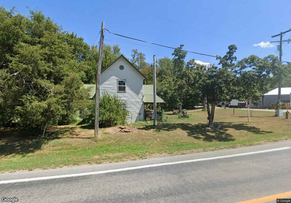
11828 N Highway 43 Maysville, AR 72747
Estimated Value: $235,861 - $518,000
--
Bed
--
Bath
1,720
Sq Ft
$238/Sq Ft
Est. Value
About This Home
This home is located at 11828 N Highway 43, Maysville, AR 72747 and is currently estimated at $409,954, approximately $238 per square foot. 11828 N Highway 43 is a home with nearby schools including Glenn Duffy Elementary School, Gravette Upper Elementary School, and Gravette Middle School.
Ownership History
Date
Name
Owned For
Owner Type
Purchase Details
Closed on
Sep 20, 2014
Sold by
Carlton Jennifer L
Bought by
C & A Builders Llc
Current Estimated Value
Purchase Details
Closed on
Jul 17, 2014
Sold by
Commission Of State Lands
Bought by
C & A Builders Llc
Purchase Details
Closed on
Jul 15, 2004
Bought by
Talbot
Purchase Details
Closed on
May 8, 1995
Bought by
Carlton
Purchase Details
Closed on
Dec 21, 1993
Bought by
Smith
Purchase Details
Closed on
Aug 4, 1993
Bought by
Smith
Purchase Details
Closed on
Apr 7, 1993
Bought by
Scott
Purchase Details
Closed on
Dec 29, 1980
Bought by
Elder
Create a Home Valuation Report for This Property
The Home Valuation Report is an in-depth analysis detailing your home's value as well as a comparison with similar homes in the area
Home Values in the Area
Average Home Value in this Area
Purchase History
| Date | Buyer | Sale Price | Title Company |
|---|---|---|---|
| C & A Builders Llc | -- | None Available | |
| C & A Builders Llc | $5,000 | None Available | |
| Talbot | -- | -- | |
| Carlton | $34,000 | -- | |
| Smith | -- | -- | |
| Smith | $37,000 | -- | |
| Scott | $10,000 | -- | |
| Elder | $17,000 | -- |
Source: Public Records
Tax History Compared to Growth
Tax History
| Year | Tax Paid | Tax Assessment Tax Assessment Total Assessment is a certain percentage of the fair market value that is determined by local assessors to be the total taxable value of land and additions on the property. | Land | Improvement |
|---|---|---|---|---|
| 2025 | $799 | $27,840 | $5,600 | $22,240 |
| 2024 | $711 | $27,840 | $5,600 | $22,240 |
| 2023 | $647 | $18,080 | $1,400 | $16,680 |
| 2022 | $630 | $18,080 | $1,400 | $16,680 |
| 2021 | $576 | $18,080 | $1,400 | $16,680 |
| 2020 | $526 | $11,510 | $860 | $10,650 |
| 2019 | $524 | $11,510 | $860 | $10,650 |
| 2018 | $522 | $11,510 | $860 | $10,650 |
| 2017 | $491 | $11,510 | $860 | $10,650 |
| 2016 | $491 | $11,510 | $860 | $10,650 |
| 2015 | $17 | $390 | $390 | $0 |
| 2014 | $17 | $11,170 | $600 | $10,570 |
Source: Public Records
Map
Nearby Homes
- 0 Arkansas 43
- . Arkansas 43
- 12537 Arkansas 43
- 40ac Tucker Rd
- . Tucker Rd
- 0 Tucker Rd
- Tract B Austin Rd
- 10604 Arkansas 43
- 13400 N Highway 43
- Tract A School House Rd
- Tract D School House Rd
- Tract D S School House Rd
- 10918 Blue Bird Rd
- 801 N 7th St
- 0 85 + -Acres W Hwy 72
- 14465 Wet Prairie Rd
- 23269 W Highway 72
- 25000 Hunters Rd
- 11228 Benson Rd
- 0 Timlake Rd Unit 1325743
- 11827 N Highway 43
- 25819 W A & B Hwy 72 Rd
- 11845 N Highway 43
- 25826 Arkansas 72
- 4571 County Rd 716
- 25811 W Hwy 72
- 25618 W Highway 72
- 45325 County Road 716
- 42295 County Road 716
- 25810 W Highway 72
- 11870 N Westside Rd
- 9421 Arkansas 43
- - Arkansas 43
- 168Ac Arkansas 43
- 8690 Arkansas 43
- 25809 W Highway 72
- 11752 Arkansas 43
- 25811 Arkansas 72
- 11902 N Highway 43 Hwy
- 25809 Arkansas 72