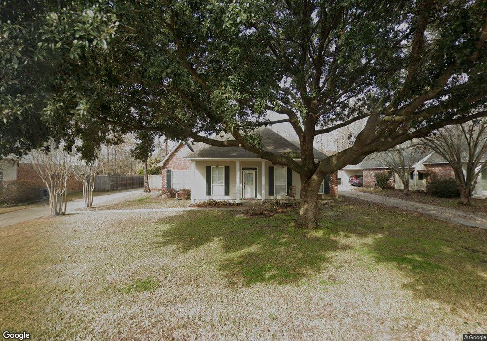
11830 N Milstead Place Baton Rouge, LA 70818
Estimated Value: $234,000 - $294,000
--
Bed
--
Bath
1,819
Sq Ft
$144/Sq Ft
Est. Value
About This Home
This home is located at 11830 N Milstead Place, Baton Rouge, LA 70818 and is currently estimated at $262,155, approximately $144 per square foot. 11830 N Milstead Place is a home located in East Baton Rouge Parish with nearby schools including Bellingrath Hills Elementary School, Central Intermediate School, and Tanglewood Elementary School.
Ownership History
Date
Name
Owned For
Owner Type
Purchase Details
Closed on
Mar 12, 2019
Sold by
Hubbard Geneva Millet
Bought by
Hubbard Geneva Millet and Mcreynolds Janet Hubbard
Current Estimated Value
Purchase Details
Closed on
Sep 7, 2006
Sold by
Delaune Steve C
Bought by
Hubbard James M
Purchase Details
Closed on
Oct 16, 2000
Sold by
Quirk Marshall W and Quirk Ann L
Bought by
Delaune Michelle Quirk
Create a Home Valuation Report for This Property
The Home Valuation Report is an in-depth analysis detailing your home's value as well as a comparison with similar homes in the area
Home Values in the Area
Average Home Value in this Area
Purchase History
| Date | Buyer | Sale Price | Title Company |
|---|---|---|---|
| Hubbard Geneva Millet | -- | None Available | |
| Hubbard James M | $165,000 | -- | |
| Delaune Michelle Quirk | -- | -- |
Source: Public Records
Tax History Compared to Growth
Tax History
| Year | Tax Paid | Tax Assessment Tax Assessment Total Assessment is a certain percentage of the fair market value that is determined by local assessors to be the total taxable value of land and additions on the property. | Land | Improvement |
|---|---|---|---|---|
| 2024 | $1,173 | $16,500 | $2,200 | $14,300 |
| 2023 | $1,173 | $16,500 | $2,200 | $14,300 |
| 2022 | $2,211 | $16,500 | $2,200 | $14,300 |
| 2021 | $2,211 | $16,500 | $2,200 | $14,300 |
| 2020 | $2,170 | $16,500 | $2,200 | $14,300 |
| 2019 | $2,234 | $16,500 | $2,200 | $14,300 |
| 2018 | $2,209 | $16,500 | $2,200 | $14,300 |
| 2017 | $2,209 | $16,500 | $2,200 | $14,300 |
| 2016 | $547 | $11,495 | $2,200 | $9,295 |
| 2015 | $1,218 | $16,500 | $2,200 | $14,300 |
| 2014 | $1,175 | $16,500 | $2,200 | $14,300 |
| 2013 | -- | $16,500 | $2,200 | $14,300 |
Source: Public Records
Map
Nearby Homes
- 12238 S Milstead Place
- 11853 Gurney Rd
- 11403 Joor Rd
- 15935 Joor Rd
- 12736 Centerra Ct
- 9296 Hooper Rd
- 11977 Gurney Rd
- LOT B Joor Rd
- LOT A Joor Rd
- 10600 Hooper Rd
- 11355 Gurney Rd
- 10838 Shoe Creek Dr
- 12409 Partridgewood Dr
- 11802 Morgan Meadow Ave
- 11358 Lazy Lake Dr
- 13138 Joor Rd
- 13574 Reed Ave
- 11222 Hooper Rd
- 10373 Gurney Rd
- 11818 Pheasantwood Dr
- 11820 N Milstead Place
- 11840 N Milstead Place
- 11810 N Milstead Place
- 11850 N Milstead Place
- 11831 N Milstead Place
- 11841 N Milstead Place
- 11821 N Milstead Place
- 11912 N Milstead Place
- 11851 N Milstead Place
- 11811 N Milstead Place
- 11913 N Milstead Place
- 11922 N Milstead Place
- 11760 N Milstead Place
- 12229 S Milstead Place
- 12219 S Milstead Place
- 12239 S Milstead Place
- 11923 N Milstead Place
- 12040 Spring Meadow Dr
- 12209 S Milstead Place
- 12249 S Milstead Place