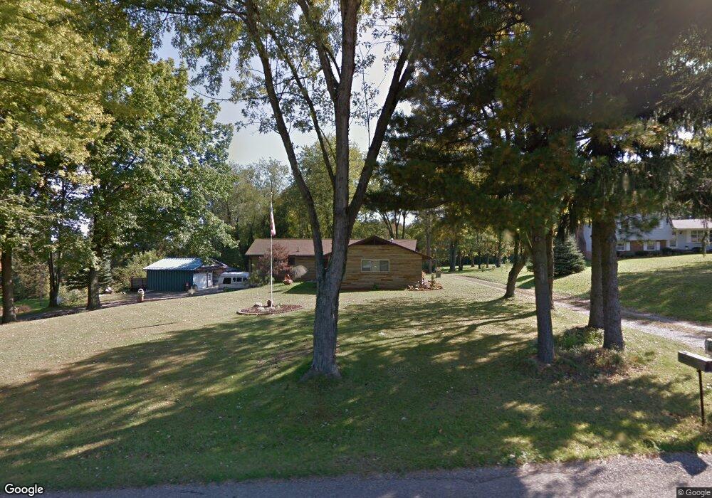
1184 Kenyon Ave SW Massillon, OH 44647
West Brookfield NeighborhoodEstimated Value: $227,000 - $377,000
3
Beds
3
Baths
2,206
Sq Ft
$139/Sq Ft
Est. Value
About This Home
This home is located at 1184 Kenyon Ave SW, Massillon, OH 44647 and is currently estimated at $306,845, approximately $139 per square foot. 1184 Kenyon Ave SW is a home located in Stark County with nearby schools including Massillon Intermediate School, Massillon Junior High School, and Washington High School.
Ownership History
Date
Name
Owned For
Owner Type
Purchase Details
Closed on
Sep 28, 2024
Sold by
Devericks Aydann
Bought by
Neace Shay
Current Estimated Value
Purchase Details
Closed on
Jul 19, 2024
Sold by
Neace Shay
Bought by
Devericks Aydann
Purchase Details
Closed on
May 16, 2007
Sold by
Bachtel Timothy J and Bachtel Patricia A
Bought by
Neace Shay
Create a Home Valuation Report for This Property
The Home Valuation Report is an in-depth analysis detailing your home's value as well as a comparison with similar homes in the area
Home Values in the Area
Average Home Value in this Area
Purchase History
| Date | Buyer | Sale Price | Title Company |
|---|---|---|---|
| Neace Shay | -- | None Listed On Document | |
| Devericks Aydann | -- | None Listed On Document | |
| Neace Shay | $175,000 | Attorney |
Source: Public Records
Tax History Compared to Growth
Tax History
| Year | Tax Paid | Tax Assessment Tax Assessment Total Assessment is a certain percentage of the fair market value that is determined by local assessors to be the total taxable value of land and additions on the property. | Land | Improvement |
|---|---|---|---|---|
| 2025 | -- | $78,370 | $12,780 | $65,590 |
| 2024 | $1,563 | $78,370 | $12,780 | $65,590 |
| 2023 | $4,509 | $61,710 | $9,910 | $51,800 |
| 2022 | $2,725 | $61,710 | $9,910 | $51,800 |
| 2021 | $2,769 | $61,710 | $9,910 | $51,800 |
| 2020 | $2,170 | $49,810 | $8,120 | $41,690 |
| 2019 | $2,223 | $49,810 | $8,120 | $41,690 |
| 2018 | $2,210 | $49,810 | $8,120 | $41,690 |
| 2017 | $4,561 | $45,830 | $7,670 | $38,160 |
| 2016 | $4,755 | $45,830 | $7,670 | $38,160 |
| 2015 | $2,110 | $43,970 | $7,670 | $36,300 |
| 2014 | $54 | $42,920 | $7,460 | $35,460 |
| 2013 | $1,032 | $42,920 | $7,460 | $35,460 |
Source: Public Records
Map
Nearby Homes
- 1200 Kenyon Ave SW
- 11904 Lochwood St SW
- 3241 Lincoln Way NW
- 822 32nd St NW
- 3130 Lincoln Way W
- 3130 Meadowcrest St NW
- 982 Lanedale St NW
- 3069 Castle West Cir NW
- 1174 Manchester Ave SW
- 2853 Autumn Ave NW
- 2855 Poplar St NW
- 4420 Lockhart Cir NW
- 1783 Heron Creek St NW
- 2480 Deerford Ave SW
- 1855 Alpha St NW
- 2760 Relda Cir SW
- 170 26th St NW
- 3575 Kenyon Creek Ave NW
- 4745 Sippo Reserves Dr NW
- 3610 Kenyon Creek Ave NW
- 1144 Kenyon Ave SW
- 1167 Kenyon Ave SW
- 1185 Kenyon Ave SW
- 1124 Kenyon Ave SW
- 1229 Kenyon Ave SW
- 1229 Kenyon Ave SW
- 1250 Kenyon Ave SW
- 1094 Kenyon Ave SW
- 1259 Highlander St SW
- 1306 Kenyon Ave SW
- 1291 Kenyon Ave SW
- 1060 Kenyon Ave SW
- 1193 Highlander St SW
- 1309 Kenyon Ave SW
- 1102 Kenyon Ave SW
- 12360 Lincoln Way NW
- 1259 Kenyon Ave SW
- 1299 Highlander St SW
- 1265 Kenyon Ave SW
- 1362 Kenyon Ave SW