
Seller's Agent in 2025
Sharon Narbonne
Laer Realty
(978) 996-4539
1 in this area
61 Total Sales
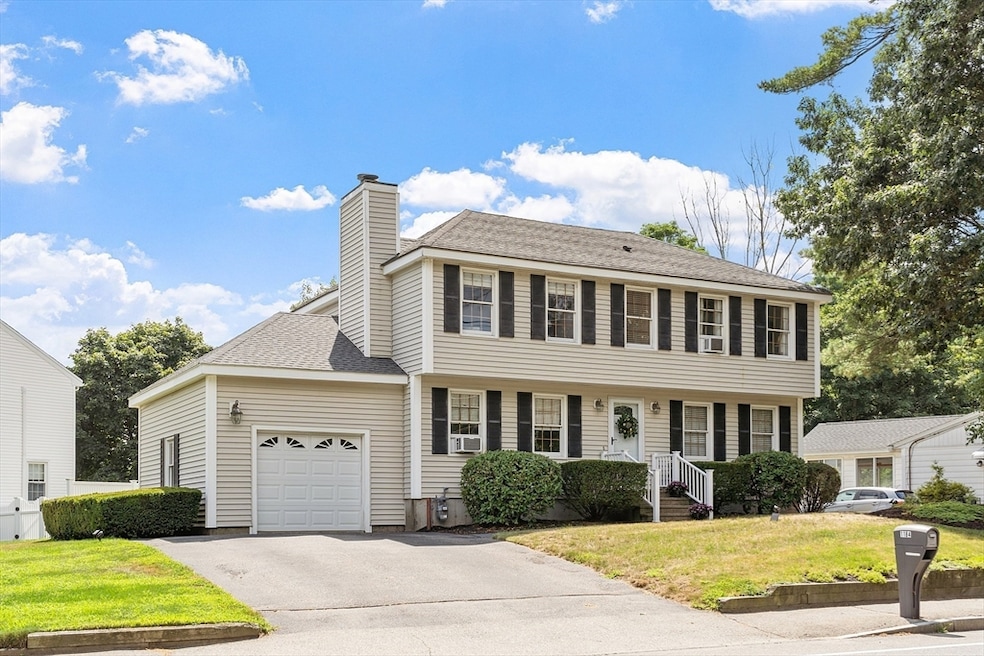
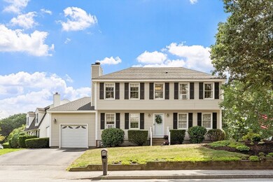
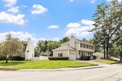
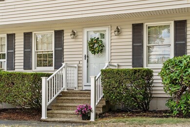
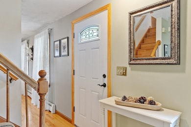
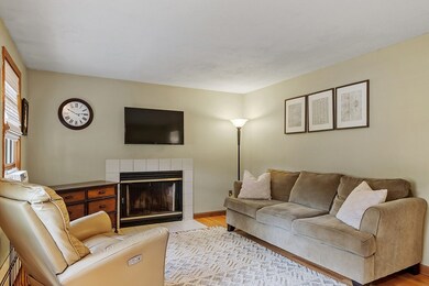
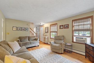
Meticulously maintained by its original owners, this classic 4-corner New England Colonial offers timeless charm, energy efficiency, & true move-in-ready condition. With 2,102 sq ft of living space, it features 4 spacious bedrooms, 2.5 baths, including a primary suite with its own bath. Gleaming hardwood floors enhance the sunlit living room with wood-burning fireplace and traditional dining room. The spacious eat-in kitchen boasts Granite counters, updated appliances & opens to new maintenance-free Trex deck. Enjoy the New Wall-Mounted On-Demand Boiler, full Mass Save insulation added, natural gas heat, updated roof, first-floor laundry, convenient half bath, attached 1-car garage w/storage & public water and sewer. Curb appeal shines with manicured landscaping and a welcoming front facade. The full high-ceiling basement offers expansion potential. Nestled in Pawtucketville centrally located near walking trails, NH tax-free shopping, and commuter routes—this is truly the Perfect Home!
| Date | Type | Sale Price | Title Company |
|---|---|---|---|
| Quit Claim Deed | $665,000 | -- |
| Date | Status | Loan Amount | Loan Type |
|---|---|---|---|
| Open | $607,000 | New Conventional |
| Date | Event | Price | List to Sale | Price per Sq Ft |
|---|---|---|---|---|
| 10/09/2025 10/09/25 | Sold | $665,000 | 0.0% | $316 / Sq Ft |
| 08/12/2025 08/12/25 | Pending | -- | -- | -- |
| 08/08/2025 08/08/25 | For Sale | $665,000 | -- | $316 / Sq Ft |
| Year | Tax Paid | Tax Assessment Tax Assessment Total Assessment is a certain percentage of the fair market value that is determined by local assessors to be the total taxable value of land and additions on the property. | Land | Improvement |
|---|---|---|---|---|
| 2025 | $6,122 | $533,300 | $178,800 | $354,500 |
| 2024 | $6,218 | $522,100 | $167,100 | $355,000 |
| 2023 | $5,985 | $481,900 | $145,300 | $336,600 |
| 2022 | $5,459 | $430,200 | $132,100 | $298,100 |
| 2021 | $5,109 | $379,600 | $114,900 | $264,700 |
| 2020 | $4,953 | $370,700 | $117,200 | $253,500 |
| 2019 | $4,873 | $347,100 | $103,200 | $243,900 |
| 2018 | $4,973 | $345,600 | $98,300 | $247,300 |
| 2017 | $4,759 | $319,000 | $89,300 | $229,700 |
| 2016 | $4,462 | $294,300 | $83,300 | $211,000 |
| 2015 | $4,190 | $270,700 | $81,600 | $189,100 |
| 2013 | $4,137 | $275,600 | $102,500 | $173,100 |
Seller's Agent in 2025
Sharon Narbonne
Laer Realty
(978) 996-4539
1 in this area
61 Total Sales
Buyer's Agent in 2025
Johnny Long
PRIVI Realty LLC
(617) 275-1415
3 in this area
164 Total Sales
Source: MLS Property Information Network (MLS PIN)
MLS Number: 73414914
APN: LOWE-000021-005880-001184
Disclaimer: Certain information contained herein is derived from information provided by parties other than Homes.com. All information provided is deemed reliable, but is not guaranteed to be accurate and should be independently verified.
![]() The property listing data and information, or the Images, set forth herein were provided to MLS Property Information Network, Inc. from third party sources, including sellers, lessors and public records, and were compiled by MLS Property Information Network, Inc. The property listing data and information, and the Images, are for the personal, non-commercial use of consumers having a good faith interest in purchasing or leasing listed properties of the type displayed to them and may not be used for any purpose other than to identify prospective properties which such consumers may have a good faith interest in purchasing or leasing. MLS Property Information Network, Inc. and its subscribers disclaim any and all representations and warranties as to the accuracy of the property listing data and information, or as to the accuracy of any of the Images, set forth herein.
The property listing data and information, or the Images, set forth herein were provided to MLS Property Information Network, Inc. from third party sources, including sellers, lessors and public records, and were compiled by MLS Property Information Network, Inc. The property listing data and information, and the Images, are for the personal, non-commercial use of consumers having a good faith interest in purchasing or leasing listed properties of the type displayed to them and may not be used for any purpose other than to identify prospective properties which such consumers may have a good faith interest in purchasing or leasing. MLS Property Information Network, Inc. and its subscribers disclaim any and all representations and warranties as to the accuracy of the property listing data and information, or as to the accuracy of any of the Images, set forth herein.
Ask me questions while you tour the home.