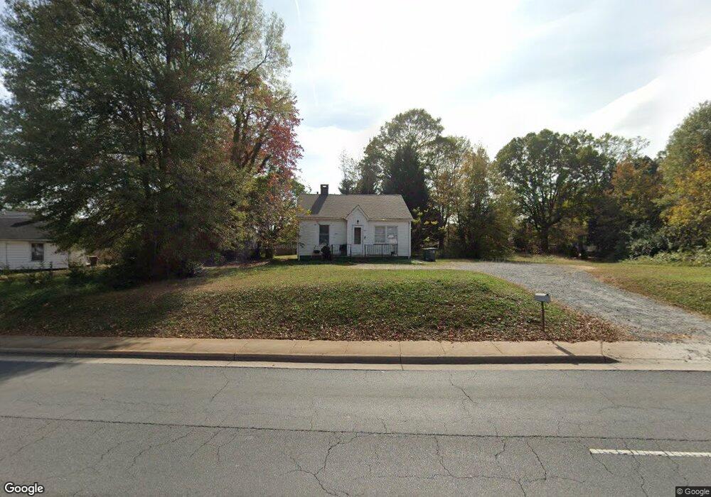
1185 Dale Earnhardt Blvd Kannapolis, NC 28083
Estimated Value: $133,000 - $179,372
2
Beds
1
Bath
861
Sq Ft
$187/Sq Ft
Est. Value
About This Home
This home is located at 1185 Dale Earnhardt Blvd, Kannapolis, NC 28083 and is currently estimated at $160,593, approximately $186 per square foot. 1185 Dale Earnhardt Blvd is a home located in Cabarrus County with nearby schools including Forest Park Elementary School, Kannapolis Middle, and A.L. Brown High School.
Ownership History
Date
Name
Owned For
Owner Type
Purchase Details
Closed on
Oct 5, 2005
Sold by
Sands Randall and Sands Susan
Bought by
Pura Vida International Llc
Current Estimated Value
Purchase Details
Closed on
Jul 29, 2003
Sold by
Equity Partners Inc
Bought by
Sands Randall and Sands Susan B
Home Financials for this Owner
Home Financials are based on the most recent Mortgage that was taken out on this home.
Original Mortgage
$44,000
Interest Rate
5.17%
Mortgage Type
Purchase Money Mortgage
Purchase Details
Closed on
Oct 3, 2002
Sold by
Mccauley Gaynell
Bought by
Equity Partners Inc
Purchase Details
Closed on
Jan 7, 1998
Sold by
Perry Coline
Bought by
Mccauley Gaynell
Create a Home Valuation Report for This Property
The Home Valuation Report is an in-depth analysis detailing your home's value as well as a comparison with similar homes in the area
Home Values in the Area
Average Home Value in this Area
Purchase History
| Date | Buyer | Sale Price | Title Company |
|---|---|---|---|
| Pura Vida International Llc | -- | Chicago Title Insurance Co | |
| Sands Randall | $51,000 | -- | |
| Equity Partners Inc | $25,000 | -- | |
| Mccauley Gaynell | -- | -- |
Source: Public Records
Mortgage History
| Date | Status | Borrower | Loan Amount |
|---|---|---|---|
| Previous Owner | Sands Randall | $44,000 |
Source: Public Records
Tax History Compared to Growth
Tax History
| Year | Tax Paid | Tax Assessment Tax Assessment Total Assessment is a certain percentage of the fair market value that is determined by local assessors to be the total taxable value of land and additions on the property. | Land | Improvement |
|---|---|---|---|---|
| 2025 | $1,780 | $156,770 | $76,440 | $80,330 |
| 2024 | $1,780 | $156,770 | $76,440 | $80,330 |
| 2023 | $1,171 | $85,480 | $61,150 | $24,330 |
| 2022 | $1,171 | $85,480 | $61,150 | $24,330 |
| 2021 | $1,171 | $85,480 | $61,150 | $24,330 |
| 2020 | $1,171 | $85,480 | $61,150 | $24,330 |
| 2019 | $1,001 | $73,050 | $49,690 | $23,360 |
| 2018 | $986 | $73,050 | $49,690 | $23,360 |
| 2017 | $972 | $73,050 | $49,690 | $23,360 |
| 2016 | -- | $74,640 | $49,690 | $24,950 |
| 2015 | $940 | $74,640 | $49,690 | $24,950 |
| 2014 | $940 | $74,640 | $49,690 | $24,950 |
Source: Public Records
Map
Nearby Homes
- 417 York Ave
- 506 Ford St
- 803 Desoto Ave
- 500 Plymouth St
- 226 York Ave
- 402 Ford St
- 613 Hillside St
- 1008 Packard Ave
- 617 Fairview St
- 615 Fairview St
- 00 Centergrove Rd
- 608 Fairview St
- 209 James St
- 1004 S Ridge Ave
- 704 Gem St Unit 17
- 202 Milton L Taylor St
- 5941 Mantle Way
- 304 Bell St
- 5880 Mantle Way
- 704 S Harding Ave
- 1210 Dale Earnhardt Blvd
- 601 Cadillac St
- 1222 Dale Earnhardt Blvd
- 603 Cadillac St
- 587,601,611,623,306G Dale Earnhardt Blvd
- 509 Cadillac St
- 612 Huron St
- 605 Cadillac St
- 612 Old Centergrove Rd
- 612 Old Centergrove Rd
- 610 Huron St
- 614 Centergrove Rd
- 607 Cadillac St
- 507 Cadillac St
- 1242 Dale Earnhardt Blvd
- 614 Old Centergrove Rd
- 610 Old Centergrove Rd
- 608 Huron St
- 606 Old Centergrove Rd
- 517 Copel St