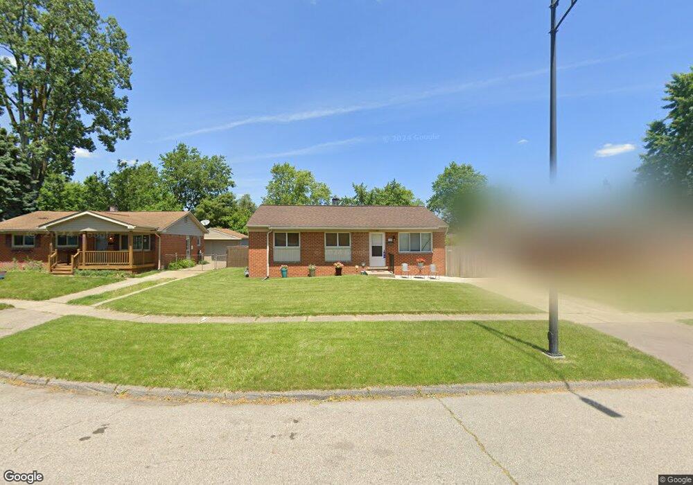
1185 Laurel Ct Ypsilanti, MI 48198
Estimated Value: $213,000 - $243,000
3
Beds
1
Bath
1,073
Sq Ft
$218/Sq Ft
Est. Value
About This Home
This home is located at 1185 Laurel Ct, Ypsilanti, MI 48198 and is currently estimated at $233,475, approximately $217 per square foot. 1185 Laurel Ct is a home located in Washtenaw County with nearby schools including Holmes Elementary School, Erickson Elementary School, and Estabrook Elementary School.
Ownership History
Date
Name
Owned For
Owner Type
Purchase Details
Closed on
Dec 27, 2018
Sold by
Misure Michelle M
Bought by
Misure Susan K
Current Estimated Value
Purchase Details
Closed on
Nov 16, 2001
Sold by
King Michael D
Bought by
Misure Michelle M
Purchase Details
Closed on
Sep 10, 1997
Sold by
Peters Jeffrey F
Bought by
Michael D King
Home Financials for this Owner
Home Financials are based on the most recent Mortgage that was taken out on this home.
Original Mortgage
$73,620
Interest Rate
7.44%
Mortgage Type
FHA
Create a Home Valuation Report for This Property
The Home Valuation Report is an in-depth analysis detailing your home's value as well as a comparison with similar homes in the area
Home Values in the Area
Average Home Value in this Area
Purchase History
| Date | Buyer | Sale Price | Title Company |
|---|---|---|---|
| Misure Susan K | -- | None Available | |
| Misure Michelle M | -- | -- | |
| Michael D King | $80,000 | -- |
Source: Public Records
Mortgage History
| Date | Status | Borrower | Loan Amount |
|---|---|---|---|
| Previous Owner | Michael D King | $73,620 | |
| Closed | Misure Michelle M | -- |
Source: Public Records
Tax History Compared to Growth
Tax History
| Year | Tax Paid | Tax Assessment Tax Assessment Total Assessment is a certain percentage of the fair market value that is determined by local assessors to be the total taxable value of land and additions on the property. | Land | Improvement |
|---|---|---|---|---|
| 2025 | -- | $106,900 | $0 | $0 |
| 2024 | -- | $99,500 | $0 | $0 |
| 2023 | -- | $92,600 | $0 | $0 |
| 2022 | $0 | $86,400 | $0 | $0 |
| 2021 | $1,444 | $77,000 | $0 | $0 |
| 2020 | $1,444 | $62,100 | $0 | $0 |
| 2019 | $1,444 | $52,500 | $52,500 | $0 |
| 2018 | $1,456 | $45,200 | $0 | $0 |
| 2017 | $1,449 | $40,400 | $0 | $0 |
| 2016 | $877 | $25,261 | $0 | $0 |
| 2015 | $1,368 | $25,186 | $0 | $0 |
| 2014 | $1,368 | $24,400 | $0 | $0 |
| 2013 | -- | $24,400 | $0 | $0 |
Source: Public Records
Map
Nearby Homes
- 1051 Redleaf Ln
- 1060 Commonwealth Ave
- 1213 Commonwealth Ave
- 819 N Harris Rd
- 1349 Candlewood Ln
- 808 Lamay Ave
- 705 E Grand Blvd
- 8843 Nottingham Dr
- 1657 Devon St
- 167 N Ford Blvd
- 1370 Stamford Rd
- 1659 Greenway Dr
- 1066 Holmes Rd
- 8650 Cedar Ct
- 620 Browning St
- 8648 Heather Ct
- 1648 Golfview Dr
- 998 E Forest Ave
- 24 Broadmoor
- 190 Emerson Ave
- 1191 Laurel Ct
- 1179 Laurel Ct
- 1261 Laurel Ave
- 1243 Laurel Ave
- 1173 Laurel Ct
- 1273 Laurel Ave
- 0 Laurel Ave
- 1149 Laurel Ct
- 1143 Laurel Ct
- 1155 Laurel Ct
- 1167 Laurel Ct
- 1161 Laurel Ct
- 1200 Laurel Ave
- 1186 Laurel Ave
- 1260 Pageant Ave
- 1208 Laurel Ave
- 1148 Laurel Ave
- 1240 Pageant Ave
- 1131 Laurel Ave
- 1254 Laurel Ave