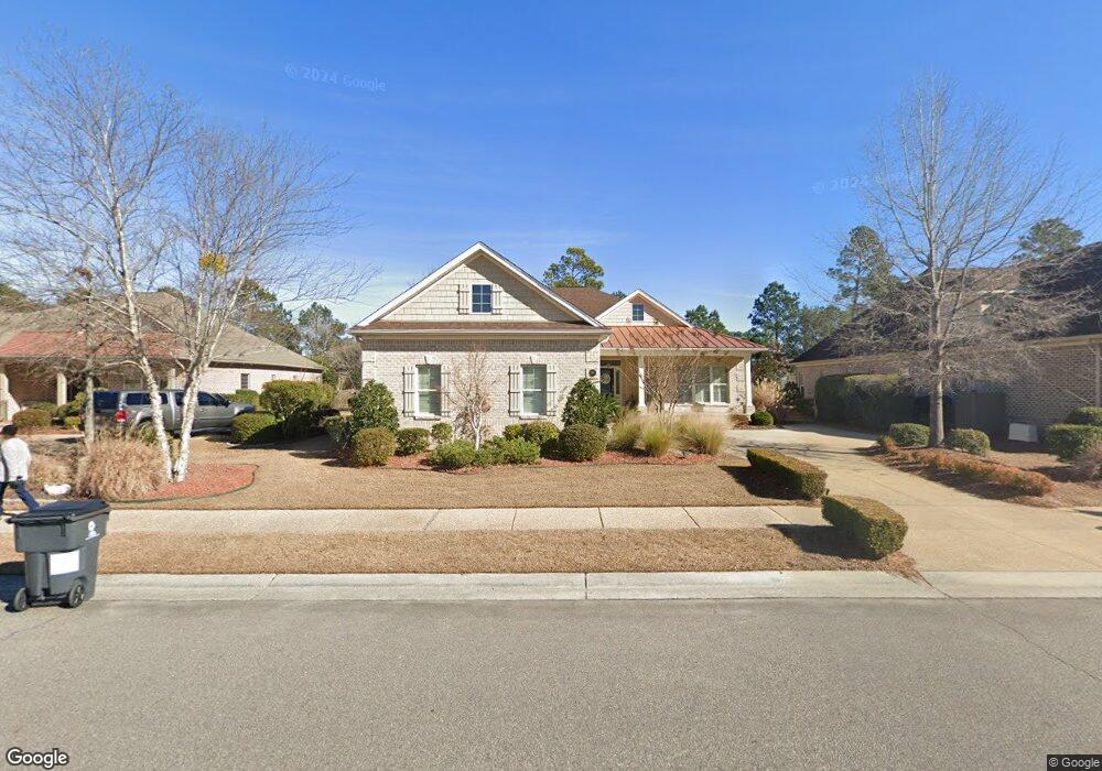
1185 Leesburg Dr Leland, NC 28451
Estimated Value: $623,017 - $714,000
3
Beds
3
Baths
2,809
Sq Ft
$235/Sq Ft
Est. Value
About This Home
This home is located at 1185 Leesburg Dr, Leland, NC 28451 and is currently estimated at $659,504, approximately $234 per square foot. 1185 Leesburg Dr is a home located in Brunswick County with nearby schools including Town Creek Elementary School and North Brunswick High School.
Ownership History
Date
Name
Owned For
Owner Type
Purchase Details
Closed on
Jun 23, 2011
Sold by
Trusst Builders Inc
Bought by
Levine Bennet M and Levine Darlene
Current Estimated Value
Purchase Details
Closed on
Feb 16, 2011
Sold by
Funston Land & Timber Llc
Bought by
Trusst Builders Inc
Home Financials for this Owner
Home Financials are based on the most recent Mortgage that was taken out on this home.
Original Mortgage
$315,600
Interest Rate
4.76%
Mortgage Type
Future Advance Clause Open End Mortgage
Create a Home Valuation Report for This Property
The Home Valuation Report is an in-depth analysis detailing your home's value as well as a comparison with similar homes in the area
Home Values in the Area
Average Home Value in this Area
Purchase History
| Date | Buyer | Sale Price | Title Company |
|---|---|---|---|
| Levine Bennet M | $395,000 | None Available | |
| Trusst Builders Inc | $95,000 | None Available |
Source: Public Records
Mortgage History
| Date | Status | Borrower | Loan Amount |
|---|---|---|---|
| Previous Owner | Trusst Builders Inc | $315,600 |
Source: Public Records
Tax History Compared to Growth
Tax History
| Year | Tax Paid | Tax Assessment Tax Assessment Total Assessment is a certain percentage of the fair market value that is determined by local assessors to be the total taxable value of land and additions on the property. | Land | Improvement |
|---|---|---|---|---|
| 2025 | $1,757 | $564,910 | $122,500 | $442,410 |
| 2024 | $1,757 | $564,910 | $122,500 | $442,410 |
| 2023 | $3,243 | $564,910 | $122,500 | $442,410 |
| 2022 | $1,943 | $396,280 | $105,000 | $291,280 |
| 2021 | $2,163 | $396,280 | $105,000 | $291,280 |
| 2020 | $2,570 | $396,280 | $105,000 | $291,280 |
| 2019 | $3,054 | $107,580 | $105,000 | $2,580 |
| 2018 | $2,916 | $92,990 | $90,000 | $2,990 |
| 2017 | $2,916 | $92,990 | $90,000 | $2,990 |
| 2016 | $2,763 | $92,990 | $90,000 | $2,990 |
| 2015 | $2,641 | $383,580 | $90,000 | $293,580 |
| 2014 | $2,388 | $368,400 | $100,000 | $268,400 |
Source: Public Records
Map
Nearby Homes
- 3781 Anslow Dr
- 3284 Gardenwood Dr
- 1715 S Stillwood Dr
- 3729 Anslow Dr
- 1709 S Stillwood Dr
- 1413 W Gantry Ct
- 2019 Annsdale Dr N
- 1308 Cross Water Cir
- 2021 Colony Pines Dr
- 2244 Villamar Dr
- 4322 Cushendale Ct
- 2115 Villamar Dr
- 2112 Cokesbury Ct
- 3511 Birdfield Ct
- 1503 Cape Fear National Dr
- 2101 Cokesbury Ct
- 2113 Cokesbury Ct
- 2143 Villamar Dr
- 1384 Still Bluff Ln
- 2016 Chartwell Ct
- 1189 Leesburg Dr
- 1181 Leesburg Dr
- 1193 Leesburg Dr
- 1193 Leesburg Dr
- 1193 Leesburg Dr Unit L-61
- 4019 Alastaire Cove
- 1177 Leesburg Dr
- 4015 Alastaire Cove
- 4021 Alastaire Cove
- 1184 Leesburg Dr
- 4013 Alastaire Cove
- 1188 Leesburg Dr
- 1180 Leesburg Dr
- 1180 Leesburg Dr
- 3783 Anslow Dr
- 3785 Anslow Dr
- 1173 Leesburg Dr
- 4009 Alastaire Cove
- 1176 Leesburg Dr
- 3787 Anslow Dr