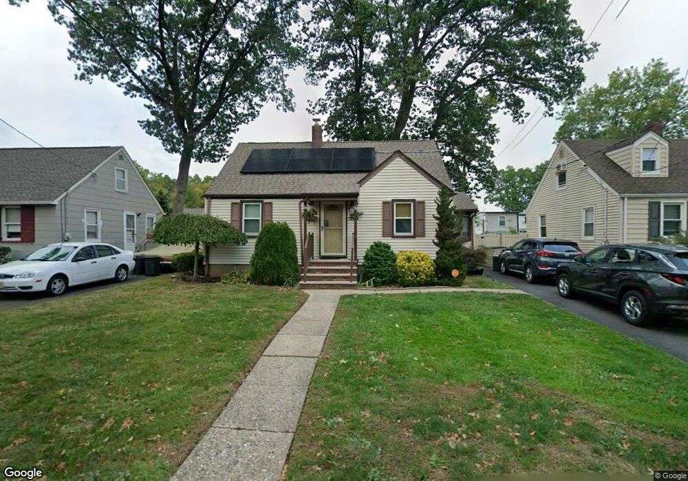
1185 Mayfair Dr Rahway, NJ 07065
Estimated Value: $475,138 - $566,000
Studio
--
Bath
1,479
Sq Ft
$347/Sq Ft
Est. Value
About This Home
This home is located at 1185 Mayfair Dr, Rahway, NJ 07065 and is currently estimated at $513,035, approximately $346 per square foot. 1185 Mayfair Dr is a home located in Union County with nearby schools including Rahway High School and Mother Seton Regional High School.
Ownership History
Date
Name
Owned For
Owner Type
Purchase Details
Closed on
Sep 15, 2023
Sold by
Mallick Michael and Mallick Joyce
Bought by
Sisco Steven Owen and Sisco Suzanne Patricia
Current Estimated Value
Home Financials for this Owner
Home Financials are based on the most recent Mortgage that was taken out on this home.
Original Mortgage
$407,000
Outstanding Balance
$398,576
Interest Rate
7.09%
Mortgage Type
FHA
Estimated Equity
$114,459
Purchase Details
Closed on
Aug 22, 1979
Bought by
Mallick Michael and Mallick Joyce Yawlak
Create a Home Valuation Report for This Property
The Home Valuation Report is an in-depth analysis detailing your home's value as well as a comparison with similar homes in the area
Home Values in the Area
Average Home Value in this Area
Purchase History
| Date | Buyer | Sale Price | Title Company |
|---|---|---|---|
| Sisco Steven Owen | $440,000 | Acres Land Title | |
| Sisco Steven Owen | $440,000 | Acres Land Title | |
| Mallick Michael | $46,000 | -- |
Source: Public Records
Mortgage History
| Date | Status | Borrower | Loan Amount |
|---|---|---|---|
| Open | Sisco Steven Owen | $407,000 | |
| Closed | Sisco Steven Owen | $407,000 |
Source: Public Records
Tax History
| Year | Tax Paid | Tax Assessment Tax Assessment Total Assessment is a certain percentage of the fair market value that is determined by local assessors to be the total taxable value of land and additions on the property. | Land | Improvement |
|---|---|---|---|---|
| 2025 | $9,834 | $132,800 | $64,100 | $68,700 |
| 2024 | $9,446 | $132,800 | $64,100 | $68,700 |
| 2023 | $9,446 | $131,700 | $64,100 | $67,600 |
| 2022 | $9,248 | $131,700 | $64,100 | $67,600 |
| 2021 | $9,154 | $131,700 | $64,100 | $67,600 |
| 2020 | $9,120 | $131,700 | $64,100 | $67,600 |
| 2019 | $9,004 | $131,700 | $64,100 | $67,600 |
| 2018 | $8,815 | $131,700 | $64,100 | $67,600 |
| 2017 | $8,597 | $131,700 | $64,100 | $67,600 |
| 2016 | $8,414 | $131,700 | $64,100 | $67,600 |
| 2015 | $8,319 | $131,700 | $64,100 | $67,600 |
| 2014 | $8,171 | $131,700 | $64,100 | $67,600 |
Source: Public Records
Map
Nearby Homes
- 1044 Madison Hill Rd
- 814 Falesky St
- 1110 Elm Terrace
- 793 Garden St
- 1206 Westfield Ave
- 22 Washington St
- 821 Milton Blvd
- 1166 Jefferson Ave
- 914 Inwood Place
- 52 Broadway
- 1472 Jefferson Ave
- 726 W Milton Ave
- 726 W Milton Ave Unit 1
- 44 Joseph St
- 66 Lincoln Blvd
- 683 Maple Ave
- 712 Moses Dr
- 157 Westfield Ave
- 593 W Hazelwood Ave
- 85 Fulton St
- 1175 Mayfair Dr
- 1195 Mayfair Dr
- 1165 Mayfair Dr
- 1186 Stone St
- 1196 Stone St
- 1176 Stone St
- 1221 Mayfair Dr
- 1155 Mayfair Dr
- 1166 Stone St
- 1206 Stone St
- 1178 Mayfair Dr
- 1188 Mayfair Dr
- 1168 Mayfair Dr
- 1200 Mayfair Dr
- 1156 Stone St
- 1158 Mayfair Dr
- 1145 Mayfair Dr
- 1212 Mayfair Dr
- 1230 Stone St
- 1220 Mayfair Dr
Your Personal Tour Guide
Ask me questions while you tour the home.