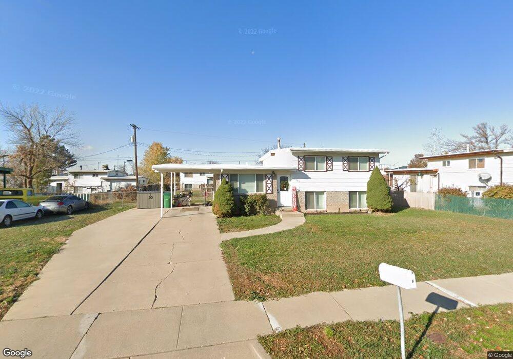
1185 N 300 W Layton, UT 84041
Estimated Value: $394,000 - $424,000
4
Beds
2
Baths
976
Sq Ft
$415/Sq Ft
Est. Value
About This Home
This home is located at 1185 N 300 W, Layton, UT 84041 and is currently estimated at $405,214, approximately $415 per square foot. 1185 N 300 W is a home located in Davis County with nearby schools including Crestview Elementary School, Central Davis Junior High School, and Northridge High School.
Ownership History
Date
Name
Owned For
Owner Type
Purchase Details
Closed on
Sep 9, 2021
Sold by
George David K and George Nancy R
Bought by
Rental 1185 Llc
Current Estimated Value
Purchase Details
Closed on
Jul 1, 2013
Sold by
Roberts Elwin C
Bought by
George David K and George Nancy R
Home Financials for this Owner
Home Financials are based on the most recent Mortgage that was taken out on this home.
Original Mortgage
$68,000
Interest Rate
3.48%
Mortgage Type
New Conventional
Create a Home Valuation Report for This Property
The Home Valuation Report is an in-depth analysis detailing your home's value as well as a comparison with similar homes in the area
Home Values in the Area
Average Home Value in this Area
Purchase History
| Date | Buyer | Sale Price | Title Company |
|---|---|---|---|
| Rental 1185 Llc | -- | None Available | |
| George David K | -- | Security Title Of Da |
Source: Public Records
Mortgage History
| Date | Status | Borrower | Loan Amount |
|---|---|---|---|
| Previous Owner | George David K | $68,000 |
Source: Public Records
Tax History Compared to Growth
Tax History
| Year | Tax Paid | Tax Assessment Tax Assessment Total Assessment is a certain percentage of the fair market value that is determined by local assessors to be the total taxable value of land and additions on the property. | Land | Improvement |
|---|---|---|---|---|
| 2025 | $1,823 | $191,400 | $100,178 | $91,222 |
| 2024 | $1,748 | $184,799 | $116,836 | $67,963 |
| 2023 | $1,738 | $178,200 | $77,392 | $100,807 |
| 2022 | $1,728 | $318,000 | $135,029 | $182,971 |
| 2021 | $1,537 | $232,000 | $103,826 | $128,174 |
| 2020 | $1,402 | $203,000 | $87,509 | $115,491 |
| 2019 | $1,410 | $200,000 | $83,247 | $116,753 |
| 2018 | $1,236 | $176,000 | $83,247 | $92,753 |
| 2016 | $875 | $64,241 | $26,501 | $37,740 |
| 2015 | $877 | $61,182 | $26,501 | $34,681 |
| 2014 | $1,022 | $59,400 | $26,501 | $32,899 |
| 2013 | -- | $65,425 | $18,612 | $46,813 |
Source: Public Records
Map
Nearby Homes
- 1096 N 300 W
- 103 W 1275 N
- 1490 N 175 W
- 1180 N 100 E
- 1583 N 25 E
- 398 Paul Ave
- 324 E 1325 N
- 1837 N 440 W
- 1553 N 250 E
- 1366 N Main St Unit 5
- 1474 N 285 E
- 1908 N 200 W
- 495 Spurlock St
- 526 King St Unit 2
- 1500 N Angel St Unit 12
- 480 Spurlock St
- 2053 Evans Cove Loop Unit 39
- 2044 Evans Cove Loop
- 1187 W Seraphim Ct
- 2048 Evans Cove Loop