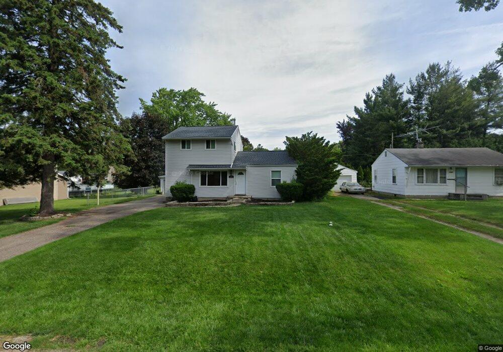
1185 N Eddie St Walled Lake, MI 48390
Estimated Value: $251,000 - $280,000
4
Beds
2
Baths
1,339
Sq Ft
$198/Sq Ft
Est. Value
About This Home
This home is located at 1185 N Eddie St, Walled Lake, MI 48390 and is currently estimated at $265,434, approximately $198 per square foot. 1185 N Eddie St is a home located in Oakland County with nearby schools including Mary Helen Guest Elementary School, James R Geisler Middle School, and Walled Lake Central High School.
Ownership History
Date
Name
Owned For
Owner Type
Purchase Details
Closed on
Apr 17, 2007
Sold by
Gordon Adam D
Bought by
Us Bank Na
Current Estimated Value
Purchase Details
Closed on
May 4, 2006
Sold by
Federal Home Loan Mortgage Corporation
Bought by
Gordon Adam D
Home Financials for this Owner
Home Financials are based on the most recent Mortgage that was taken out on this home.
Original Mortgage
$118,400
Interest Rate
6.72%
Mortgage Type
Balloon
Purchase Details
Closed on
Jun 29, 2004
Sold by
Saveliev Alexei and Saveliev Rafal Olga
Bought by
Federal Home Loan Mortgage Corporation
Purchase Details
Closed on
Oct 15, 1997
Sold by
Wojczynski Lorin J
Bought by
Wilson Phillip W
Home Financials for this Owner
Home Financials are based on the most recent Mortgage that was taken out on this home.
Original Mortgage
$126,534
Interest Rate
7.38%
Create a Home Valuation Report for This Property
The Home Valuation Report is an in-depth analysis detailing your home's value as well as a comparison with similar homes in the area
Home Values in the Area
Average Home Value in this Area
Purchase History
| Date | Buyer | Sale Price | Title Company |
|---|---|---|---|
| Us Bank Na | $124,296 | None Available | |
| Gordon Adam D | $148,000 | None Available | |
| Federal Home Loan Mortgage Corporation | $152,572 | -- | |
| Wilson Phillip W | $127,900 | -- |
Source: Public Records
Mortgage History
| Date | Status | Borrower | Loan Amount |
|---|---|---|---|
| Previous Owner | Gordon Adam D | $118,400 | |
| Previous Owner | Wilson Phillip W | $126,534 |
Source: Public Records
Tax History Compared to Growth
Tax History
| Year | Tax Paid | Tax Assessment Tax Assessment Total Assessment is a certain percentage of the fair market value that is determined by local assessors to be the total taxable value of land and additions on the property. | Land | Improvement |
|---|---|---|---|---|
| 2024 | $1,540 | $105,010 | $0 | $0 |
| 2023 | $1,451 | $98,260 | $0 | $0 |
| 2022 | $1,445 | $91,200 | $0 | $0 |
| 2021 | $1,464 | $88,090 | $0 | $0 |
| 2020 | $1,399 | $83,410 | $0 | $0 |
| 2019 | $1,442 | $75,460 | $0 | $0 |
| 2018 | $1,440 | $67,930 | $0 | $0 |
| 2017 | $1,426 | $66,780 | $0 | $0 |
| 2016 | $1,430 | $62,480 | $0 | $0 |
| 2015 | -- | $50,230 | $0 | $0 |
| 2014 | -- | $36,360 | $0 | $0 |
| 2011 | -- | $41,100 | $0 | $0 |
Source: Public Records
Map
Nearby Homes
- 1128 Annjo St
- 1439 Shankin Dr
- 1747 Shankin Dr
- 2144 Park Place Dr
- 1442 Sunset Dr
- 2160 Newport Ct
- 2159 Helmsford Dr
- 2145 Helmsford Dr
- 2230 Briar Ridge
- 1904 Meadow Ridge Dr
- 688 Wolverine Dr
- 275 Angola St
- 770 Brushwood Dr
- 3101 Cameron Cir
- 2450 S Commerce Rd
- 853 Adelaide Dr
- 2323 Solano Dr
- 1131 Indianwood Trail Unit 12
- 29204 April Ct Unit 236
- 8204 Alexa Dr Unit 88
- 1189 N Eddie St
- 1171 N Eddie St
- 1195 N Eddie St
- 1192 Quinif Dr
- 1174 Quinif Dr
- 1180 Quinif Dr
- 1184 N Eddie St
- 1178 N Eddie St
- 1165 N Eddie St Unit Bldg-Unit
- 1165 N Eddie St
- 1190 N Eddie St
- 1160 Quinif Dr
- 1196 N Eddie St
- 1160 N Eddie St
- 1185 S Eddie St
- 1558 Quinif Dr Unit Bldg-Unit
- 1558 Quinif Dr
- 1566 Quinif Dr
- 1550 Quinif Dr
- 1149 N Eddie St