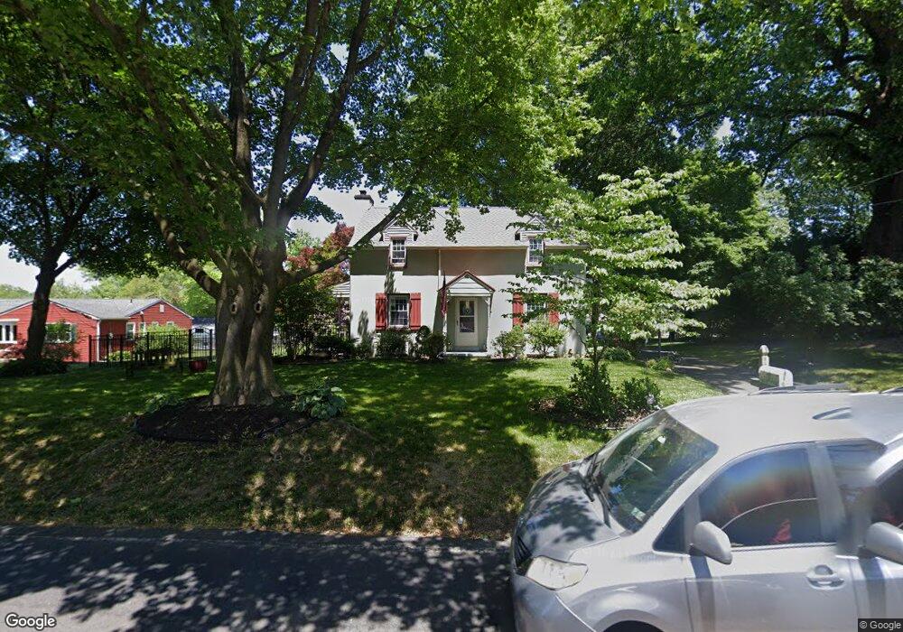
1185 W Bristol Rd Warminster, PA 18974
Estimated Value: $563,000 - $568,720
3
Beds
3
Baths
2,340
Sq Ft
$242/Sq Ft
Est. Value
About This Home
This home is located at 1185 W Bristol Rd, Warminster, PA 18974 and is currently estimated at $566,180, approximately $241 per square foot. 1185 W Bristol Rd is a home located in Bucks County with nearby schools including Jamison Elementary School, Tamanend Middle School, and Central Bucks High School - South.
Ownership History
Date
Name
Owned For
Owner Type
Purchase Details
Closed on
Jun 10, 1999
Sold by
Slaymaker John H and Slaymaker Mildred H
Bought by
Piselli Anthony and Piselli Shelleen
Current Estimated Value
Home Financials for this Owner
Home Financials are based on the most recent Mortgage that was taken out on this home.
Original Mortgage
$167,200
Outstanding Balance
$44,241
Interest Rate
7.09%
Estimated Equity
$521,939
Create a Home Valuation Report for This Property
The Home Valuation Report is an in-depth analysis detailing your home's value as well as a comparison with similar homes in the area
Home Values in the Area
Average Home Value in this Area
Purchase History
| Date | Buyer | Sale Price | Title Company |
|---|---|---|---|
| Piselli Anthony | $176,000 | -- |
Source: Public Records
Mortgage History
| Date | Status | Borrower | Loan Amount |
|---|---|---|---|
| Open | Piselli Anthony | $167,200 |
Source: Public Records
Tax History Compared to Growth
Tax History
| Year | Tax Paid | Tax Assessment Tax Assessment Total Assessment is a certain percentage of the fair market value that is determined by local assessors to be the total taxable value of land and additions on the property. | Land | Improvement |
|---|---|---|---|---|
| 2025 | $4,943 | $28,400 | $5,440 | $22,960 |
| 2024 | $4,943 | $28,400 | $5,440 | $22,960 |
| 2023 | $4,787 | $28,400 | $5,440 | $22,960 |
| 2022 | $4,733 | $28,400 | $5,440 | $22,960 |
| 2021 | $4,680 | $28,400 | $5,440 | $22,960 |
| 2020 | $4,680 | $28,400 | $5,440 | $22,960 |
| 2019 | $4,652 | $28,400 | $5,440 | $22,960 |
| 2018 | $4,652 | $28,400 | $5,440 | $22,960 |
| 2017 | $4,616 | $28,400 | $5,440 | $22,960 |
| 2016 | $4,616 | $28,400 | $5,440 | $22,960 |
| 2015 | -- | $28,400 | $5,440 | $22,960 |
| 2014 | -- | $28,400 | $5,440 | $22,960 |
Source: Public Records
Map
Nearby Homes
- 1130 W Bristol Rd
- 1024 Gates Place
- 1127 Oak Leaf Ln
- 5302 Knox Ct Unit 5302
- 1203 Knox Ct Unit 1203
- 1202 Knox Ct
- 2307 Knox Ct Unit 2307
- 1067 Log College Dr
- 3208 Knox Ct Unit 3208
- 875 W Bristol Rd
- 3303 Knox Ct Unit 3303
- 868 Aster Rd
- 1117 Lynch Cir
- 1008 Julian Dr W Unit W
- 202 Strawberry Ct Unit 249
- 1252 Dahlia Rd
- 919 Lavera Rd
- 0 W Bristol Rd
- Kingswood Plan at Breton Hill
- Mayweather Plan at Breton Hill
- 1167 W Bristol Rd
- 1199 W Bristol Rd
- 1155 W Bristol Rd
- 1207 W Bristol Rd
- 1204 Hart Ln
- 1154 W Bristol Rd
- 1140 W Bristol Rd
- 1196 Hart Ln
- 1215 Hart Ln
- 1223 W Bristol Rd
- 1186 Hart Ln
- 1230 Hart Ln
- 1170 W Bristol Rd
- 1236 Hart Ln
- 1235 W Bristol Rd
- 1412 York Rd
- 1412 York Rd Unit B
- 1412 York Rd Unit C
- 1120 W Bristol Rd
- 1176 Hart Ln