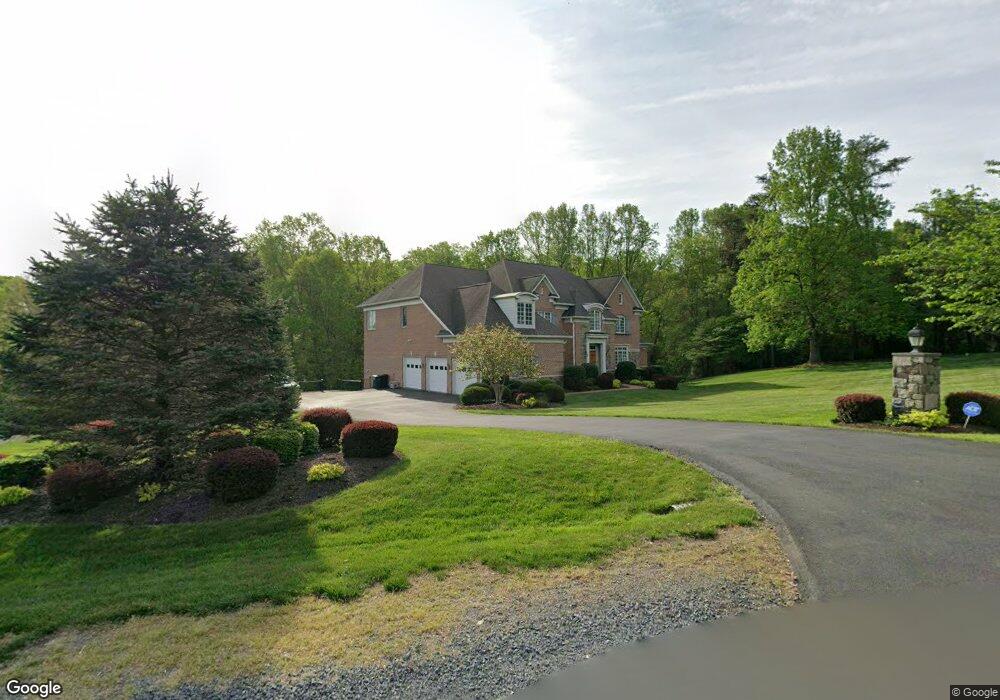
1185 Windrock Dr McLean, VA 22102
Greenway Heights NeighborhoodEstimated Value: $3,447,146 - $3,750,000
5
Beds
7
Baths
6,089
Sq Ft
$584/Sq Ft
Est. Value
About This Home
This home is located at 1185 Windrock Dr, McLean, VA 22102 and is currently estimated at $3,554,537, approximately $583 per square foot. 1185 Windrock Dr is a home located in Fairfax County with nearby schools including Spring Hill Elementary School, Cooper Middle School, and Langley High School.
Ownership History
Date
Name
Owned For
Owner Type
Purchase Details
Closed on
Aug 7, 2014
Sold by
Tran Loc D
Bought by
Tran Tr Loc D and Nguyen Tr Bichlan T
Current Estimated Value
Purchase Details
Closed on
Jul 1, 2003
Sold by
Kamat Dilip P
Bought by
Tran Loc D
Home Financials for this Owner
Home Financials are based on the most recent Mortgage that was taken out on this home.
Original Mortgage
$1,000,000
Interest Rate
5.53%
Mortgage Type
New Conventional
Create a Home Valuation Report for This Property
The Home Valuation Report is an in-depth analysis detailing your home's value as well as a comparison with similar homes in the area
Home Values in the Area
Average Home Value in this Area
Purchase History
| Date | Buyer | Sale Price | Title Company |
|---|---|---|---|
| Tran Tr Loc D | -- | -- | |
| Tran Tr Loc D | -- | -- | |
| Tran Loc D | $1,780,000 | -- |
Source: Public Records
Mortgage History
| Date | Status | Borrower | Loan Amount |
|---|---|---|---|
| Previous Owner | Tran Loc D | $1,000,000 |
Source: Public Records
Tax History
| Year | Tax Paid | Tax Assessment Tax Assessment Total Assessment is a certain percentage of the fair market value that is determined by local assessors to be the total taxable value of land and additions on the property. | Land | Improvement |
|---|---|---|---|---|
| 2025 | $31,577 | $2,921,260 | $1,015,000 | $1,906,260 |
| 2024 | $31,577 | $2,672,620 | $1,015,000 | $1,657,620 |
| 2023 | $26,931 | $2,338,790 | $1,002,000 | $1,336,790 |
| 2022 | $25,536 | $2,189,120 | $928,000 | $1,261,120 |
| 2021 | $23,128 | $1,933,000 | $807,000 | $1,126,000 |
| 2020 | $22,425 | $1,858,690 | $776,000 | $1,082,690 |
| 2019 | $23,293 | $1,930,650 | $776,000 | $1,154,650 |
| 2018 | $21,837 | $1,898,880 | $776,000 | $1,122,880 |
| 2017 | $22,613 | $1,909,890 | $776,000 | $1,133,890 |
| 2016 | $23,624 | $1,999,470 | $776,000 | $1,223,470 |
| 2015 | $24,322 | $2,135,410 | $776,000 | $1,359,410 |
| 2014 | -- | $1,916,530 | $776,000 | $1,140,530 |
Source: Public Records
Map
Nearby Homes
- 1033 Union Church Rd
- 1239 Daleview Dr
- 8537 Old Dominion Dr
- 8912 Gallant Green Dr
- 8437 Sparger St
- 949 Bellview Rd
- 8355 Alvord St
- 1362 Woodside Dr
- 8340 Springhaven Garden Ln
- Lot 2 Knolewood
- 8652 Belle Tree
- Lot 15 Knolewood
- 1339 Hawkin Rd
- 1411 Woodhurst Blvd
- 8520 Lewinsville Rd
- 1465 Mayhurst Blvd
- 8111 Georgetown Pike
- 1200 Chadsworth Ct
- 8306 Summerwood Dr
- 8023 Georgetown Pike
- 1183 Windrock Dr
- 1187 Windrock Dr
- 1181 Windrock Dr
- 1191 Windrock Dr
- 8891 Windy Ridge Way
- 8890 Windy Ridge Way
- 1179 Windrock Dr
- 8801 Windy Creek Way
- 1193 Windrock Dr
- 8893 Windy Ridge Way
- 8894 Windy Ridge Way
- 1177 Windrock Dr
- 1192 Windrock Dr
- 1142 Daleview Dr
- 8803 Windy Creek Way
- 1138 Daleview Dr
- 1148 Daleview Dr
- 1154 Daleview Dr
- 1176 Windrock Dr
- 8895 Windy Ridge Way