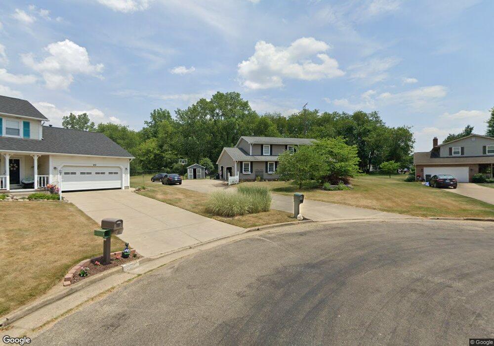
11856 Patroon Cir NW Canal Fulton, OH 44614
Estimated Value: $321,000 - $375,000
4
Beds
4
Baths
1,940
Sq Ft
$173/Sq Ft
Est. Value
About This Home
This home is located at 11856 Patroon Cir NW, Canal Fulton, OH 44614 and is currently estimated at $336,396, approximately $173 per square foot. 11856 Patroon Cir NW is a home located in Stark County with nearby schools including W.S. Stinson Elementary School, Northwest Primary School, and Northwest Middle School.
Ownership History
Date
Name
Owned For
Owner Type
Purchase Details
Closed on
Jun 1, 2016
Sold by
Miller Karen L
Bought by
Penrod Robert B and Penrod Sharon L
Current Estimated Value
Home Financials for this Owner
Home Financials are based on the most recent Mortgage that was taken out on this home.
Original Mortgage
$186,459
Outstanding Balance
$148,497
Interest Rate
3.59%
Mortgage Type
FHA
Estimated Equity
$187,899
Purchase Details
Closed on
Nov 6, 2009
Sold by
Miller Thomas D
Bought by
Miller Karen L
Purchase Details
Closed on
Jun 23, 1999
Sold by
Spradling Howard and Spradling Kristen
Bought by
Miller Thomas D and Miller Karen L
Home Financials for this Owner
Home Financials are based on the most recent Mortgage that was taken out on this home.
Original Mortgage
$133,700
Interest Rate
7.15%
Mortgage Type
Purchase Money Mortgage
Create a Home Valuation Report for This Property
The Home Valuation Report is an in-depth analysis detailing your home's value as well as a comparison with similar homes in the area
Home Values in the Area
Average Home Value in this Area
Purchase History
| Date | Buyer | Sale Price | Title Company |
|---|---|---|---|
| Penrod Robert B | $189,900 | Clear Title Solutions Inc | |
| Miller Karen L | -- | Attorney | |
| Miller Thomas D | $152,900 | Buckeye Reserve Title Agency |
Source: Public Records
Mortgage History
| Date | Status | Borrower | Loan Amount |
|---|---|---|---|
| Open | Penrod Robert B | $186,459 | |
| Previous Owner | Miller Thomas D | $133,700 |
Source: Public Records
Tax History Compared to Growth
Tax History
| Year | Tax Paid | Tax Assessment Tax Assessment Total Assessment is a certain percentage of the fair market value that is determined by local assessors to be the total taxable value of land and additions on the property. | Land | Improvement |
|---|---|---|---|---|
| 2025 | -- | $110,810 | $14,980 | $95,830 |
| 2024 | -- | $110,810 | $14,980 | $95,830 |
| 2023 | $3,695 | $81,310 | $12,670 | $68,640 |
| 2022 | $3,693 | $81,310 | $12,670 | $68,640 |
| 2021 | $4,047 | $81,310 | $12,670 | $68,640 |
| 2020 | $3,424 | $67,240 | $10,220 | $57,020 |
| 2019 | $4,162 | $67,240 | $10,220 | $57,020 |
| 2018 | $3,733 | $67,240 | $10,220 | $57,020 |
| 2017 | $3,253 | $61,320 | $7,700 | $53,620 |
| 2016 | $3,269 | $61,320 | $7,700 | $53,620 |
| 2015 | $1,491 | $55,760 | $7,700 | $48,060 |
| 2014 | $787 | $48,130 | $6,650 | $41,480 |
| 2013 | $1,373 | $48,130 | $6,650 | $41,480 |
Source: Public Records
Map
Nearby Homes
- 12347 Stover Farm Dr NW
- 1719 Bruce St
- 782 Beverly Ave
- 915 Shackleton Dr
- 1808 Pauli St
- 919 Baffin Dr
- 11380 Banning Cir NW
- 2101 Livingston Dr
- 5484 Bonham Ave NW
- 921 Cabot Dr
- 12562 Weygandt St NW
- 764 Chris Cir
- 707 Parkview Ave
- 10778 Yare Cir NW
- 0 V L Milhaven Ave NW
- 872 Sandlewood Dr NW
- S/L 32 Lakewood Dr E
- S/L 27 Lakewood Dr E
- 10411 Scatell St NW
- 539 E Lakewood Dr
- 11857 Patroon Cir NW
- 11868 Patroon Cir NW
- 11865 Patroon Cir NW
- 11886 Patroon Cir NW
- 11883 Patroon Cir NW
- 15 Cartage Ave NW
- 11 Cartage Ave NW
- 10 Cartage Ave NW
- 17 Cartage Ave NW
- 11847 Poleman Cir NW
- 11866 Packets St NW
- 11841 Poleman Cir NW
- 11884 Packets St NW
- 11899 Patroon Cir NW
- 11904 Patroon Cir NW
- 11857 Poleman Cir NW
- 11898 Packets St NW
- 6259 Cartage Ave NW
- 6243 Cartage Ave NW
- 11911 Patroon Cir NW