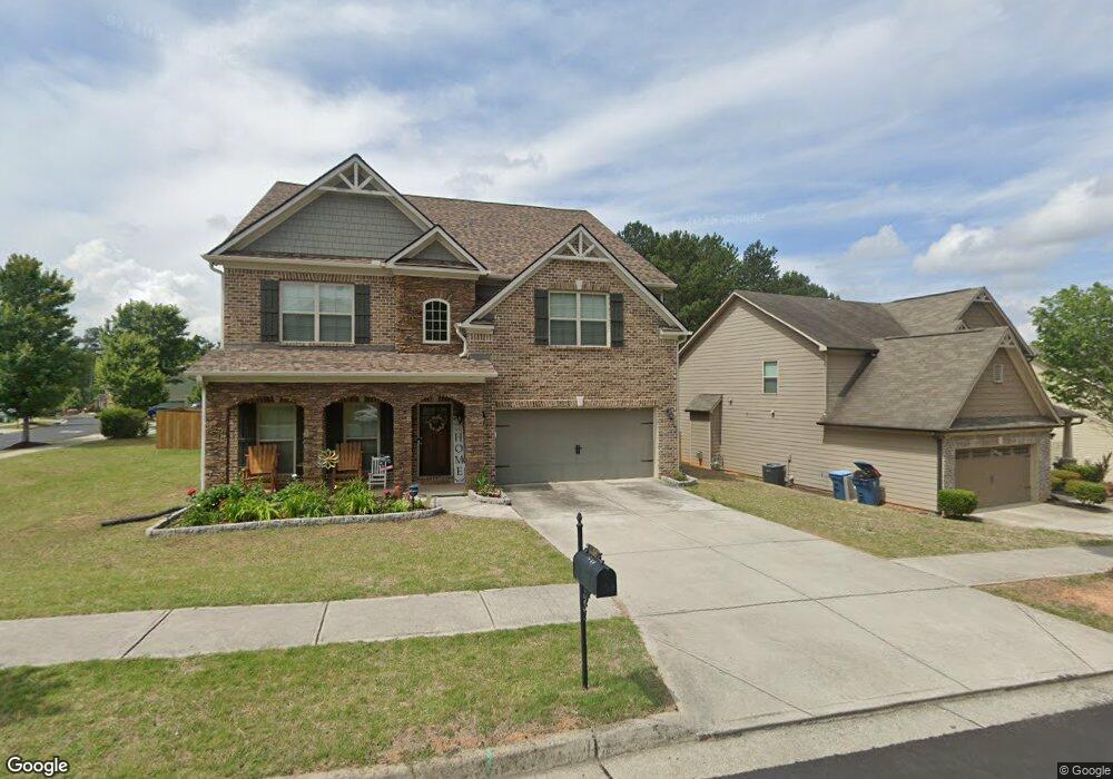
1186 Clear Stream Ridge Unit 46A Auburn, GA 30011
Estimated Value: $507,041 - $553,000
4
Beds
4
Baths
3,700
Sq Ft
$144/Sq Ft
Est. Value
About This Home
This home is located at 1186 Clear Stream Ridge Unit 46A, Auburn, GA 30011 and is currently estimated at $531,260, approximately $143 per square foot. 1186 Clear Stream Ridge Unit 46A is a home located in Gwinnett County with nearby schools including Mulberry Elementary School, Dacula Middle School, and Dacula High School.
Ownership History
Date
Name
Owned For
Owner Type
Purchase Details
Closed on
Dec 29, 2014
Sold by
The Ryland Grp Inc
Bought by
Hok John
Current Estimated Value
Home Financials for this Owner
Home Financials are based on the most recent Mortgage that was taken out on this home.
Original Mortgage
$248,698
Outstanding Balance
$190,792
Interest Rate
4.04%
Mortgage Type
New Conventional
Estimated Equity
$340,468
Create a Home Valuation Report for This Property
The Home Valuation Report is an in-depth analysis detailing your home's value as well as a comparison with similar homes in the area
Home Values in the Area
Average Home Value in this Area
Purchase History
| Date | Buyer | Sale Price | Title Company |
|---|---|---|---|
| Hok John | $276,332 | -- |
Source: Public Records
Mortgage History
| Date | Status | Borrower | Loan Amount |
|---|---|---|---|
| Open | Hok John | $248,698 |
Source: Public Records
Tax History Compared to Growth
Tax History
| Year | Tax Paid | Tax Assessment Tax Assessment Total Assessment is a certain percentage of the fair market value that is determined by local assessors to be the total taxable value of land and additions on the property. | Land | Improvement |
|---|---|---|---|---|
| 2025 | $6,267 | $236,400 | $30,000 | $206,400 |
| 2024 | $5,862 | $207,200 | $32,800 | $174,400 |
| 2023 | $5,862 | $205,200 | $32,800 | $172,400 |
| 2022 | $5,213 | $177,560 | $28,000 | $149,560 |
| 2021 | $4,315 | $130,880 | $22,400 | $108,480 |
| 2020 | $4,302 | $128,880 | $18,400 | $110,480 |
| 2019 | $4,176 | $128,880 | $18,400 | $110,480 |
| 2018 | $4,184 | $128,880 | $18,400 | $110,480 |
| 2016 | $3,785 | $109,520 | $12,800 | $96,720 |
| 2015 | $3,413 | $94,280 | $12,800 | $81,480 |
| 2014 | $306 | $7,200 | $7,200 | $0 |
Source: Public Records
Map
Nearby Homes
- 1267 Clear Stream Ridge
- 3569 Tupelo Trail
- 3439 Tupelo Trail
- 3590 Tupelo Trail
- 1100 Rock Elm Dr Unit 1
- 3630 Tupelo Trail Unit 1
- 3536 Bridle Brook Dr
- 3613 Walking Stick Way
- 310 Meacham Ct
- 3463 Hillyard Dr
- 300 Meacham Ct
- 619 Catesby Terrace
- 3266 Bridle Brook Dr
- 735 Galloping Bend Ct
- 3449 Mulberry Cove Way
- 1186 Clear Stream Ridge
- 1196 Clear Stream Ridge
- 1196 Clear Stream Ridge Unit 45
- 3458 Clear Stream Run Unit 47
- 3458 Clear Stream Run
- 3401 Clear Stream Ridge
- 0 Clear Stream Run NE Unit 8695277
- 0 Clear Stream Run NE Unit 8230368
- 0 Clear Stream Run NE Unit 7545344
- 0 Clear Stream Run NE Unit 8621655
- 0 Clear Stream Run NE Unit 8204232
- 0 Clear Stream Run NE Unit 8581068
- 0 Clear Stream Run NE Unit 8558755
- 0 Clear Stream Run NE Unit 8389711
- 0 Clear Stream Run NE Unit 8925419
- 1197 Clear Stream Ridge
- 3461 Clear Stream Run
- 3448 Clear Stream Run
- 1216 Clear Stream Ridge
- 1216 Clear Stream Ridge Unit 44