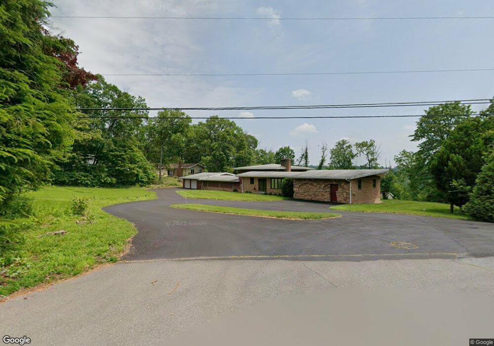
1186 Oakhurst Dr Slatington, PA 18080
Estimated Value: $424,000 - $639,000
3
Beds
2
Baths
5,608
Sq Ft
$94/Sq Ft
Est. Value
About This Home
This home is located at 1186 Oakhurst Dr, Slatington, PA 18080 and is currently estimated at $528,090, approximately $94 per square foot. 1186 Oakhurst Dr is a home located in Lehigh County with nearby schools including Slatington Elementary School, Peters Elementary School, and Northern Lehigh Middle School.
Ownership History
Date
Name
Owned For
Owner Type
Purchase Details
Closed on
Jun 13, 2017
Sold by
Quilling Mare
Bought by
Artinyan Rachael M
Current Estimated Value
Home Financials for this Owner
Home Financials are based on the most recent Mortgage that was taken out on this home.
Original Mortgage
$199,813
Outstanding Balance
$166,248
Interest Rate
4.03%
Mortgage Type
FHA
Estimated Equity
$361,842
Purchase Details
Closed on
Apr 28, 2003
Sold by
Montrom Stanley C and Montrom Blanche
Bought by
Montrom Terran
Create a Home Valuation Report for This Property
The Home Valuation Report is an in-depth analysis detailing your home's value as well as a comparison with similar homes in the area
Home Values in the Area
Average Home Value in this Area
Purchase History
| Date | Buyer | Sale Price | Title Company |
|---|---|---|---|
| Artinyan Rachael M | $203,500 | None Available | |
| Montrom Terran | -- | -- |
Source: Public Records
Mortgage History
| Date | Status | Borrower | Loan Amount |
|---|---|---|---|
| Open | Artinyan Rachael M | $199,813 |
Source: Public Records
Tax History
| Year | Tax Paid | Tax Assessment Tax Assessment Total Assessment is a certain percentage of the fair market value that is determined by local assessors to be the total taxable value of land and additions on the property. | Land | Improvement |
|---|---|---|---|---|
| 2025 | $12,387 | $328,100 | $64,400 | $263,700 |
| 2024 | $11,859 | $328,100 | $64,400 | $263,700 |
| 2023 | $11,171 | $328,100 | $64,400 | $263,700 |
| 2022 | $11,006 | $328,100 | $263,700 | $64,400 |
| 2021 | $10,671 | $328,100 | $64,400 | $263,700 |
| 2020 | $10,366 | $328,100 | $64,400 | $263,700 |
| 2019 | $10,139 | $328,100 | $64,400 | $263,700 |
| 2018 | $9,936 | $328,100 | $64,400 | $263,700 |
| 2017 | $9,895 | $328,100 | $64,400 | $263,700 |
| 2016 | -- | $328,100 | $64,400 | $263,700 |
| 2015 | -- | $328,100 | $64,400 | $263,700 |
| 2014 | -- | $383,300 | $64,400 | $318,900 |
Source: Public Records
Map
Nearby Homes
- 2218 High Point Ln
- 2222 High Point Ln
- 1170 Oakhurst Dr
- 1216 Oakhurst Dr
- 1179 Oakhurst Dr
- 2214 High Point Ln
- 2230 High Point Ln
- 1226 Oakhurst Dr
- 2226 High Point Ln
- 1227 Oakhurst Dr
- 1171 Oakhurst Dr
- 2234 High Point Ln
- 1152 Oakhurst Dr
- 1236 Oakhurst Dr
- 1161 Oakhurst Dr
- 1010 Maple Spring Dr
- 1235 Oakhurst Dr
- 2238 High Point Ln
- 1150 Morris Ln
- 1157 Oakhurst Dr