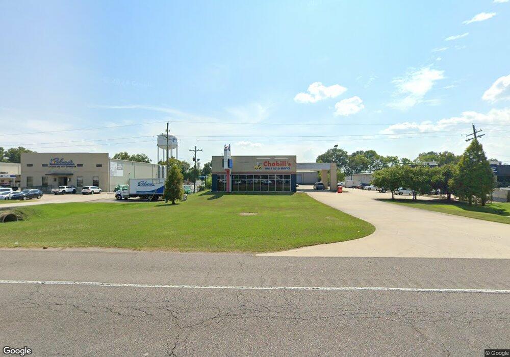
11860 Airline Hwy Baton Rouge, LA 70817
Shenandoah NeighborhoodEstimated Value: $2,282,931
--
Bed
--
Bath
16,418
Sq Ft
$139/Sq Ft
Est. Value
About This Home
This home is located at 11860 Airline Hwy, Baton Rouge, LA 70817 and is currently estimated at $2,282,931, approximately $139 per square foot. 11860 Airline Hwy is a home located in East Baton Rouge Parish with nearby schools including Jefferson Terrace Elementary School, Woodlawn High School, and Parkview Baptist School.
Ownership History
Date
Name
Owned For
Owner Type
Purchase Details
Closed on
Apr 4, 2018
Sold by
William B Potter Llc A Louisiana Limited
Bought by
Charles L Gowland Sr Family Llc A Louisi
Current Estimated Value
Home Financials for this Owner
Home Financials are based on the most recent Mortgage that was taken out on this home.
Original Mortgage
$1,800,000
Outstanding Balance
$1,547,610
Interest Rate
4.43%
Mortgage Type
New Conventional
Estimated Equity
$735,321
Purchase Details
Closed on
Jun 11, 2012
Sold by
Kodiak Equipment Llc
Bought by
William B Potter Llc
Purchase Details
Closed on
Apr 29, 2005
Sold by
Boots And Saddles Inc
Bought by
Kodiak Equipment
Home Financials for this Owner
Home Financials are based on the most recent Mortgage that was taken out on this home.
Original Mortgage
$50,000,000
Interest Rate
5.93%
Mortgage Type
Construction
Create a Home Valuation Report for This Property
The Home Valuation Report is an in-depth analysis detailing your home's value as well as a comparison with similar homes in the area
Home Values in the Area
Average Home Value in this Area
Purchase History
| Date | Buyer | Sale Price | Title Company |
|---|---|---|---|
| Charles L Gowland Sr Family Llc A Louisi | $1,800,000 | Guaranteed Trust Title Llc | |
| William B Potter Llc | $477,000 | -- | |
| Kodiak Equipment | $450,000 | -- |
Source: Public Records
Mortgage History
| Date | Status | Borrower | Loan Amount |
|---|---|---|---|
| Open | Charles L Gowland Sr Family Llc A Louisi | $1,800,000 | |
| Previous Owner | Kodiak Equipment | $50,000,000 |
Source: Public Records
Tax History Compared to Growth
Tax History
| Year | Tax Paid | Tax Assessment Tax Assessment Total Assessment is a certain percentage of the fair market value that is determined by local assessors to be the total taxable value of land and additions on the property. | Land | Improvement |
|---|---|---|---|---|
| 2024 | $23,613 | $205,794 | $38,934 | $166,860 |
| 2023 | $23,613 | $190,550 | $36,050 | $154,500 |
| 2022 | $21,408 | $190,550 | $36,050 | $154,500 |
| 2021 | $20,989 | $190,550 | $36,050 | $154,500 |
| 2020 | $20,844 | $190,550 | $36,050 | $154,500 |
| 2019 | $21,050 | $185,000 | $35,000 | $150,000 |
| 2018 | $15,330 | $136,450 | $27,500 | $108,950 |
| 2017 | $15,330 | $136,450 | $27,500 | $108,950 |
| 2016 | $14,926 | $136,450 | $27,500 | $108,950 |
| 2015 | $14,633 | $133,950 | $25,000 | $108,950 |
| 2014 | $14,308 | $133,950 | $25,000 | $108,950 |
| 2013 | -- | $51,900 | $25,000 | $26,900 |
Source: Public Records
Map
Nearby Homes
- 11845 Parkview Ct Unit F
- 11825 Parkview Ct Unit H
- 11815 Parkview Ct Unit I
- 11835 Parkview Ct Unit G
- 11834 Parkview Ct Unit D
- 5810 Parkforest Dr
- 5908 Stumberg Ln Unit 49
- 6212 Stumberg Ln Unit 505
- 6212 Stumberg Ln Unit 402
- 6212 Stumberg Ln Unit 103
- 5738 Parkknoll Place Dr
- 11011 Shoreline Dr
- 12525 Parkknoll Ave
- 5402 Heron Landing Dr
- 5415 Heron Nest Dr
- 5638 Hidden Ridge Ln
- 6220 Mourning Dove Dr
- 13310 Prath Dr
- 10757 Oakley Trace Dr
- 13309 Bergin Dr
- 11750 Airline Hwy
- 11652 Investor Dr
- 11645 Cloverland Ave
- 11645 N Cloverland
- 11987 Airline Hwy
- 11831 Cloverland Ave
- 11560 Investor Dr
- 11851 Cloverland Ave
- 0113 Hollyfield Dr
- 0 Hollyfield Dr
- 6105 Hollyfield Dr
- 11855 Airline Hwy
- 11855 Airline Hwy
- 6134 Benefit Dr
- 11447 Cloverland Ave
- LOT 13-B Cloverland Ct
- 6125 Hollyfield Dr
- 11314 Parkview Church Rd
- 11149 Cloverland Ave
- 6210 Hollyfield Dr
