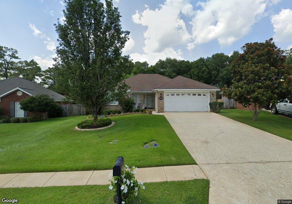
11860 Liberty Cir N Mobile, AL 36608
Outer West Mobile NeighborhoodEstimated Value: $227,000 - $244,000
3
Beds
2
Baths
1,388
Sq Ft
$168/Sq Ft
Est. Value
About This Home
This home is located at 11860 Liberty Cir N, Mobile, AL 36608 and is currently estimated at $233,666, approximately $168 per square foot. 11860 Liberty Cir N is a home located in Mobile County with nearby schools including Taylor White Elementary School, Bernice J Causey Middle School, and Baker High School.
Ownership History
Date
Name
Owned For
Owner Type
Purchase Details
Closed on
Aug 21, 2023
Sold by
Field Donice M
Bought by
Donice Miller Field Irrevocable Trust
Current Estimated Value
Purchase Details
Closed on
Jul 27, 2007
Sold by
Benchmark Homes Inc
Bought by
Field Donice M
Home Financials for this Owner
Home Financials are based on the most recent Mortgage that was taken out on this home.
Original Mortgage
$67,000
Interest Rate
6.65%
Mortgage Type
Unknown
Create a Home Valuation Report for This Property
The Home Valuation Report is an in-depth analysis detailing your home's value as well as a comparison with similar homes in the area
Home Values in the Area
Average Home Value in this Area
Purchase History
| Date | Buyer | Sale Price | Title Company |
|---|---|---|---|
| Donice Miller Field Irrevocable Trust | $192,000 | None Listed On Document | |
| Field Donice M | $143,950 | None Available |
Source: Public Records
Mortgage History
| Date | Status | Borrower | Loan Amount |
|---|---|---|---|
| Previous Owner | Field Donice M | $67,000 |
Source: Public Records
Tax History Compared to Growth
Tax History
| Year | Tax Paid | Tax Assessment Tax Assessment Total Assessment is a certain percentage of the fair market value that is determined by local assessors to be the total taxable value of land and additions on the property. | Land | Improvement |
|---|---|---|---|---|
| 2024 | -- | $21,330 | $4,000 | $17,330 |
| 2023 | $864 | $19,200 | $3,600 | $15,600 |
| 2022 | $772 | $17,280 | $2,990 | $14,290 |
| 2021 | $663 | $15,060 | $2,600 | $12,460 |
| 2020 | $678 | $15,350 | $2,600 | $12,750 |
| 2019 | $669 | $15,180 | $0 | $0 |
| 2018 | $605 | $13,860 | $0 | $0 |
| 2017 | $694 | $14,240 | $0 | $0 |
| 2016 | $629 | $14,360 | $0 | $0 |
| 2013 | -- | $15,600 | $0 | $0 |
Source: Public Records
Map
Nearby Homes
- 11920 Ives Ln
- 12171 Yancey Glen Dr
- 0 Busby Rd
- 2760 Wildflower Dr W
- 1762 Trail Side Way
- 1734 Trail Side Way
- 1716 Trail Side Way
- 1688 Trail Side Way
- 1674 Trail Side Way
- 1748 Trail Side Way
- 1658 Trail Side Way
- 1717 Plan at Pines of Dawes
- The Kingston Plan at Coxwell Crossing
- 1348 Plan at Pines of Dawes
- 2029 Plan at Pines of Dawes
- 1525 Plan at Pines of Dawes
- 1635-C Plan at Pines of Dawes
- The Avery Plan at Coxwell Crossing
- 1425 Plan at Pines of Dawes
- The Mckenzie Plan at Coxwell Crossing
- 11870 Liberty Cir N
- 11850 Liberty Cir N
- 11880 Liberty Cir N
- 2111 Liberty Dr E
- 2121 Liberty Dr E
- 11890 Liberty Cir N
- 11910 Liberty Cir N
- 11900 Liberty Cir N
- 2131 Liberty Dr E
- 2141 Liberty Dr E
- 11860 Ives Ln
- 11870 Ives Ln
- 11880 Ives Ln
- 2151 Liberty Dr E
- 11890 Ives Ln
- 2161 Liberty Dr E
- 11900 Ives Ln
- 2091 Wolf Branch Dr N
- 2171 Liberty Dr E
- 2090 Wolf Branch Dr N