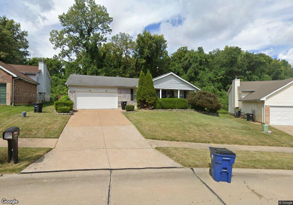
11867 7 Hills Dr Florissant, MO 63033
Estimated Value: $237,835 - $270,000
4
Beds
2
Baths
1,634
Sq Ft
$155/Sq Ft
Est. Value
About This Home
This home is located at 11867 7 Hills Dr, Florissant, MO 63033 and is currently estimated at $252,709, approximately $154 per square foot. 11867 7 Hills Dr is a home located in St. Louis County with nearby schools including Commons Lane Elementary School, Cross Keys Middle School, and McCluer North High School.
Ownership History
Date
Name
Owned For
Owner Type
Purchase Details
Closed on
Feb 28, 2024
Sold by
Collector and Collector City Revenue
Bought by
Afshari Joseph P and Afshari Charlotte P
Current Estimated Value
Purchase Details
Closed on
Oct 16, 1998
Sold by
Afshari Joseph P and Afshari Charlotte P
Bought by
Austin Karen D
Home Financials for this Owner
Home Financials are based on the most recent Mortgage that was taken out on this home.
Original Mortgage
$69,800
Interest Rate
12.65%
Create a Home Valuation Report for This Property
The Home Valuation Report is an in-depth analysis detailing your home's value as well as a comparison with similar homes in the area
Home Values in the Area
Average Home Value in this Area
Purchase History
| Date | Buyer | Sale Price | Title Company |
|---|---|---|---|
| Afshari Joseph P | -- | None Listed On Document | |
| Austin Karen D | -- | -- |
Source: Public Records
Mortgage History
| Date | Status | Borrower | Loan Amount |
|---|---|---|---|
| Previous Owner | Austin Karen D | $69,800 | |
| Closed | Austin Karen D | $32,250 |
Source: Public Records
Tax History Compared to Growth
Tax History
| Year | Tax Paid | Tax Assessment Tax Assessment Total Assessment is a certain percentage of the fair market value that is determined by local assessors to be the total taxable value of land and additions on the property. | Land | Improvement |
|---|---|---|---|---|
| 2025 | $2,623 | $41,270 | $4,220 | $37,050 |
| 2024 | $2,623 | $34,830 | $3,250 | $31,580 |
| 2023 | $2,613 | $34,830 | $3,250 | $31,580 |
| 2022 | $2,405 | $28,120 | $3,250 | $24,870 |
| 2021 | $2,398 | $28,120 | $3,250 | $24,870 |
| 2020 | $1,947 | $21,190 | $2,930 | $18,260 |
| 2019 | $1,908 | $21,190 | $2,930 | $18,260 |
| 2018 | $2,202 | $21,890 | $1,670 | $20,220 |
| 2017 | $2,190 | $21,890 | $1,670 | $20,220 |
| 2016 | $2,133 | $20,770 | $2,360 | $18,410 |
| 2015 | $2,145 | $20,770 | $2,360 | $18,410 |
| 2014 | $1,835 | $18,300 | $2,150 | $16,150 |
Source: Public Records
Map
Nearby Homes
- 3921 Max-Weich Place
- 3905 Max-Weich Place
- 11830 7 Hills Dr
- 2255 Wheatfield Dr
- 4040 Helmkampf Dr
- 1945 Pohlman Rd
- 2320 Greenberry Dr
- 2520 Greenberry Dr
- 11790 New Halls Ferry Rd
- 100 Broadmere Dr
- 4354 Metarus Dr
- 12415 Danube Dr
- 11550 W Florissant Ave
- 4244 Miletus Dr
- 3515 Saint Catherine St
- 12062 Cato Dr
- 11767 MacRinus Dr
- 4493 Caracalla Dr
- 4384 Remus Dr
- 3435 Saint Catherine St
- 11863 7 Hills Dr
- 3976 Max Weich Place
- 3970 Max Weich Place
- 11858 7 Hills Dr
- 11858 Seven Hills Dr
- 3966 Max Weich Place
- 3957 Max Weich Place
- 11861 Northport Dr
- 11854 7 Hills Dr
- 2304 Pohlman Rd
- 2312 Pohlman Rd
- 2320 Pohlman Rd
- 3958 Max Weich Place
- 11850 Seven Hills Dr
- 11850 7 Hills Dr
- 11853 Northport Dr
- 3949 Max Weich Place
- 2328 Pohlman Rd
- 11858 Northport Dr
- 11862 Northport Dr