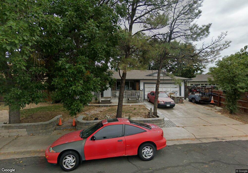
11868 Saint Paul Cir Thornton, CO 80233
Estimated Value: $450,000 - $521,000
3
Beds
2
Baths
1,368
Sq Ft
$353/Sq Ft
Est. Value
About This Home
This home is located at 11868 Saint Paul Cir, Thornton, CO 80233 and is currently estimated at $483,050, approximately $353 per square foot. 11868 Saint Paul Cir is a home located in Adams County with nearby schools including Woodglen Elementary School, Century Middle School, and Mountain Range High School.
Ownership History
Date
Name
Owned For
Owner Type
Purchase Details
Closed on
Jan 9, 2007
Sold by
Gehauf Ronald J and Gehauf Roseanne
Bought by
Gehauf Ronald J and Gehauf Roseanne
Current Estimated Value
Purchase Details
Closed on
Dec 16, 2004
Sold by
Wells Fargo Bank Na
Bought by
Gehauf Ronald J and Gehauf Roseanne
Home Financials for this Owner
Home Financials are based on the most recent Mortgage that was taken out on this home.
Original Mortgage
$170,895
Outstanding Balance
$84,271
Interest Rate
5.5%
Mortgage Type
Unknown
Estimated Equity
$398,779
Create a Home Valuation Report for This Property
The Home Valuation Report is an in-depth analysis detailing your home's value as well as a comparison with similar homes in the area
Home Values in the Area
Average Home Value in this Area
Purchase History
| Date | Buyer | Sale Price | Title Company |
|---|---|---|---|
| Gehauf Ronald J | -- | None Available | |
| Gehauf Ronald J | $170,895 | Fahtco |
Source: Public Records
Mortgage History
| Date | Status | Borrower | Loan Amount |
|---|---|---|---|
| Open | Gehauf Ronald J | $170,895 |
Source: Public Records
Tax History Compared to Growth
Tax History
| Year | Tax Paid | Tax Assessment Tax Assessment Total Assessment is a certain percentage of the fair market value that is determined by local assessors to be the total taxable value of land and additions on the property. | Land | Improvement |
|---|---|---|---|---|
| 2024 | $3,229 | $30,320 | $5,480 | $24,840 |
| 2023 | $3,196 | $34,910 | $5,410 | $29,500 |
| 2022 | $2,768 | $25,130 | $5,560 | $19,570 |
| 2021 | $2,860 | $25,130 | $5,560 | $19,570 |
| 2020 | $2,633 | $23,600 | $5,720 | $17,880 |
| 2019 | $2,638 | $23,600 | $5,720 | $17,880 |
| 2018 | $2,379 | $20,670 | $5,760 | $14,910 |
| 2017 | $2,163 | $20,670 | $5,760 | $14,910 |
| 2016 | $1,705 | $15,870 | $3,180 | $12,690 |
| 2015 | $1,703 | $15,870 | $3,180 | $12,690 |
| 2014 | -- | $13,740 | $2,470 | $11,270 |
Source: Public Records
Map
Nearby Homes
- 11776 Saint Paul St
- 11817 Cook St
- 2656 E 117th Way
- 3491 E 119th St
- 11879 Madison Place
- 12131 Elizabeth Ct
- 11928 Monroe St
- 12113 York St
- 11845 Garfield St
- 11957 Claude Ct
- 11936 E 119th Place
- 11630 Columbine St
- 11861 Claude Way
- 11848 Jackson Cir
- 11875 Claude Way
- 11546 Monroe Way
- 11901 Bellaire St Unit D
- 3880 E 117th Ave
- 12215 Garfield Place
- 3225 E 124th Ave
- 11888 Saint Paul Cir
- 11848 Saint Paul Cir
- 11912 Saint Paul St
- 2825 E 118th Ct
- 2845 E 118th Ct
- 11838 Saint Paul Cir
- 2865 E 118th Ct
- 11859 Saint Paul Cir
- 11860 Saint Paul St
- 11900 Saint Paul Cir
- 2805 E 118th Ct
- 11880 Saint Paul St
- 11879 Saint Paul Cir
- 11840 Saint Paul St
- 11922 Saint Paul St
- 11820 St Paul St
- 11820 Saint Paul St
- 11910 Saint Paul Cir
- 11800 Saint Paul St
- 2800 E 118th Ct