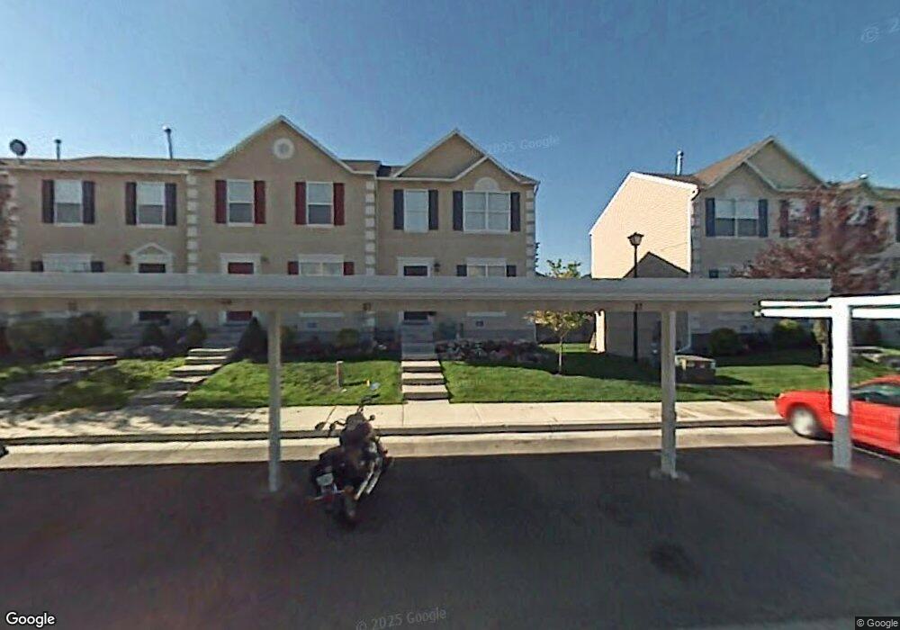
1187 Dunrobin Ct S Murray, UT 84123
Estimated Value: $386,000 - $410,000
3
Beds
2
Baths
1,668
Sq Ft
$237/Sq Ft
Est. Value
About This Home
This home is located at 1187 Dunrobin Ct S, Murray, UT 84123 and is currently estimated at $395,274, approximately $236 per square foot. 1187 Dunrobin Ct S is a home located in Salt Lake County with nearby schools including Longview Elementary School, Riverview Junior High School, and Murray High School.
Ownership History
Date
Name
Owned For
Owner Type
Purchase Details
Closed on
Jun 13, 2019
Sold by
Plant Porter R and Plant Ashley L
Bought by
Ostrowski Hatty R
Current Estimated Value
Home Financials for this Owner
Home Financials are based on the most recent Mortgage that was taken out on this home.
Original Mortgage
$238,620
Outstanding Balance
$209,805
Interest Rate
4.1%
Mortgage Type
New Conventional
Estimated Equity
$185,469
Purchase Details
Closed on
Mar 1, 2019
Sold by
Plant Porter R and Plant Ashley L
Bought by
Plant Porter R and Plant Ashley L
Home Financials for this Owner
Home Financials are based on the most recent Mortgage that was taken out on this home.
Original Mortgage
$35,000
Interest Rate
4.4%
Mortgage Type
Stand Alone Second
Purchase Details
Closed on
Jan 20, 2017
Sold by
Hyland Grant O and Hyland Allison P
Bought by
Plant Porter R and Land Ashley L
Home Financials for this Owner
Home Financials are based on the most recent Mortgage that was taken out on this home.
Original Mortgage
$196,377
Interest Rate
4.13%
Mortgage Type
FHA
Purchase Details
Closed on
Feb 1, 2007
Sold by
Capener Jordan C and Capener Mercedes
Bought by
Hyland Grant O and Hyland Allison P
Home Financials for this Owner
Home Financials are based on the most recent Mortgage that was taken out on this home.
Original Mortgage
$144,800
Interest Rate
6.37%
Mortgage Type
Purchase Money Mortgage
Purchase Details
Closed on
Dec 19, 2001
Sold by
Armstrong Emily D and Armstrong Mark D
Bought by
Capener Jordan C and Capener Mercedes
Home Financials for this Owner
Home Financials are based on the most recent Mortgage that was taken out on this home.
Original Mortgage
$140,000
Interest Rate
9.62%
Mortgage Type
Purchase Money Mortgage
Purchase Details
Closed on
Aug 17, 2000
Sold by
Glencoe Llc
Bought by
Armstrong Mark D and Armstrong Emily D
Home Financials for this Owner
Home Financials are based on the most recent Mortgage that was taken out on this home.
Original Mortgage
$127,390
Interest Rate
8.16%
Mortgage Type
Purchase Money Mortgage
Create a Home Valuation Report for This Property
The Home Valuation Report is an in-depth analysis detailing your home's value as well as a comparison with similar homes in the area
Home Values in the Area
Average Home Value in this Area
Purchase History
| Date | Buyer | Sale Price | Title Company |
|---|---|---|---|
| Ostrowski Hatty R | -- | Sutherland Title | |
| Plant Porter R | -- | Meridian Title | |
| Plant Porter R | -- | Richland Title Ins Agency In | |
| Hyland Grant O | -- | Merrill Title | |
| Capener Jordan C | -- | Title West | |
| Armstrong Mark D | -- | First American Title Insuran |
Source: Public Records
Mortgage History
| Date | Status | Borrower | Loan Amount |
|---|---|---|---|
| Open | Ostrowski Hatty R | $238,620 | |
| Previous Owner | Plant Porter R | $35,000 | |
| Previous Owner | Plant Porter R | $196,377 | |
| Previous Owner | Hyland Grant O | $144,800 | |
| Previous Owner | Capener Jordan C | $140,000 | |
| Previous Owner | Armstrong Mark D | $127,390 |
Source: Public Records
Tax History
| Year | Tax Paid | Tax Assessment Tax Assessment Total Assessment is a certain percentage of the fair market value that is determined by local assessors to be the total taxable value of land and additions on the property. | Land | Improvement |
|---|---|---|---|---|
| 2025 | $1,700 | $392,200 | $98,400 | $293,800 |
| 2024 | $1,700 | $377,000 | $94,300 | $282,700 |
| 2023 | $1,770 | $376,000 | $92,400 | $283,600 |
| 2022 | $1,902 | $384,100 | $90,600 | $293,500 |
| 2021 | $1,597 | $284,500 | $75,500 | $209,000 |
| 2020 | $1,438 | $242,400 | $51,300 | $191,100 |
| 2019 | $1,424 | $231,800 | $51,300 | $180,500 |
| 2016 | $1,073 | $173,600 | $51,600 | $122,000 |
Source: Public Records
Map
Nearby Homes
- 1207 Torwood Ct
- 6052 S Macbeth Ct
- 1239 W 5840 S
- 1294 Glengyle Ct
- 1427 W 6170 S
- 5812 1250 W
- 5808 S Duck Pond Ln
- 6034 S Family Tree Place
- 1451 S Bluemont Dr
- 1501 W Bluemont Dr
- 5776 Tripp Ln
- 931 Coalburn Way Unit 102
- 931 W Coalburn Way
- 931 W Coalburn Way Unit 103
- 5781 Tripp Ln
- 931 W Coalburn Unit 101 Way Unit 7-58
- 5987 S Blue Stone Cir
- 5767 Tripp Ln
- 912 W Bellshill Dr Unit 15
- 912 W Bellshill Dr
- 1187 Dun Robin Ct
- 1183 W Dun Robin Ct
- 1183 Dun Robin Ct
- 1191 W Dun Robin Ct
- 1191 Dun Robin Ct
- 1181 Dun Robin Ct
- 1181 W Dun Robin Ct
- 1193 Dun Robin Ct
- 1179 Dun Robin Ct
- 1193 Dunrobin Ct S
- 1177 Dun Robin Ct
- 1197 W Dun Robin Ct
- 1197 Dun Robin Ct
- 1199 Dun Robin Ct
- 1216 W Crystal River Dr
- 1173 Dun Robin Ct
- 1208 W Crystal River Dr
- 1173 W Dun Robin Ct
- 1171 Dun Robin Ct
- 1171 W Dun Robin Ct Unit 211
Your Personal Tour Guide
Ask me questions while you tour the home.