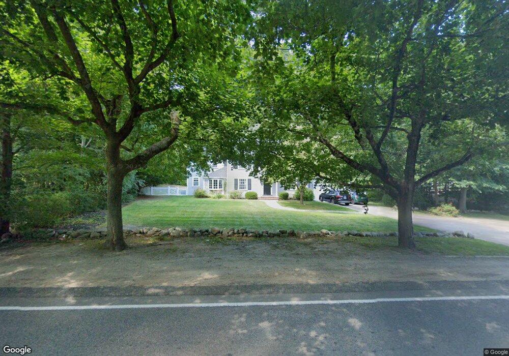
1187 Main St Hingham, MA 02043
South Hingham NeighborhoodEstimated Value: $1,151,000 - $1,329,000
3
Beds
2
Baths
1,954
Sq Ft
$629/Sq Ft
Est. Value
About This Home
This home is located at 1187 Main St, Hingham, MA 02043 and is currently estimated at $1,228,656, approximately $628 per square foot. 1187 Main St is a home located in Plymouth County with nearby schools including South Elementary School, Hingham Middle School, and Hingham High School.
Ownership History
Date
Name
Owned For
Owner Type
Purchase Details
Closed on
Jan 27, 2009
Sold by
George Robert Reed
Bought by
George Robert Reed and George Carrie E
Current Estimated Value
Purchase Details
Closed on
Jan 16, 2003
Sold by
Triggs Daniel V and Triggs Angela M
Bought by
George Robert R
Purchase Details
Closed on
Mar 6, 1998
Sold by
Barnhorst Thomas J and Barnhorst Laura E
Bought by
Triggs Daniel and Triggs Angela M
Home Financials for this Owner
Home Financials are based on the most recent Mortgage that was taken out on this home.
Original Mortgage
$275,500
Interest Rate
6.93%
Mortgage Type
Purchase Money Mortgage
Purchase Details
Closed on
Oct 28, 1994
Sold by
Deluca Paul M and Deluca Merope E
Bought by
Barnhorst Laura E and Barnhorst Thomas J
Home Financials for this Owner
Home Financials are based on the most recent Mortgage that was taken out on this home.
Original Mortgage
$235,350
Interest Rate
8.65%
Mortgage Type
Purchase Money Mortgage
Purchase Details
Closed on
Apr 13, 1987
Sold by
Will Anthony A
Bought by
Deluca Paul M
Home Financials for this Owner
Home Financials are based on the most recent Mortgage that was taken out on this home.
Original Mortgage
$207,200
Interest Rate
9.02%
Mortgage Type
Purchase Money Mortgage
Create a Home Valuation Report for This Property
The Home Valuation Report is an in-depth analysis detailing your home's value as well as a comparison with similar homes in the area
Home Values in the Area
Average Home Value in this Area
Purchase History
| Date | Buyer | Sale Price | Title Company |
|---|---|---|---|
| George Robert Reed | -- | -- | |
| George Robert R | $480,000 | -- | |
| Triggs Daniel | $290,000 | -- | |
| Barnhorst Laura E | $261,500 | -- | |
| Deluca Paul M | $259,000 | -- |
Source: Public Records
Mortgage History
| Date | Status | Borrower | Loan Amount |
|---|---|---|---|
| Previous Owner | Deluca Paul M | $260,000 | |
| Previous Owner | Deluca Paul M | $275,500 | |
| Previous Owner | Deluca Paul M | $235,350 | |
| Previous Owner | Deluca Paul M | $207,200 |
Source: Public Records
Tax History
| Year | Tax Paid | Tax Assessment Tax Assessment Total Assessment is a certain percentage of the fair market value that is determined by local assessors to be the total taxable value of land and additions on the property. | Land | Improvement |
|---|---|---|---|---|
| 2025 | $11,645 | $1,089,300 | $455,700 | $633,600 |
| 2024 | $11,213 | $1,033,500 | $455,700 | $577,800 |
| 2023 | $9,808 | $980,800 | $455,700 | $525,100 |
| 2022 | $9,382 | $811,600 | $391,900 | $419,700 |
| 2021 | $9,369 | $794,000 | $391,900 | $402,100 |
| 2020 | $8,837 | $766,400 | $391,900 | $374,500 |
| 2019 | $8,765 | $742,200 | $391,900 | $350,300 |
| 2018 | $8,736 | $742,200 | $391,900 | $350,300 |
| 2017 | $8,064 | $658,300 | $377,900 | $280,400 |
| 2016 | $7,997 | $640,300 | $359,900 | $280,400 |
| 2015 | $6,785 | $541,500 | $342,600 | $198,900 |
Source: Public Records
Map
Nearby Homes
- 12 Country Dr
- 100 Whiting St
- 1 Kerri Ln
- 4 Kerri Ln
- 183 Gardner St
- 17 Pine Haven Cir
- 22 Longmeadow Rd
- 214 Washington St Unit 24
- 214 Washington St Unit 28
- 18 Whiting Ln
- 18 Colby St
- 5 Blueberry Ct
- 55 Turner Rd
- 8 Blueberry Ct
- 5 Old County Rd
- 9 Mast Hill Rd
- 49 Washington Park Dr
- 18 Winterberry Ln
- 251 Prospect St
- 738 Whiting St
- 1 Queen Anne Ln
- 1175 Main St
- 1186 Main St
- 1191 Main St
- 2 Queen Anne Ln
- 1169 Main St
- 3 Queen Anne Ln
- 2 King Philip Path
- 1166 Main St
- 1 King Philip Path
- 5 Queen Anne Ln
- 6 Queen Anne Ln
- 4 King Philip Path
- 3 King Philip Path
- 7 Queen Anne Ln
- 8 Queen Anne Ln
- 6 King Philip Path
- 1154 Main St
- 5 Damon Farm Way Unit 5
- 9 Queen Anne Ln
Your Personal Tour Guide
Ask me questions while you tour the home.