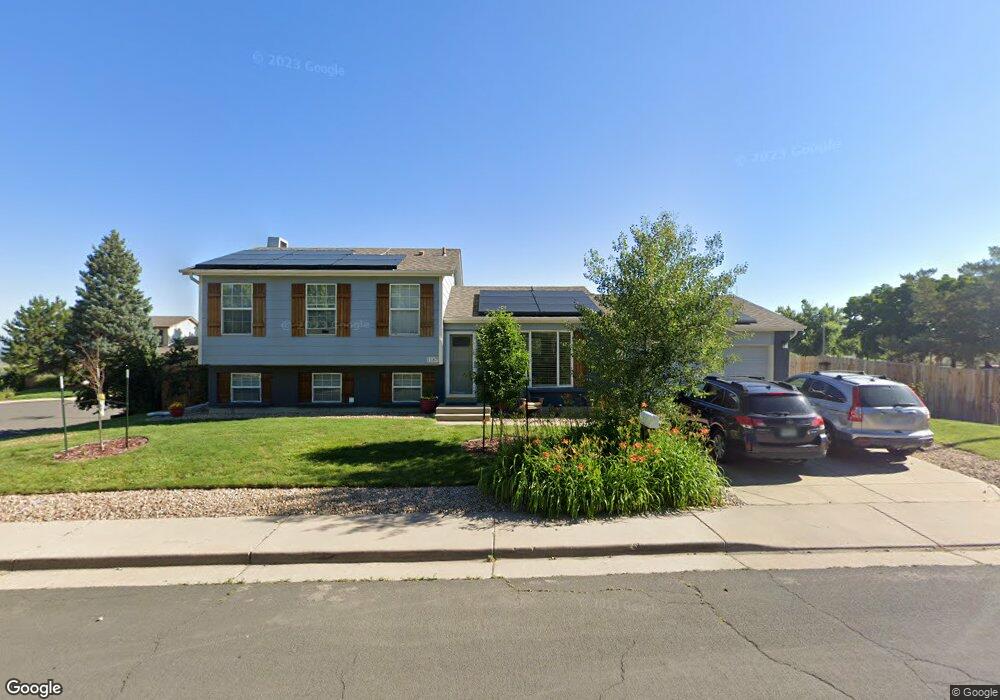
1187 Maple Dr Broomfield, CO 80020
Lac Amora NeighborhoodEstimated Value: $545,043 - $576,000
4
Beds
2
Baths
1,850
Sq Ft
$302/Sq Ft
Est. Value
About This Home
This home is located at 1187 Maple Dr, Broomfield, CO 80020 and is currently estimated at $558,761, approximately $302 per square foot. 1187 Maple Dr is a home located in Broomfield County with nearby schools including Aspen Creek K-8 School, Broomfield High School, and Nativity: Faith and Reason.
Ownership History
Date
Name
Owned For
Owner Type
Purchase Details
Closed on
Nov 15, 2014
Sold by
Merlino Lisa H
Bought by
Hill Lisa A
Current Estimated Value
Home Financials for this Owner
Home Financials are based on the most recent Mortgage that was taken out on this home.
Original Mortgage
$225,834
Outstanding Balance
$171,387
Interest Rate
3.75%
Mortgage Type
FHA
Estimated Equity
$387,374
Purchase Details
Closed on
Oct 27, 2000
Purchase Details
Closed on
Aug 20, 1996
Purchase Details
Closed on
Oct 22, 1992
Create a Home Valuation Report for This Property
The Home Valuation Report is an in-depth analysis detailing your home's value as well as a comparison with similar homes in the area
Home Values in the Area
Average Home Value in this Area
Purchase History
| Date | Buyer | Sale Price | Title Company |
|---|---|---|---|
| Hill Lisa A | -- | Fitco | |
| -- | $215,000 | -- | |
| -- | $122,000 | -- | |
| -- | $89,500 | -- |
Source: Public Records
Mortgage History
| Date | Status | Borrower | Loan Amount |
|---|---|---|---|
| Open | Hill Lisa A | $225,834 |
Source: Public Records
Tax History Compared to Growth
Tax History
| Year | Tax Paid | Tax Assessment Tax Assessment Total Assessment is a certain percentage of the fair market value that is determined by local assessors to be the total taxable value of land and additions on the property. | Land | Improvement |
|---|---|---|---|---|
| 2025 | $3,330 | $35,210 | $9,050 | $26,160 |
| 2024 | $3,330 | $35,540 | $8,200 | $27,340 |
| 2023 | $3,324 | $40,680 | $9,380 | $31,300 |
| 2022 | $2,834 | $29,310 | $6,600 | $22,710 |
| 2021 | $2,819 | $30,150 | $6,790 | $23,360 |
| 2020 | $2,648 | $28,150 | $6,440 | $21,710 |
| 2019 | $2,643 | $28,340 | $6,480 | $21,860 |
| 2018 | $2,190 | $23,200 | $4,570 | $18,630 |
| 2017 | $2,157 | $25,650 | $5,050 | $20,600 |
| 2016 | $1,856 | $19,680 | $5,050 | $14,630 |
| 2015 | $1,792 | $16,610 | $5,050 | $11,560 |
| 2014 | $1,546 | $16,610 | $5,050 | $11,560 |
Source: Public Records
Map
Nearby Homes
- 1087 Lilac St
- 1179 Lilac St
- 1043 Lilac Ct
- 3132 W 10th Avenue Place
- 880 Lilac St
- 2340 Rim Dr
- 2150 Ridge Dr
- 2191 Ridge Dr
- 639 Quartz Way
- 1010 Opal St Unit 102
- 1320 W 12th Ave
- 1740 W 6th Ave
- 1148 Opal St Unit 101
- 1176 Opal St Unit 104
- 1176 Opal St Unit 102
- 1196 Opal St Unit 201
- 1190 W 11th Ct
- 1196 Sunset Dr
- 1035 Iris St
- 680 Kalmia Way
- 1185 Maple Dr
- 1184 Maple Dr
- 1177 Maple Dr
- 1167 Maple Dr
- 1175 Maple Dr
- 1174 Maple Dr
- 2882 Ridge Dr
- 1164 Maple Dr
- 1165 Maple Cir
- 2892 Ridge Dr
- 1157 Maple Cir
- 1155 Maple Cir
- 1154 Maple Dr
- 2909 W 11th Avenue Cir
- 2919 W 11th Avenue Cir
- 2872 Ridge Dr
- 2893 Ridge Dr
- 1144 Maple Dr
- 1135 Maple Cir
- 1147 Maple Cir