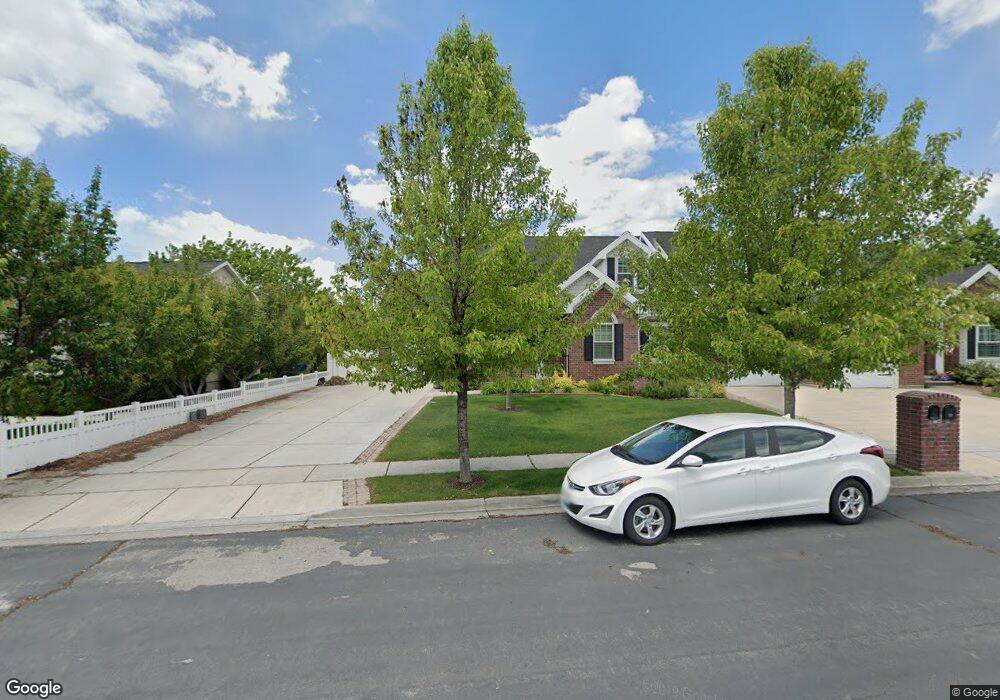
1187 N 1270 E American Fork, UT 84003
Estimated Value: $827,000 - $883,000
About This Home
Property Id: 1576004
Hey! Welcome to our home! We've absolutely loved living here and while we're sad to say goodbye, we're excited to pass this incredible place on to someone new. Whether you're just starting out or have a bustling household, this house is perfect for any stage of life.
We're in a prime spot in Utah, just five minutes from great shopping, the Murdock Canal trail system, the entrance to American Fork Canyon, and top-rated schools. Plus, this property backs up to a beautiful 6-acre HOA park with playgrounds, walking paths, and stunning mountain views.
We recently renovated in 2022, adding new floors, a room addition, and a fresh coat of paint. One of our favorite features is the charming garden in the side yard, complete with blackberry bushes and grapevines! We hope you'll come check it out and fall in love with this home just like we did!
Ownership History
Purchase Details
Purchase Details
Home Financials for this Owner
Home Financials are based on the most recent Mortgage that was taken out on this home.Home Values in the Area
Average Home Value in this Area
Purchase History
| Date | Buyer | Sale Price | Title Company |
|---|---|---|---|
| Wild Trust | -- | None Listed On Document | |
| Wild Jordan | -- | Provo Land Title Company |
Mortgage History
| Date | Status | Borrower | Loan Amount |
|---|---|---|---|
| Previous Owner | Wild Jordan | $484,350 |
Property History
| Date | Event | Price | List to Sale | Price per Sq Ft |
|---|---|---|---|---|
| 09/28/2024 09/28/24 | For Rent | $4,000 | -- | -- |
Tax History Compared to Growth
Tax History
| Year | Tax Paid | Tax Assessment Tax Assessment Total Assessment is a certain percentage of the fair market value that is determined by local assessors to be the total taxable value of land and additions on the property. | Land | Improvement |
|---|---|---|---|---|
| 2025 | $3,758 | $410,740 | $115,400 | $631,400 |
| 2024 | $3,758 | $417,560 | $0 | $0 |
| 2023 | $3,425 | $403,425 | $0 | $0 |
| 2022 | $3,017 | $350,735 | $0 | $0 |
| 2021 | $2,701 | $490,500 | $105,000 | $385,500 |
| 2020 | $2,627 | $462,700 | $105,000 | $357,700 |
| 2019 | $2,356 | $429,200 | $105,000 | $324,200 |
| 2018 | $2,464 | $429,200 | $105,000 | $324,200 |
| 2017 | $2,424 | $227,810 | $0 | $0 |
| 2016 | $2,590 | $226,215 | $0 | $0 |
| 2015 | $2,621 | $217,250 | $0 | $0 |
| 2014 | $2,415 | $197,450 | $0 | $0 |
Map
- 1243 N 1270 E
- 1162 E 1180 N
- 1172 Murdock Dr
- 4441 W Bridgestone Dr
- 9587 N 4500 W
- 248 N Deerfield Ln
- 1058 N 930 E Unit 64
- 1089 N 950 E
- 1059 N 930 E
- The McKenzie Plan at Autumn Crest
- The Christine Plan at Autumn Crest
- The Avery Plan at Autumn Crest
- The Madison Plan at Autumn Crest
- The Roosevelt Plan at Autumn Crest
- The Annie Plan at Autumn Crest
- The Michelle Plan at Autumn Crest
- 2969 N 1350 W
- 1045 N 930 E Unit 58
- 9681 N Peach Ct
- 4631 W Harvey Blvd
- 1187 N 1270 E Unit 71
- 1187 N 1270 E Unit 70
- 1189 N 1270 E Unit 71
- 1165 N 1270 E
- 1163 N 1270 E
- 1184 N 1270 E
- 1141 N 1270 E Unit 67
- 1221 N 1270 E
- 1196 N 1270 E
- 1139 N 1270 E Unit 66
- 1139 N 1270 E
- 1162 N 1270 E
- 1162 N 1270 E Unit 58
- 1186 N 1190 E
- 560 N 1270 E Unit 111
- 1100 N 1270 E
- 1100 N 1270 E Unit 71
- 1100 N 1270 E Unit 75
- 1100 N 1270 E Unit 70
- 1100 N 1270 E Unit 56