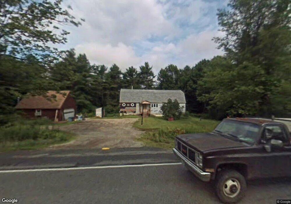
1188 Lewiston Rd New Gloucester, ME 04260
Estimated Value: $340,000 - $409,219
3
Beds
1
Bath
1,248
Sq Ft
$306/Sq Ft
Est. Value
About This Home
This home is located at 1188 Lewiston Rd, New Gloucester, ME 04260 and is currently estimated at $381,305, approximately $305 per square foot. 1188 Lewiston Rd is a home located in Cumberland County with nearby schools including Gray-New Gloucester High School and Spurwink School - Auburn.
Ownership History
Date
Name
Owned For
Owner Type
Purchase Details
Closed on
Aug 30, 2021
Sold by
Clifford Lawrence A
Bought by
Clifford Lawrence A and Clifford Barbara J
Current Estimated Value
Home Financials for this Owner
Home Financials are based on the most recent Mortgage that was taken out on this home.
Original Mortgage
$147,000
Outstanding Balance
$132,967
Interest Rate
2.7%
Mortgage Type
Purchase Money Mortgage
Estimated Equity
$248,338
Create a Home Valuation Report for This Property
The Home Valuation Report is an in-depth analysis detailing your home's value as well as a comparison with similar homes in the area
Home Values in the Area
Average Home Value in this Area
Purchase History
| Date | Buyer | Sale Price | Title Company |
|---|---|---|---|
| Clifford Lawrence A | -- | None Available |
Source: Public Records
Mortgage History
| Date | Status | Borrower | Loan Amount |
|---|---|---|---|
| Open | Clifford Lawrence A | $147,000 |
Source: Public Records
Tax History Compared to Growth
Tax History
| Year | Tax Paid | Tax Assessment Tax Assessment Total Assessment is a certain percentage of the fair market value that is determined by local assessors to be the total taxable value of land and additions on the property. | Land | Improvement |
|---|---|---|---|---|
| 2025 | $3,031 | $195,926 | $60,386 | $135,540 |
| 2024 | $2,917 | $195,926 | $60,386 | $135,540 |
| 2023 | $2,800 | $195,926 | $60,386 | $135,540 |
| 2022 | $2,704 | $195,926 | $60,386 | $135,540 |
| 2021 | $2,587 | $187,432 | $60,386 | $127,046 |
| 2020 | $2,558 | $187,432 | $60,386 | $127,046 |
| 2019 | $2,927 | $173,200 | $62,300 | $110,900 |
| 2018 | $2,737 | $173,200 | $62,300 | $110,900 |
| 2017 | $3,175 | $203,500 | $62,300 | $141,200 |
| 2016 | $2,991 | $203,500 | $62,300 | $141,200 |
| 2015 | $2,981 | $203,500 | $62,300 | $141,200 |
| 2014 | $2,951 | $203,500 | $62,300 | $141,200 |
| 2013 | $2,737 | $203,500 | $62,300 | $141,200 |
Source: Public Records
Map
Nearby Homes
- 10-56 C&E Bowdoin Way
- 12 Country Charm Ln
- 164 Intervale Rd
- 10 Spring Valley Ln
- 161 Beaver Dam Dr
- 832 Old Danville Rd
- 10 Cobbs Bridge Rd
- 114 Garden Cir
- 16 Harvest Hill Ln Unit 2
- 22 Lantern Way Unit 23
- 14 Harvest Hill Ln Unit 1
- 24 Swamp Rd
- 15 Country Club Dr
- 200 Woodman Rd
- 120 Brentwood Dr
- 160 Gloucester Hill Rd
- 22 Shaw Rd
- 271 Bennett Rd
- 730 Beech Hill Rd
- 155 & 151 Gloucester Hill Rd